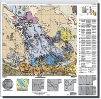
Geologic Map of the Aeolis Dorsa Region, Mars
Links
- Document: Report (1 MB pdf)
- Sheet: Sheet (32 MB pdf) - Geologic Map of the Aeolis Dorsa Region, Mars
- Additional Report Piece: Interactive map - Geologic Map of Aeolis Dorsa, 1:500K. Burr et al. (2021)
- Datasets:
- GIS Files and Database Part 1 of 2 (7 GB zip) - Both files need to be downloaded before unzipping
- GIS Files and Database Part 2 of 2 (4 GB zip) - Both files need to be downloaded before unzipping
- Data Release: USGS data release - Interactive Map: USGS SIM 3480 Geologic Map of the Aeolis Dorsa Region, Mars
- Metadata:
- Read Me: Read Me (5 KB txt)
- Download citation as: RIS | Dublin Core
Abstract
The Aeolis Dorsa region of Mars, located just north of the global dichotomy boundary, includes the Aeolis and Zephyria Plana, and a depositional basin between them. This interplana region consists of extensive networks of ridges—the eponymous Aeolis Dorsa—and is interpreted as having formed by topographic inversion of fluvial and alluvial deposits. To the south is a nearly 1-km-deep trough (Aeolis Chaos) and the southern highlands. These elements of the map area compose a landscape of extensive erosional and depositional sedimentary processes. The plana are pervasively abraded into yardangs, and the interplana area shows scattered yardangs superposed on the underlying terrain. The Aeolis Dorsa fluvial deposits are concentrated within and around the margins of the interplana region, exposed and (or) inverted by this pervasive aeolian abrasion. During this period of extensive erosion and deposition, impacts have also redistributed material. The geologic mapping of this region, conducted at 1:500,000 scale to enable depiction of the fine-scale fluvial features, divides the landscape into six unit groups. The highlands units group comprises three units, located in the southwestern map area. These units, having the highest elevation in the map area, consist of mesas surrounded by more gently sloping terrain. The transitional units group, located northeast of the highlands units, includes the Aeolis Chaos, denoted as a chaos terrain unit, and two transitional units, differentiated on the basis of surface texture and relative elevation. The plana units group comprises five units. The oldest unit consists of mesas similar to those of the highlands mesas unit but located about 200 kilometers north of the highlands in Aeolis Planum. Three other plana units, located on the Aeolis and Zephyria Plana, are differentiated on the basis of yardang texture, crosscutting relations, and relative elevations. They are interpreted as abraded sedimentary and (or) volcaniclastic deposits. The fifth plana unit, which crops out in the north corners of the map area, is at low elevation, has numerous small craters, and is interpreted as cratered lava plains. The interplana units group hosts a hummocky unit and a mounds unit, differentiated on the basis of texture and relief. In the Aeolis Dorsa units group, four units are mapped on the basis of dorsa morphology and adjacent textures. Stratigraphic relations indicate a decrease in discharge over time. The crater units group includes a crater unit, found throughout the map area although concentrated within the interplana region, and a crater fill unit that is found within several craters in this interplana region. Based on this mapping, the interpretation of the regional geologic record begins with emplacement of the highlands terrain during the Noachian Period. Emplacement was followed during the Early Hesperian by erosion and redistribution of this high-standing terrain to form the transitional units, and Aeolis Chaos formed after deposition of the other transitional units. The high-standing plana were emplaced and eroded repeatedly throughout the Hesperian and Early Amazonian time, and impact cratering occurred at decreasing crater sizes. The fluvial and alluvial activity that gave rise to the Aeolis Dorsa also extended throughout this time, leaving their diagnostic signature on this region.
Suggested Citation
Burr, D.M., Jacobsen, R.E., Lefort A., Borden R.M., and Peel, S.E., 2021, Geologic map of the Aeolis Dorsa Region, Mars: U.S. Geological Survey Scientific Investigations Map 3480, pamphlet 11 p., 1 sheet, scale 1:500,000, https://doi.org/10.3133/sim3480.
ISSN: 2329-132X (online)
ISSN: 2329-1311 (print)
Table of Contents
- Introduction
- Geography
- Base Map and Data
- Methodology
- Age Determinations
- Geologic Summary
- Acknowledgments
- References Cited
| Publication type | Report |
|---|---|
| Publication Subtype | USGS Numbered Series |
| Title | Geologic map of the Aeolis Dorsa Region, Mars |
| Series title | Scientific Investigations Map |
| Series number | 3480 |
| DOI | 10.3133/sim3480 |
| Publication Date | December 14, 2021 |
| Year Published | 2021 |
| Language | English |
| Publisher | U.S. Geological Survey |
| Publisher location | Reston, VA |
| Contributing office(s) | Astrogeology Science Center |
| Description | Report: iv, 11 p.; 1 Sheet: 52.47 x 51.39 inches;Data Set; Metadata; Read Me |
| Other Geospatial | Mars |
| Online Only (Y/N) | N |
| Additional Online Files (Y/N) | Y |


