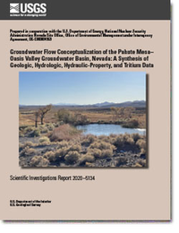
Groundwater Flow Conceptualization of the Pahute Mesa–Oasis Valley Groundwater Basin, Nevada: A Synthesis of Geologic, Hydrologic, Hydraulic-Property, and Tritium Data
Links
- Document: Report (9.6 MB pdf)
- Plates:
- Appendixes:
- Download citation as: RIS | Dublin Core
Abstract
This report provides a groundwater-flow conceptualization that integrates geologic, hydrologic, hydraulic-property, and radionuclide data in the Pahute Mesa–Oasis Valley (PMOV) groundwater basin, southern Nevada. Groundwater flow in the PMOV basin is of interest because 82 underground nuclear tests were detonated, most near or below the water table. A potentiometric map and nine sets of hydrostratigraphic and hydrologic cross sections supplement the conceptualization.
Potentiometric contours indicate that groundwater in the PMOV basin generally flows south-southwest and discharges at Oasis Valley. Groundwater encounters an alternating sequence of low- and high-transmissivity rocks, referred to as dams and pools, respectively, as it moves from east to west across eastern Pahute Mesa. Flow from all Pahute Mesa nuclear tests is to Oasis Valley and is well-constrained by water-level data. Flow converges along a corridor of high transmissivity between Pahute Mesa and Oasis Valley.
The location of the lateral PMOV basin boundary is well defined, and this boundary, with a few minor exceptions, represents a no-flow boundary. Some boundary uncertainty exists in the northeastern part of the basin, but potential flow-rate estimates across the northeastern boundary resulting from this uncertainty are small relative to the basin groundwater budget.
Recharge in the PMOV basin is derived from episodic pulses of modern water and the diffuse percolation of old water (greater than 1,000 years). Episodic recharge is a minor recharge component observed as a rise in groundwater levels that occurs 3 months to 1 year following a wet winter. Minor amounts of episodic recharge through an unsaturated zone in excess of 1,000 feet (ft) requires preferential flow through faults and fractures. The dominant recharge component is slow, steady, diffuse percolation of old water through the unsaturated zone. A large component of old water recharging the groundwater system is consistent with observations of isotopically light deuterium and oxygen 18 compositions in water from wells on Pahute Mesa and central Oasis Valley. About half the recharge in the PMOV basin is derived from the eastern Pahute Mesa area. The remaining recharge is derived primarily from other highland areas including Timber Mountain, Belted and Kawich Ranges, and Black Mountain.
The PMOV groundwater system is nearly steady state, where recharge is balanced by the 5,900 acre-feet per year of natural discharge at Oasis Valley. This assumption is reasonable because the basin is dominated by steady-state conditions, where long-term changes in groundwater storage are minimal. Total groundwater withdrawals from 1963 to 2018 have amounted to less than 10 percent of annual groundwater discharge and less than 0.2 percent of the basin’s groundwater storage. Therefore, present-day (2020) conditions are considered representative of predevelopment (pre-1950) conditions in nearly all areas of the basin.
The lower PMOV basin boundary is defined at 4,000 ft below the water table to encompass all underground nuclear tests and tritium plumes. This boundary defines the lower boundary of radionuclide migration. However, nearly all flow and tritium transport occur in the upper 1,600 ft of the saturated zone because a transmissivity-with-depth relation indicates that greater than 90 percent of the transmissivity contributing to groundwater flow occurs within 1,600 ft of the water table. Rocks at deeper depths have low transmissivity because argillic and mineralized alterations plug the fractures.
Volcanic rocks form the primary aquifers and confining units in the PMOV basin. Volcanic hydrogeologic units (HGUs) and hydrostratigraphic units (HSUs) have transmissivity distributions that span up to eight orders of magnitude with considerable overlap between distributions. Despite the large overlap between units, mean transmissivities of aquifers are one-to-two orders of magnitude greater than the confining units. However, all volcanic-rock HGUs and HSUs are composite units, meaning that they can function spatially as either an aquifer or confining unit.
Suggested Citation
Jackson, T.R., Fenelon, J.M., and Paylor, R.L., 2021, Groundwater flow conceptualization of the Pahute Mesa–Oasis Valley Groundwater Basin, Nevada—A synthesis of geologic, hydrologic, hydraulic-property, and tritium data: U.S. Geological Survey Scientific Investigations Report 2020–5134, 100 p., https://doi.org/10.3133/sir20205134.
ISSN: 2328-0328 (online)
Study Area
Table of Contents
- Abstract
- Introduction
- Study Methods
- Hydraulic-Property and Rock-Alteration Analyses
- Groundwater Flow Conceptualization of the Pahute Mesa–Oasis Valley Groundwater Basin
- Summary
- Acknowledgments
- References Cited
- Appendixes 1–7
| Publication type | Report |
|---|---|
| Publication Subtype | USGS Numbered Series |
| Title | Groundwater flow conceptualization of the Pahute Mesa–Oasis Valley Groundwater Basin, Nevada—A synthesis of geologic, hydrologic, hydraulic-property, and tritium data |
| Series title | Scientific Investigations Report |
| Series number | 2020-5134 |
| DOI | 10.3133/sir20205134 |
| Publication Date | January 27, 2021 |
| Year Published | 2021 |
| Language | English |
| Publisher | U.S. Geological Survey |
| Publisher location | Reston, VA |
| Contributing office(s) | Nevada Water Science Center |
| Description | Report: viii, 100 p.; 2 Plates: 26.00 x 42.00 inches and 120.01 x 36.00 inches; 7 Appendixes |
| Country | United States |
| State | Nevada |
| Other Geospatial | Pahute Mesa–Oasis Valley Groundwater Basin |
| Online Only (Y/N) | Y |


