Scientific Investigations Report 2008–5071
U.S. GEOLOGICAL SURVEY
Scientific Investigations Report 2008–5071
Conceptual Model of Hydrologic and Thermal Conditions
The subsurface of the study area consists of unconsolidated sedimentary layers with a wide range of hydraulic conductivities. These layers are deposited on top of bedrock to form two aquifers separated by a confining unit, which is absent in the northwestern part of the study area. An aquifer is a hydrogeologic unit that contains sufficient saturated permeable material to yield significant quantities of water to wells or springs, and a confining unit is a hydrogeologic unit of distinctly less permeable material bounding one or more aquifers. The lower aquifer, which is in direct contact with the Columbia River, is the source of water for the regional water system, the Eastbank Hatchery, and irrigation and industrial uses.
Rocky Reach Dam and the Eastbank Aquifer system are located in a canyon incised into Late Cretaceous metamorphic bedrock of biotite gneiss (Tabor and others, 1987). The canyon has been eroded by the ancestral Columbia River and multiple catastrophic outburst floods from glacial Lake Missoula during the Pleistocene age. Estimates of the discharge of those floods are on the order of 600 million ft3/s (O’Connor and Baker, 1992). Large gravel deposits have formed inside the Columbia River valley from the accumulation of up to boulder-sized sediments deposited by the catastrophic floods at locations of channel widening or downstream of bedrock promontories, such as Turtle Rock Island located about 1 mi northeast of the study area (fig. 1). In the Columbia River valley south of Wenatchee, catastrophic-flood discharges from Moses Coulee deposited sufficient sediment to create temporary flood backwater and a lake that deposited fine-grained, lacustrine sediments. Cycles of catastrophic flooding and lake formation deposited the glacio-fluvial gravels and varved clays that make up the aquifers and confining unit, respectively, of the Eastbank Aquifer system.
Previous studies (Stone and Webster Engineering Corporation, 1959; CH2M Hill, 1977 and 1988; and Water & Environmental Systems Technology, Inc., 1990) determined that at river levels following the completion of Rocky Reach Dam, the Eastbank Aquifer system consists of two highly permeable, sand-and-gravel aquifers separated by a confining unit. A schematic hydrogeologic cross section through the south-central part of the Eastbank Aquifer system is shown in figure 5. In this study, the lower confined aquifer is referred to as the Lower Aquifer and the upper unconfined aquifer is referred to as the Upper Aquifer. Previous studies have used different names and terminology for the hydrogeologic units (table 1). The confining unit, which consists of varved clays and is referred to as the Clay Confining Unit in this study, generally thins towards the north, west, and east and is absent in the northwestern part of the study area (fig. 6; Water & Environmental Systems Technology, Inc., 1990). Where the Clay Confining Unit is absent, the Lower and Upper Aquifers merge to form the Combined Aquifer, which is unconfined.
The Eastbank Aquifer system lies on top of crystalline bedrock, which has an undulating surface as shown in figure 7 (Water & Environmental Systems Technology, Inc., 1990). Near the RW wells near the center of the study area, the altitude of the top of the bedrock is less than 340 ft. This is lower than approximated on the hydrogeologic cross sections by CH2M Hill (1988; appendix 1) but is based on interpretations of seismic-refraction data reported by CH2M Hill (1988). Water & Environmental Systems Technology, Inc. (1990) relied on indirect methods to estimate the altitude of the top of bedrock near the center of the study area because none of the RW wells was drilled to bedrock. It is estimated that there may be up to about 200 ft of sedimentary material about which little is known between the bottom of the RW wells and the top of bedrock (appendix 1). In the eastern part of the study area bedrock is shallower and truncates the Lower Aquifer. Water & Environmental Systems Technology, Inc. (1990) cautions, however, that well coverage in the eastern part of the study area is sparse and thus the interpretation of the subsurface is less certain. The resulting thickness of the Lower Aquifer in the study area, including the Combined Aquifer, ranges from 0 ft to more than 300 ft (fig. 8; Water & Environmental Systems Technology, Inc., 1990). It is not known how far north the Lower Aquifer extends beyond the study area.
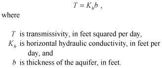
During construction of Rocky Reach Dam, Stone and Webster Engineering Corporation (1959) determined on the basis of a dye-tracer study that the hydraulic conductivities of the Lower Aquifer near the subsurface cutoff wall are on the order of 14,000 to 22,000 ft/d. Hydraulic conductivity is a measure of the ease with which water can move through a material. The horizontal hydraulic conductivity of an aquifer is related to the transmissivity of an aquifer according to
 (1)
(1)
Transmissivity is defined as the volume of water per unit time that will flow through a unit width of an aquifer perpendicular to the flow direction in response to a unit hydraulic head gradient. Another important aquifer parameter, the storativity, is defined as the volume of water an aquifer releases from, or takes into, storage per unit area of aquifer per unit change in head. Transmissivities and storativities of the Lower Aquifer calculated from aquifer tests performed between 1973 and 1990 in different parts of the study area ranged from 37,000 to 1.7 million ft2/d and from 0.0021 to 0.12, respectively (table 2). Results from aquifer tests of the CT well field (wells CT1, CT2, CT3, and CT4) described by CH2M Hill (1988) are not included in table 2 because they were reported as apparent transmissivities and storativities due to interference of the aquifer tests by intermittent pumping by the regional water system and other complications. The transmissivities and storativities of the Lower Aquifer indicate that it is a highly permeable, leaky confined aquifer with recharge entering the aquifer primarily from the Columbia River (Water & Environmental Systems Technology, Inc., 1990). In a numerical model of the Eastbank Aquifer system, Water & Environmental Systems Technology, Inc. (1990) achieved the best results by simulating hydraulic conductivities in the Lower and Upper Aquifers of 9,500 and 6,700 ft/d, respectively.
The interpretation of the hydrogeologic framework of the Eastbank Aquifer system in previous studies is based primarily on lithologic and geophysical logs of wells and borings. Although many well logs were available for use in this study, a significant number were not available and either no information was known about certain wells or only limited information was known from descriptions by previous studies. To learn more about these wells and also to ascertain the condition of all accessible wells currently (2008) in the study area, downhole-camera surveys and natural-gamma logs were made of selected wells in December 2007. A description of the downhole-camera surveys is included in appendix 2 and the natural-gamma logs are included in appendix 3. Several wells that existed when previous studies were conducted have since been abandoned or destroyed and were not available in this study. Wells that are currently (2008) in the study area and the hydrogeologic units the wells are open to are shown in figure 9; known information for these wells is summarized in table 3.

![]() U.S. Department of the Interior | U.S. Geological Survey
U.S. Department of the Interior | U.S. Geological Survey
URL: http://pubs.usgs.gov/sir/2008/5071
Page Contact Information: Publications Team
Page Last Modified: Thursday, 10-Jan-2013 18:46:27 EST
