![]()
![]()
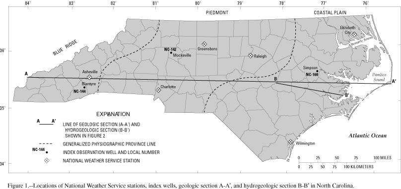
Figure 1. Locations of weather stations and index wells in North Carolina
GIF · PDF (159 KB)
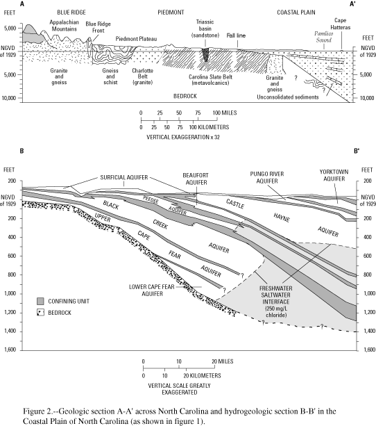
Figure 2. Geologic section A-A' across North Carolina and hydrogeologic section B-B' in the Coastal Plain of North Carolina
GIF · PDF (193 KB)
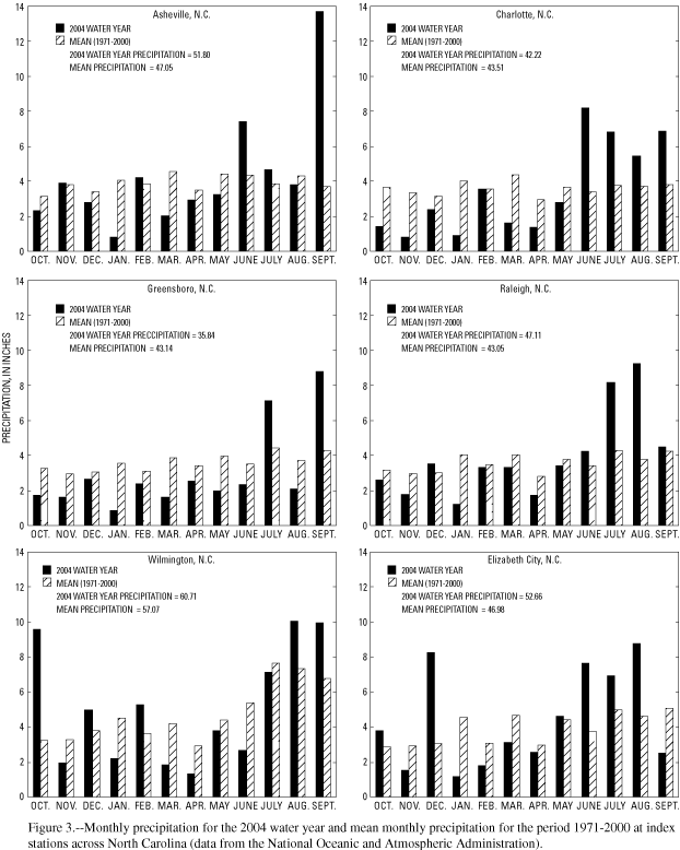
Figure 3. Monthly precipitation at index stations for 2004 water year and mean monthly precipitation for the period 1971-2000
GIF · PDF (174 KB)
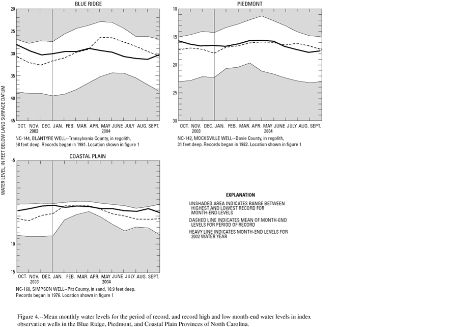
Figure 4. Water levels in index observation wells in the Blue Ridge, Piedmont, and Coastal Plain Provinces
GIF · PDF (157 KB)
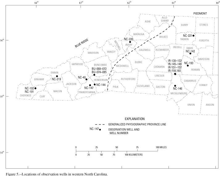
Figure 5. Locations of observation wells in western North Carolina
GIF · PDF (135 KB)
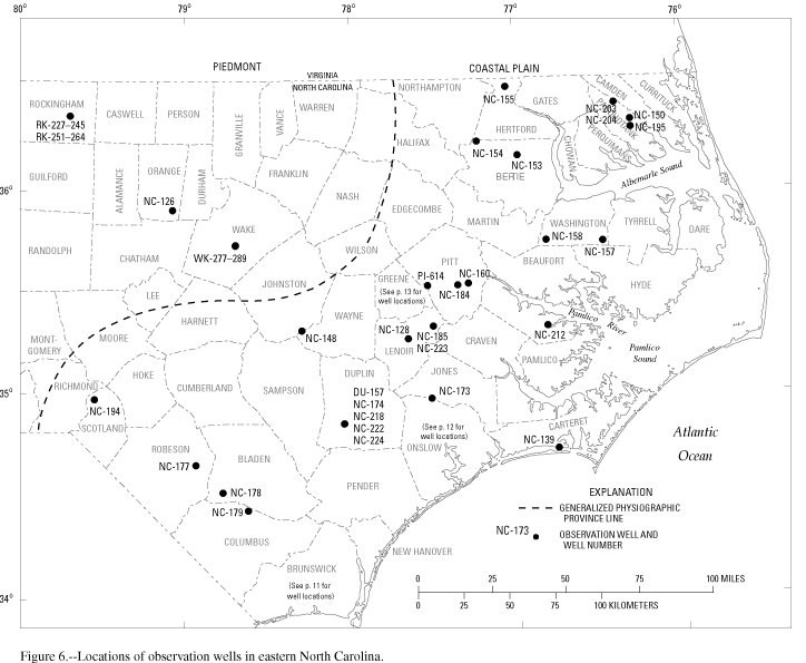
Figure 6. Locations of observation wells in eastern North Carolina
GIF · PDF (226 KB)
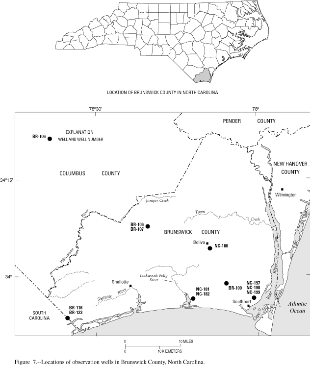
Figure 7. Locations of observation wells in Brunswick County
GIF · PDF (181 KB)
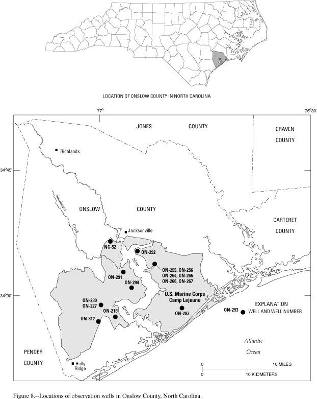
Figure 8. Locations of observation wells in Onslow County
GIF · PDF (167 KB)
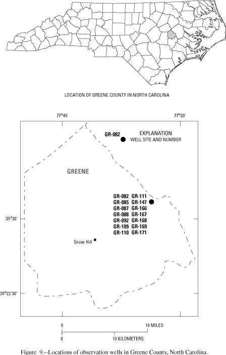
Figure 9. Locations of observation wells in Greene County
GIF · PDF (91 KB)
![]()
Return to WY 2004 Annual Data Report Home Page
![]()