![]()
![]()
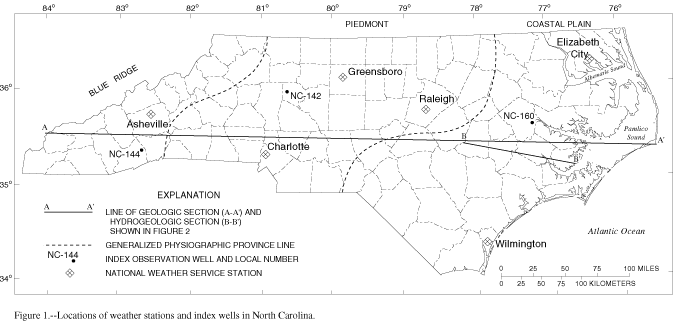
Figure 1. Location of weather stations and index wells in North Carolina
GIF · PDF (231 KB)
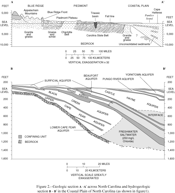
Figure 2. Geologic section A-A' across North Carolina and hydrogeologic section B-B' in the Coastal Plain of North Carolina
GIF · PDF (189 KB)
Figure 3. Monthly rainfall at index stations for 2001 water year and average monthly rainfall for the period 1971-00
GIF · PDF (83 KB)
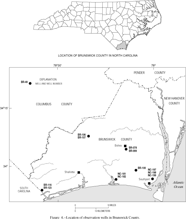
Figure 4. Location of observation wells in Brunswick County
GIF · PDF (200 KB)
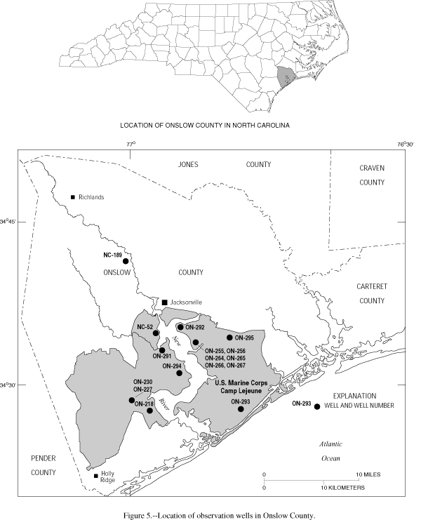
Figure 5. Location of observation wells in Onslow County
GIF · PDF (210 KB)
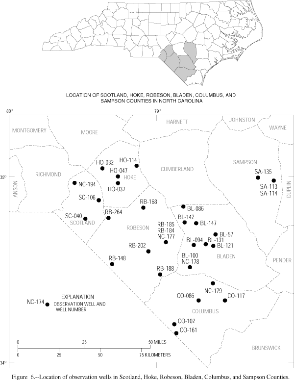
Figure 6. Location of observation wells in Scotland, Hoke, Robeson, Bladen, Columbus and Sampson Counties
GIF · PDF (176 KB)
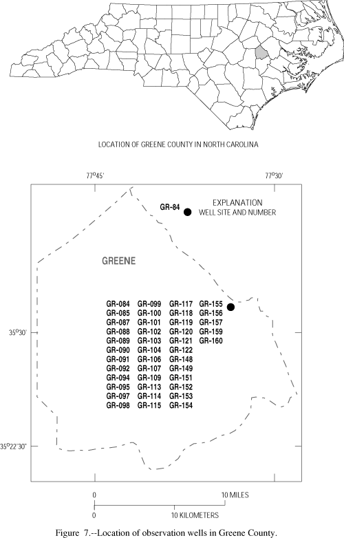
Figure 7. Location of observation wells in Greene County
GIF · PDF (109 KB)
Figure 8. Location of observation wells in Cherry Point, Marine Corps Air Station
GIF · PDF (220 KB)
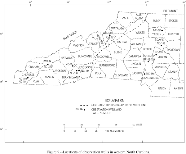
Figure 9. Location of observation wells in western North Carolina
GIF · PDF (246 KB)
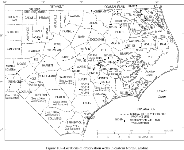
Figure 10. Location of observation wells in eastern North Carolina
GIF · PDF (375 KB)
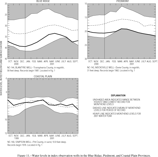
Figure 11. Water levels in index observation wells in the Blue Ridge, Piedmont, and Coastal Plain Provinces
GIF · PDF (55 KB)
![]()
Return to WY 2001 Annual Data Report Home Page
![]()