Data Series 921
| Survey Overview and AcquisitionLidar beach morphology data were collected using the Coastal Lidar and Radar Imaging System (CLARIS) vehicle traveling approximately 5 kilometers per hour (km/h) along two 30-km shore-parallel transits. The seaward side of the dune and the upper beach were surveyed during the first transit, and the area from near the shoreline and the lower beach were surveyed during the second transit. The survey was designed to provide an area of extensive overlap used to verify system accuracy and assess survey precision. 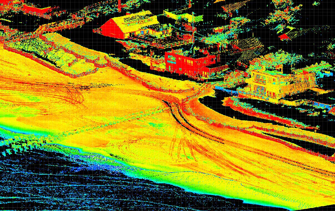 Figure 3. Three-dimensional rendering of high-resolution elevation data collected using the CLARIS system at Fire Island, New York. This image is an example of the data density and coverage acquired during a typical survey, and the data shown here do not reflect post-processing and editing procedures. [larger version] |

![]() U.S. Department of the Interior |
U.S. Geological Survey
U.S. Department of the Interior |
U.S. Geological Survey
URL: http://pubsdata.usgs.gov/pubs/ds/0921/ds921_data-aquisition.html
Page Contact Information: GS Pubs Web Contact
Page Last Modified: Monday, 28-Nov-2016 20:31:59 EST
