Data Series 921
| Project SummaryFollowing Hurricane Sandy on October 29, 2012, the U.S. Geological Survey (USGS) collaborated with the U.S. Army Corps of Engineers (USACE) to document and assess the morphological storm response and post-storm beach recovery at Fire Island, New York (N.Y.). As part of the ongoing beach monitoring within Hurricane Sandy Supplemental Project GS2-2B, the USGS St. Petersburg Coastal and Marine Science Center (SPCMSC) and the USACE Field Research Facility (FRF) in Duck, North Carolina (N.C.), collected ground-based light detection and ranging (lidar) elevation data along 30 kilometers (km) of Fire Island beach from the western boundary of Fire Island National Seashore to the Wilderness Breach (figs. 1, 2). The data were collected on April 10, 2013. The resulting high-resolution beach morphology documents widespread beach erosion that occurred in the winter months after Hurricane Sandy due to a series of nor’easter storms and acts as a baseline for measuring recovery. For more information, refer to USGS Open-File Report 2013-1231 (https://pubs.usgs.gov/of/2013/1231/) and the USGS Fire Island Coastal Change Web site at http://coastal.er.usgs.gov/fire-island/research/sandy/. April 1, 2014, Fire Island ground-based lidar elevation data is available at: https://dx.doi.org/10.5066/F77H1GNN.  Figure 1. U.S. Army Corps of Engineers survey vehicle collecting ground-based lidar along the upper beach near Fire Island Lighthouse on Fire Island, New York. [larger version] 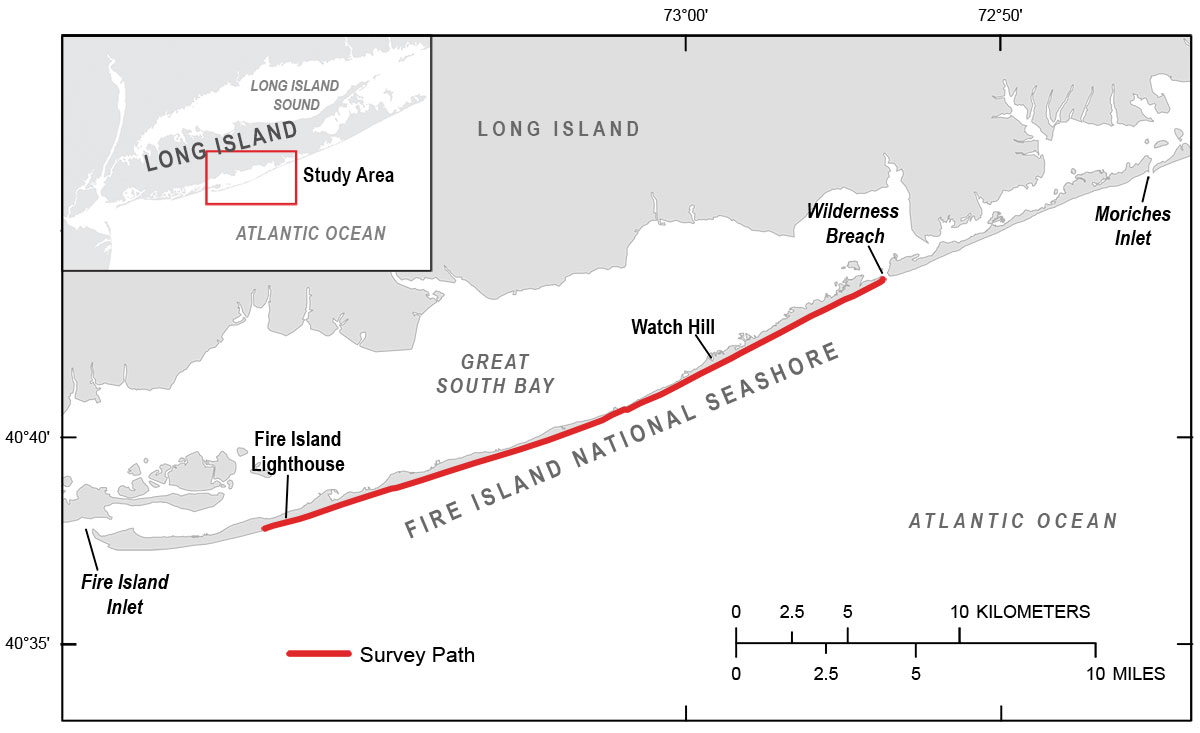 Figure 2. Ground-based lidar beach survey extends from the western boundary of Fire Island National Seashore to the Wilderness Breach at Fire Island, New York, April 10, 2013. [larger version] |

![]() U.S. Department of the Interior |
U.S. Geological Survey
U.S. Department of the Interior |
U.S. Geological Survey
URL: http://pubsdata.usgs.gov/pubs/ds/0921/ds921_summary.html
Page Contact Information: GS Pubs Web Contact
Page Last Modified: Monday, 28-Nov-2016 20:32:01 EST
