Data Series 931
| IntroductionHurricane Sandy made U.S. landfall, coincident with astronomical high tides, near Atlantic City, New Jersey, on October 29, 2012. The storm, the largest on historical record in the Atlantic basin, affected an extensive area of the east coast of the United States. The highest waves and storm surge were focused along the heavily populated New York and New Jersey coasts. At the height of the storm, a record significant wave height of 9.6 meters (m) was recorded at the wave buoy offshore of Fire Island, New York (fig. 1, inset). Prior to Hurricane Sandy, the U.S. Geological Survey (USGS) had an established coastal morphologic change and processes project at Fire Island, New York. One of the objectives of the project was to understand the morphologic evolution of the barrier system on a variety of time scales (storms-decades-centuries). As part of this effort, a USGS field team conducted differential global positioning system (DGPS) surveys at Fire Island to quantify the morphologic state of the beach and dunes immediately prior to Hurricane Sandy. The area was re-surveyed after the storm, as soon as access to the island was possible. Additional monitoring occurred monthly through April 2013 and continued every 2–3 months thereafter until October 2014, with the dry beach system measured during the daytime at spring low tide. The field surveys document the response of the system following Hurricane Sandy, the cumulative changes that resulted from a series of strong extratropical (nor’easter) storms in the winter of 2012–13, and the recovery over an approximately 2-year period after Hurricane Sandy. 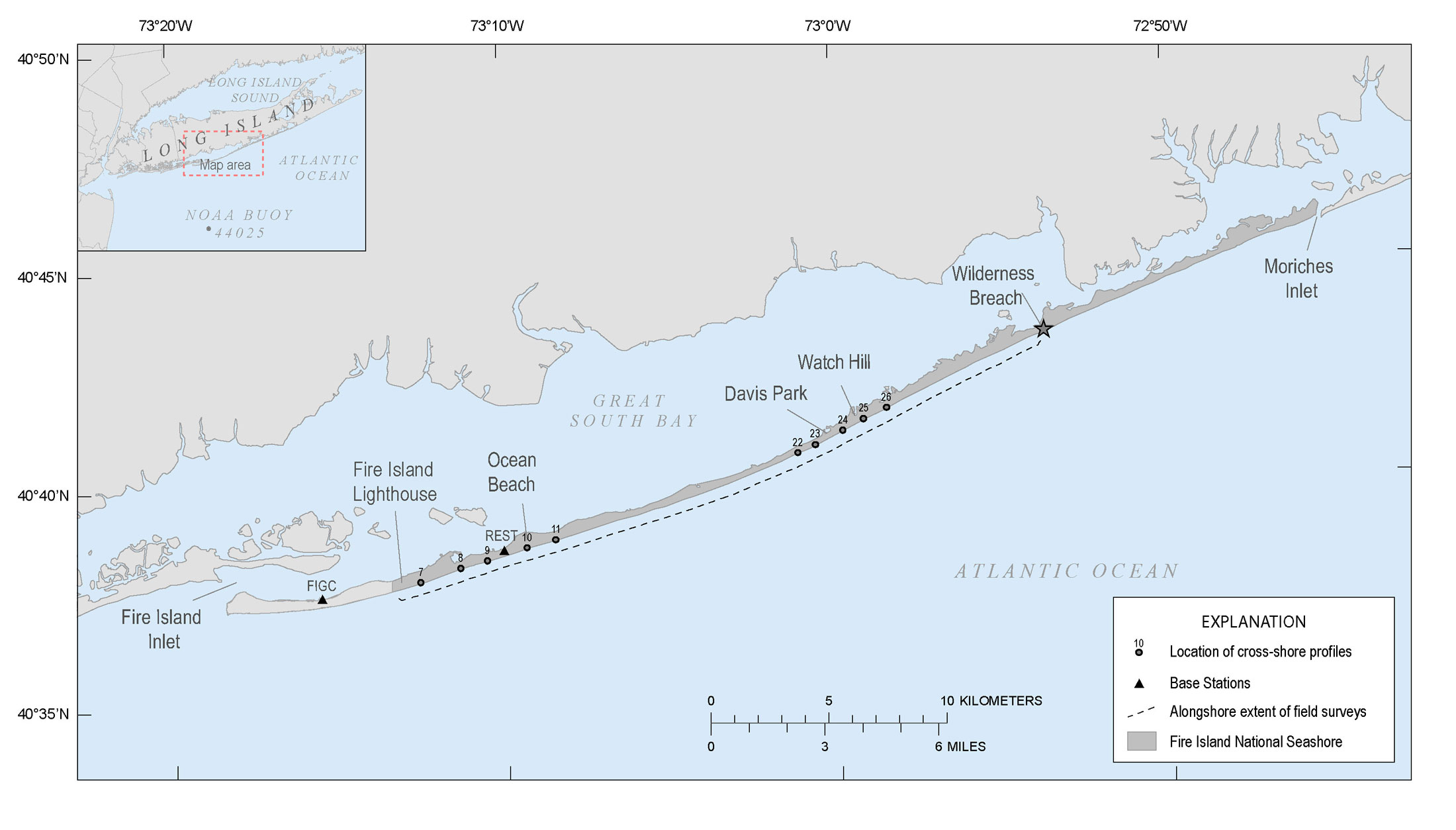 Figure 1. Regional map showing Fire Island National Seashore (FIIS) in relation to Long Island, NY. The study area includes alongshore and cross-shore data coverage from Fire Island Lighthouse to the Wilderness Breach. Also shown are the base stations at Robbins Rest (REST) and Fire Island Coast Guard station (FICG). [larger version] |

![]() U.S. Department of the Interior |
U.S. Geological Survey
U.S. Department of the Interior |
U.S. Geological Survey
URL: http://pubsdata.usgs.gov/pubs/ds/0931/ds931_intro.html
Page Contact Information: GS Pubs Web Contact
Page Last Modified: Monday, 28-Nov-2016 20:35:36 EST
