Data Series 999
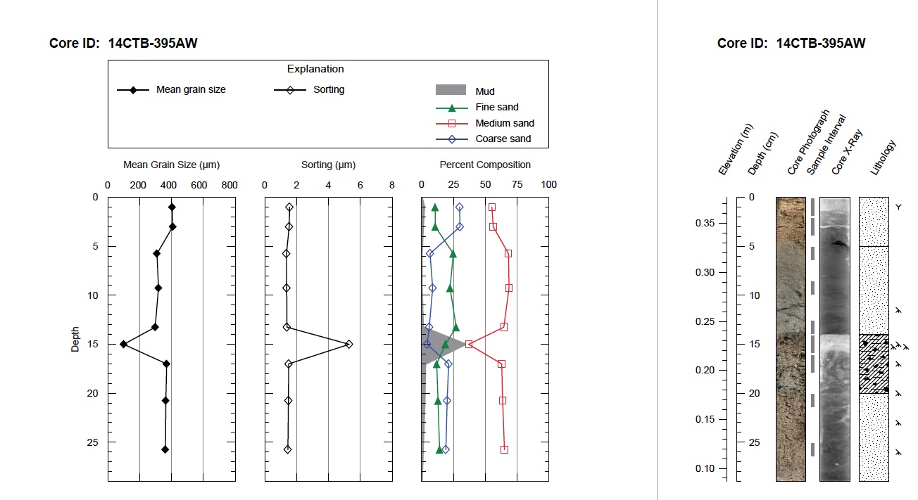
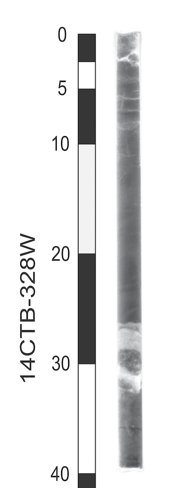
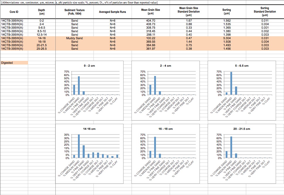
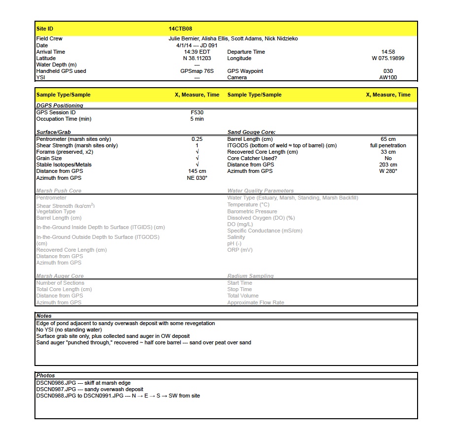
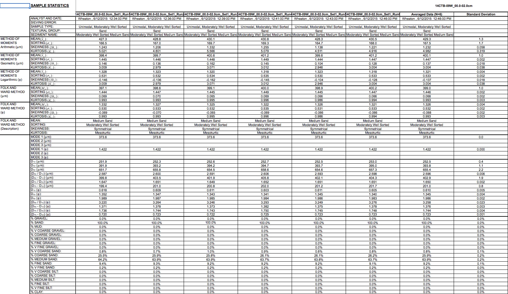
| Data DownloadsThe sediment data described in this report, including field logs, descriptive core logs, core photographs and x-radiographs, processed grain-size data, and Geographic Information System (GIS) data files with accompanying formal Federal Geographic Data Committee (FGDC) metadata, can be downloaded from the table below. Field Activity Collection System (FACS) documents, field logs, sample location tables, and core logs are provided in Portable Document Format (PDF) format and can be viewed using the free software Adobe Reader. Digital FACS and field logs were generated from handwritten field notes and logbooks. The core photographs and x-radiographs are provided as high-resolution Joint Photographic Experts Group (JPEG) and TIFF formats, respectively, and can be viewed using standard image viewing software. The sample location tables and grain-size spreadsheets were created in Microsoft Excel 2010 and can be opened using Microsoft Excel 2007 or higher; these data may also be viewed using the free Microsoft Excel Viewer. The sample locations are also provided as GIS data files in Esri file geodatabase (.gdb) and Keyhole Markup Language (KML) format; these files can be opened using the free ArcGIS Explorer or Google Earth GIS viewers. All sample locations and GIS data files presented in this report use the projected coordinate system North American Datum of 1983 (NAD83), Universal Transverse Mercator (UTM) Zone 18 North (18N), and all elevations are North American Vertical Datum of 1988 (NAVD 88) orthometric heights, derived using the GEOID 12A geoid model. Data Download Table
Supplemental Information
|

![]() U.S. Department of the Interior |
U.S. Geological Survey
U.S. Department of the Interior |
U.S. Geological Survey
URL: http://pubsdata.usgs.gov/pubs/ds/0999/ds999_data.html
Page Contact Information: GS Pubs Web Contact
Page Last Modified: Monday, 28-Nov-2016 20:49:53 EST