Data Series 999
1U.S. Geological Survey
2Cherokee Nation Technology Solutions
| Abstract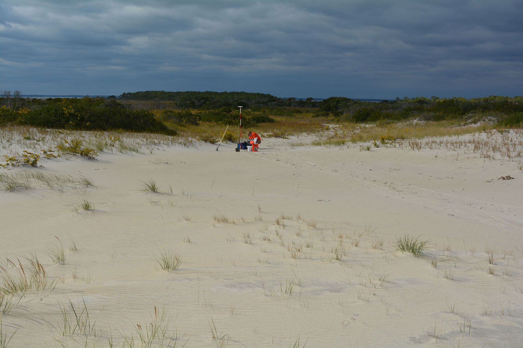 Photograph looking approximately west along washover fan to core site 14CTB-432, with back-barrier wetlands and Chincoteague Bay in the background. Photograph by Marci Marot (USGS). [Click image to enlarge] The U.S. Geological Survey has a long history of responding to and documenting the impacts of storms along the Nation’s coasts and incorporating these data into storm impact and coastal change vulnerability assessments. Although physical changes caused by tropical and extratropical storms to the sandy beaches and dunes fronting barrier islands are generally well documented, the interaction between sandy shoreline erosion and overwash with the back-barrier wetland and estuarine environments is poorly constrained. The goal of the Barrier Island and Estuarine Wetland Physical Change Assessment project is to integrate a wetland-change assessment with existing coastal-change assessments for the adjacent sandy dunes and beaches, initially focusing on Assateague Island along the Maryland and Virginia coastline. Assateague Island was impacted by waves and storm surge associated with the passage of Hurricane Sandy in October 2012, causing erosion and overwash along the ocean-facing sandy shoreline as well as erosion and overwash deposition in the back-barrier and estuarine bay environments. This report describes sediment data collected using sand augers in active overwash zones on Assateague Island in Maryland. Samples were collected by the U.S. Geological Survey (USGS) during two surveys in March/April and October 2014 (USGS Field Activity Numbers [FAN] 2014-301-FA and 2014-322-FA, respectively). The physical characteristics (for example, sediment texture or bedding structure) of and spatial differences among these deposits will provide information about overwash processes and sediment transport from the sandy barrier-island reaches to the back-barrier environments. Metrics derived from these data, such as mean grain size or deposit thicknesses, can be used to ground-truth remote sensing and geophysical data and can also be incorporated into sediment transport models. Data products, including sample location tables, descriptive core logs, core photographs and x-radiographs, the results of sediment grain-size analyses, and Geographic Information System (GIS) data files with accompanying formal Federal Geographic Data Committee (FGDC) metadata can be downloaded from the Data Downloads page. AcknowledgmentsThis study was funded under the Disaster Relief Appropriations Act of 2013, using the U.S. Department of the Interior Hurricane Sandy supplemental funding. The authors thank Bill Huslander and Neil Winn (U.S. National Park Service) for logistical support and facility use during field work and Scott Adams (Cherokee Nation Technology Solutions, CNTS) for field assistance. Jolene Gittens (U.S. Geological Survey) assisted with the report layout and Web design. We also thank Noreen Buster, Kyle Kelso, and Arnell Forde (U.S. Geological Survey) for conducting scientific, editorial, and metadata reviews that improved the content and presentation of the report. Information StatementAlthough these data have been processed successfully on a computer system at the U.S. Geological Survey (USGS), no warranty expressed or implied is made regarding the display or utility of the data on any other system or for general or scientific purposes, nor shall the act of distribution constitute any such warranty. The USGS or the U.S. Government shall not be held liable for improper or incorrect use of the data described and (or) contained herein. Any use of trade, firm, or product names is for descriptive purposes only and does not imply endorsement by the U.S. Government. Suggested CitationBernier, J.C., Zaremba, N.J., Wheaton, C.J., Ellis, A.M., Marot, M.E., and Smith, C.G., 2016, Sedimentologic characteristics of recent washover deposits from Assateague Island, Maryland: U.S. Geological Survey Data Series 999, https://dx.doi.org/10.3133/ds999. Contact
Julie Bernier |

![]() U.S. Department of the Interior |
U.S. Geological Survey
U.S. Department of the Interior |
U.S. Geological Survey
URL: http://pubsdata.usgs.gov/pubs/ds/0999/index.html
Page Contact Information: GS Pubs Web Contact
Page Last Modified: Monday, 28-Nov-2016 20:49:52 EST
