Data Series 999
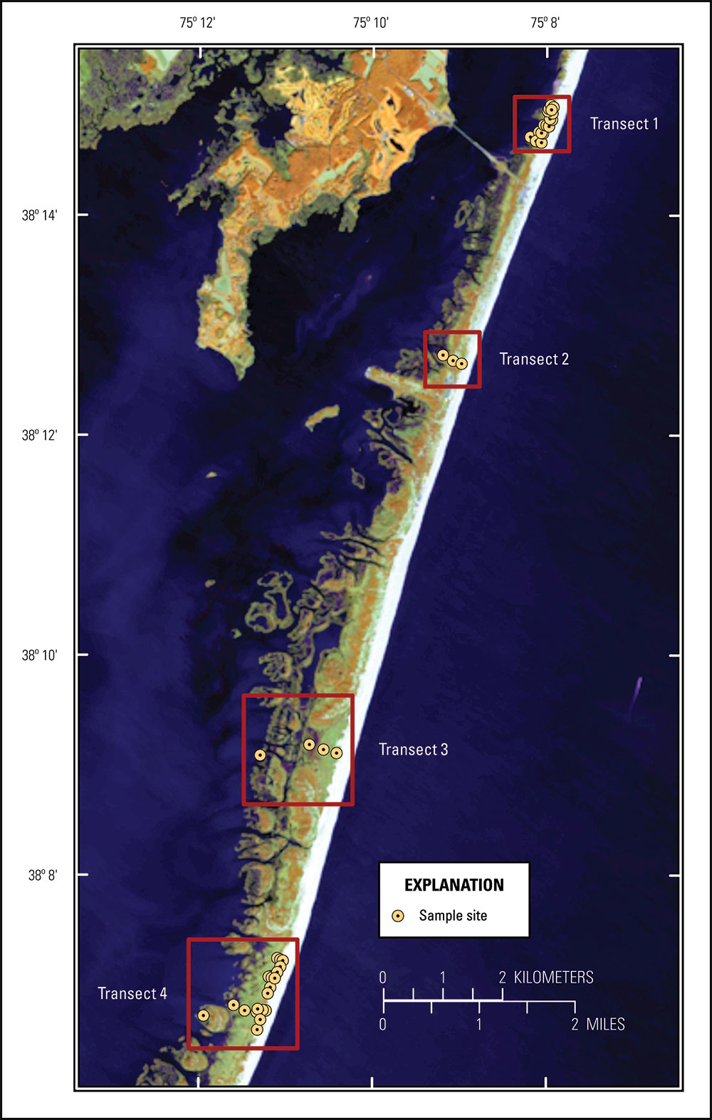
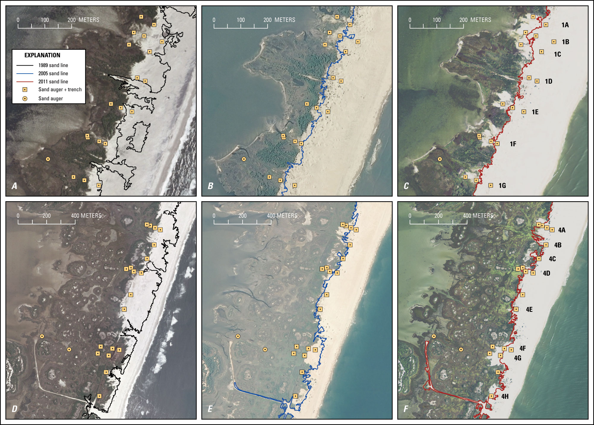
| Field Data CollectionUSGS scientists collected sediment samples from Assateague Island and Chincoteague Bay during two surveys—one in the spring, March 26 to April 4, 2014, and one in the fall, October 21–30, 2014 (USGS FAN 2014-301-FA and 2014-322-FA, respectively). Samples were collected from a variety of depositional environments, including mainland wetlands, back-barrier wetlands, and sparsely vegetated to unvegetated washover deposits. Site locations were identified as 14CTB-XXX# where XXX is a consecutive number from 01 to 500 (01–200 for spring; 300–500 for fall) and # represents the type of sample collected. Site locations shown in figure 2 are abbreviated XXX. This report describes sediment data from sand augers (sample type W) collected from active overwash zones on Assateague Island. Sediment data from surface samples (sample type S), marsh push cores (sample type M), and peat auger cores (sample type R) from Assateague Island and the estuarine mainland are described by Smith and others (2015), and sediment data from submerged grab samples (sample type G) in Chincoteague Bay are described by Ellis and others (2015). Ground penetrating radar (GPR) data collected along washover coring transects during the October survey are reported by Zaremba and others (2016). Sand extents derived from pre- and post-storm aerial imagery (Guy, 2015) were analyzed to identify areas of Assateague Island that were overwashed during Hurricane Sandy. Coring sites targeted three active overwash zones (transects 1, 3, and 4) and one control transect (transect 2). During the spring survey, a total of 19 cores were collected from 17 sites, including 8 cores from 7 back-barrier marsh sites (fig. 2). During the fall survey, all of the spring sand auger sites were re-cored, and additional cores were collected from overwash deposits at transects 1 and 4 located approximately 1 km north of the Verrazano Bridge Causeway on Sinepuxent Bay and at the Fox Hills Level north of Green Run Bay, respectively (figs. 1, 3). The expanded sampling strategy targeted sites that had overwashed historically (since 1989; Guy, 2015) in addition to those sites that were overwashed during Hurricane Sandy. In October, a total of 81 core sections were collected from 51 sites.
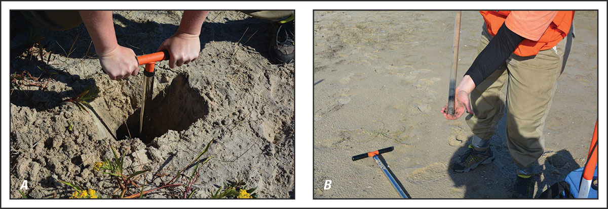
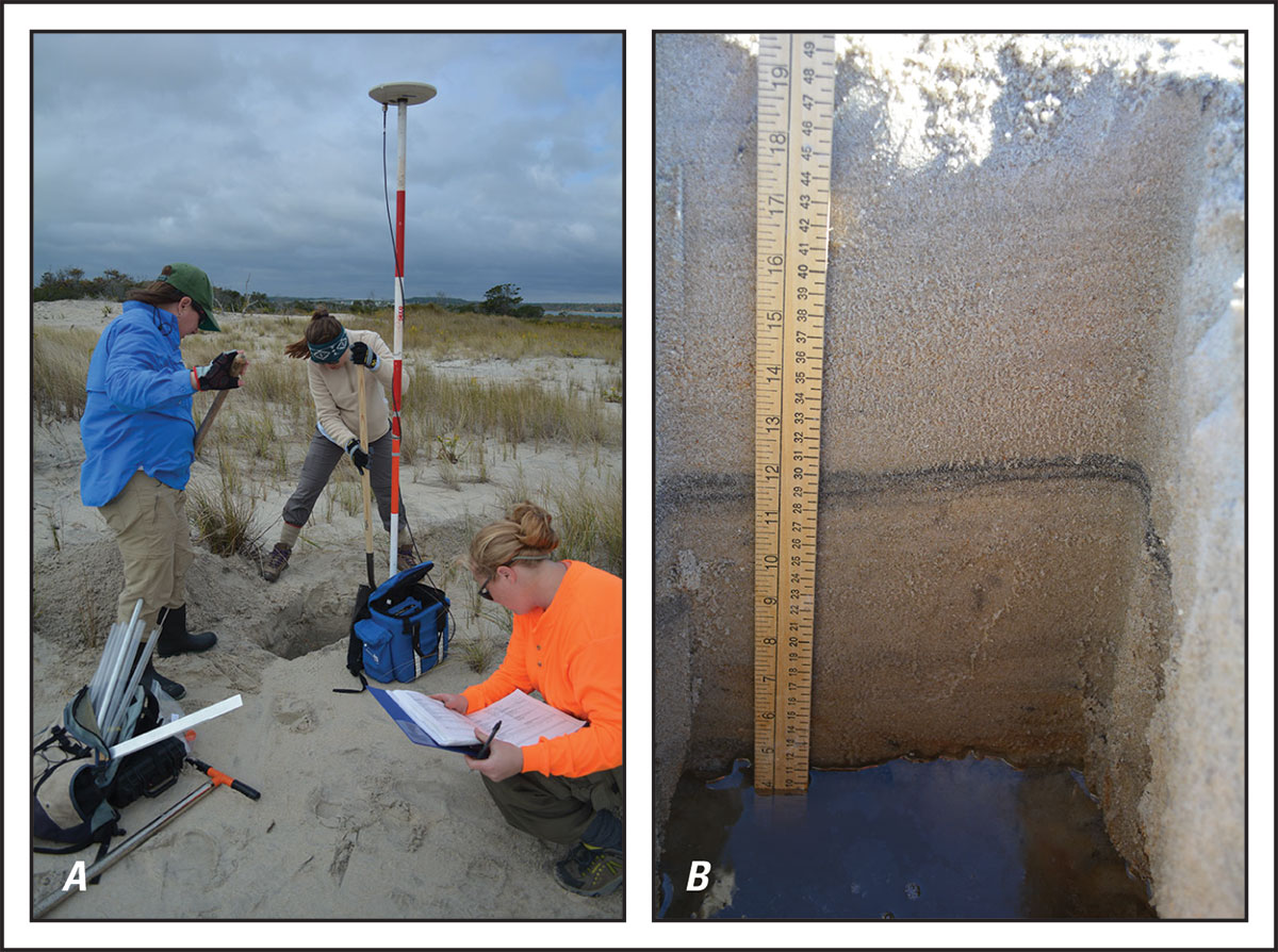
All sample locations were recorded at the time of collection with a Garmin GPSMAP 76S handheld Global Positioning System (GPS) receiver. Position and elevation data were also recorded with an Ashtech Differential Global Positioning System (DGPS) receiver and geodetic antenna, which provided more accurate horizontal and vertical control than handheld GPS systems. A stop-and-go rapid-static survey technique was used, with a static occupation duration of 5 minutes at each sample site. DGPS data were recorded concurrently throughout the survey at multiple NPS benchmarks located on the back-barrier side of Assateague Island using a similar instrument combination. Cores were collected using an AMS sand/loose sediment soil probe (fig. 4), which can accommodate a 2.54-centimeter (cm) (1-inch) diameter by approximately 60-cm (2-feet) plastic sleeve. In addition to cores collected from the ground surface, during the October survey a second core was collected at some sites from a trench dug to just above the groundwater table. The purpose of collecting a second, deeper, core was to try to penetrate organic-rich deposits representing the pre-overwash surface below the washover sediments. Cores from sites where a second core was collected were identified as 14CTB-XXXW-1 (surface core) and 14CTB-XXXW-2. After extraction, each core was capped, sealed, and labeled with transect location, core number, and orientation. The cores were transported to the USGS St. Petersburg Coastal and Marine Science Center (SPCMSC) for processing and analysis. During the October survey, shallow trenches (fig. 5) were also dug at each of the transect 1 and 4 washover sites for the purpose of supplementing washover thickness and sedimentologic data from the sand augers with additional sediment samples from targeted strata. Trench depths, however, were limited by a shallow water table, and in most cases the trenches back filled or collapsed before the pre-overwash surface could be identified. The site information, along with core and trench descriptions, is available from the Data Downloads page.
|

![]() U.S. Department of the Interior |
U.S. Geological Survey
U.S. Department of the Interior |
U.S. Geological Survey
URL: http://pubsdata.usgs.gov/pubs/ds/0999/ds999_field-data-collection.html
Page Contact Information: GS Pubs Web Contact
Page Last Modified: Monday, 28-Nov-2016 20:49:54 EST