Data Series 1027
|
IntroductionThe Grand Canyon Monitoring and Research Center (GCMRC) of the U.S. Geological Survey (USGS)'s Southwest Biological Science Center is the primary science provider for the Glen Canyon Dam Adaptive Management Program (GCDAMP). In support of that mission, GCMRC periodically collects airborne image data for the Colorado River corridor within Arizona (fig. 1), allowing scientists to study the operational effects of Glen Canyon Dam on the corridor's natural and cultural resources. The segment of the Colorado River that flows through Glen, Marble, and Grand Canyons is characterized by steep terrain and a commonly narrow, sinuous riparian corridor, making many areas logistically difficult to study. Thus, remotely sensed data and derived maps are important logistical tools for field research and monitoring and for image-based, high-resolution change detection. These data are collected from just upstream of Glen Canyon Dam (in Lake Powell) near Page, Arizona, downstream to Lake Mead's Pearce Ferry, Arizona, for a total length of 475 kilometers (km) at a width of about 500 meters (m) centered on the mainstem of the Colorado River and its seven primary tributaries: the Paria River, the Little Colorado River, Bright Angel Creek, Shinumo Creek, Tapeats Creek, Kanab Creek, and Havasu Creek (fig. 1). These data can be used for remotely sensed change detection with other data from the GCMRC image archive, which includes four dates of comparable full-corridor, digitally acquired, multispectral datasets since 2002, as well as a longer-term record of analog and film-based aerial photography. 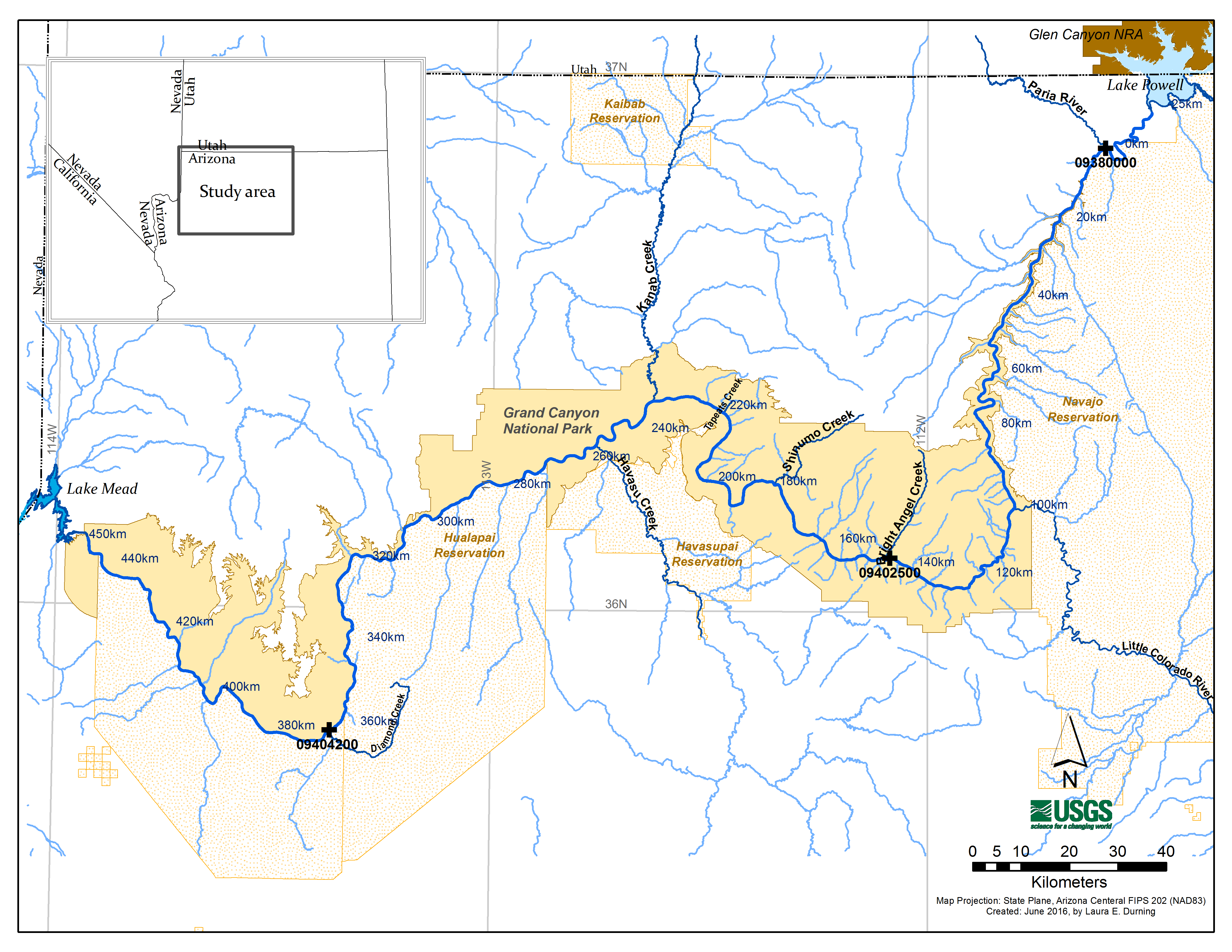 Figure 1. Map showing Colorado River in Grand Canyon and location of the U.S. Geological Survey's Grand Canyon Monitoring and Research Center (GCMRC) study area. Heavy blue lines, the Colorado River mainstem path, including seven primary tributaries and Diamond Creek; light-blue lines, perennial and ephemeral streams, including large named washes in watersheds surrounding river corridor; heavy black crosses, USGS streamgage station locations (09380000, Colorado River at Lees Ferry; 09402500, Colorado River near Grand Canyon; 09404200, Colorado River above Diamond Creek near Peach Springs); blue numbers, GCMRC river kilometer system, starting with kilometer 0 at Lees Ferry (gage 0938000) and increasing downstream. |

![]() U.S. Department of the Interior |
U.S. Geological Survey
U.S. Department of the Interior |
U.S. Geological Survey
URL: http://pubsdata.usgs.gov/pubs/ds/1027/ds1027_introduction.html
Page Contact Information: GS Pubs Web Contact
Page Last Modified: Monday, 12-Dec-2016 18:54:48 EST
