Project Description - South Charlotte Harbor and offshore Sanibel Island (2003-2004)
|
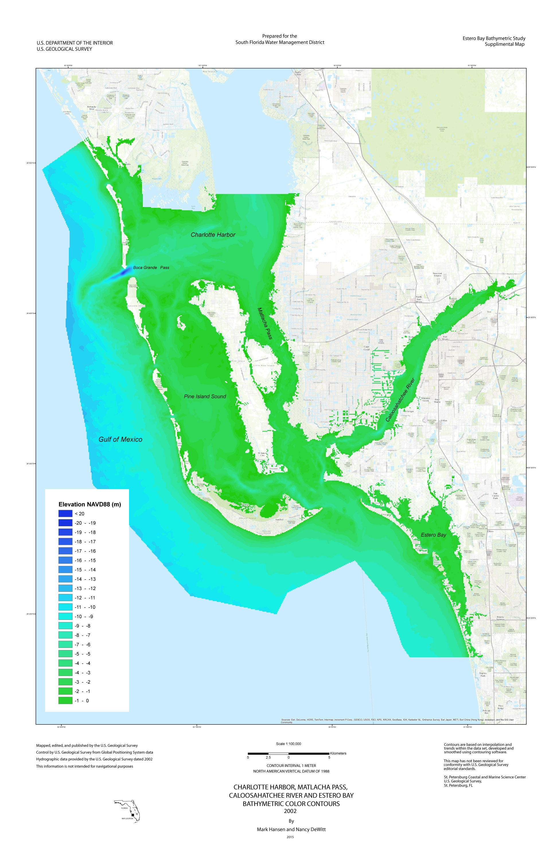
Figure 29. Project study area - Charlotte Harbor, Pine Island Sound, and offshore Sanibel Island, Florida. [Click on icon for link to data page] Charlotte Harbor is the 17th largest open water estuary in the United States and the second largest in Florida (fig. 29). It has a broad barrier island chain, large parts of which are in public ownership; its mangrove shoreline is largely intact and in public management. Regardless, the Charlotte Harbor watershed is under pressure from significant development with potential impact on stormwater runoff characteristics, salinity patterns and temporal variations within the harbor, and nutrient and turbidity levels. The harbor itself is particularly vulnerable to future degradation and, therefore, needs significant and sustained investment in water resource restoration. This project supports several South Florida Water Management District (SFWMD) efforts including the Caloosahatchee minimal flow levels (MFL), the Southwest Florida Feasibility Study (SWFFS), and the Surface Water Improvement Management (SWIM) Program designation of Charlotte Harbor. In addition, a need for a Charlotte Harbor estuarine mixing model has been identified by the Southwest Florida Regional Restoration Coordination Team and the SWFFS. In order to create an accurate model, updated bathymetric data were required for Charlotte Harbor and adjacent areas. Bathymetry data were also needed for the creation of a seagrass vision map, for a National Estuary Program (NEP) effort, and to populate the species response models being created as assessment tools for the restoration program. This project addresses the collection and interpretation of data necessary to develop the present day bathymetry of the lower portion of Charlotte Harbor, which includes Pine Island Sound, and the region offshore of Little Gasparilla Island to south Sanibel Island, Florida. The U.S. Geological Survey (USGS), in cooperation with SFWMD, performed a bathymetric survey of the lower portion of Charlotte Harbor, Pine Island Sound, and offshore of Little Gasparilla Island to Captiva Island using a single-beam, GPS, hydrographic system (fig. 30). GPS-based bathymetric surveying is a proven method to accurately map coastal and bay seafloor elevations.
Figure 30. Color-coded bathymetric map of the Charlotte Harbor study area. [Click to enlarge] |
SURVEY HIGHLIGHTS
|