Project Description - Estero Bay to Matlacha Pass and offshore to Wiggins Pass (2003)
|
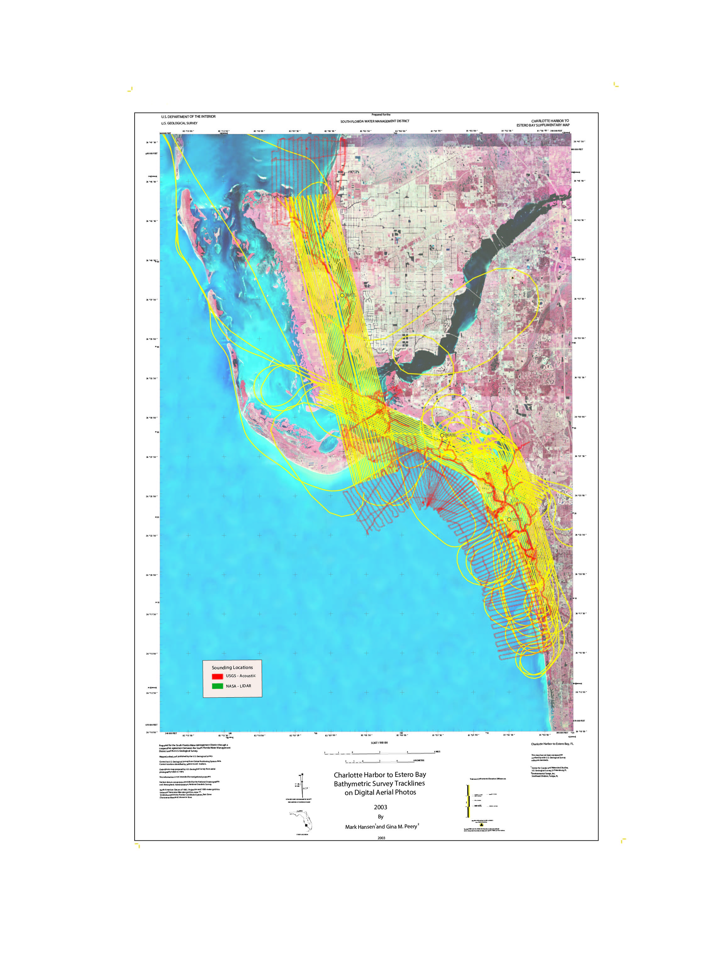
Figure 23. Project study area - Estero Bay and Matlacha Pass, Florida. [Click on icon for link to data page] The Estero Bay (fig. 23) watershed is under pressure from significant development with potential impacts on stormwater runoff characteristics and changes in salinity patterns and nutrient and turbidity levels. Environmental quality in the bay is particularly vulnerable to future degradation due to increasing urbanization and the bay's limited volume. In recent years, the Caloosahatchee estuary system has also been affected because of development and water management activities. These impacts have prompted the development of minimum flows and levels (MFLs) for the Caloosahatchee River by the South Florida Water Management District (SFWMD). A District revision of the MFLs for the Caloosahatchee River and Estero Bay regions required the development of hydrodynamic and water-quality models. Updated and accurate bathymetry data are necessary to facilitate the development and proper implementation of these numerical models. This project also supports the Southwest Florida Feasibility Study (SWFFS) and other nonmodeling efforts such as determination of the oligohaline zone in the Estero Bay system. This project addresses the collection and interpretation of data necessary to develop the present day bathymetry of Matlacha Pass to Estero Bay. The U.S. Geological Survey (USGS), in cooperation with National Aeronautics and Space Administration (NASA) and SFWMD, performed a bathymetric survey of Estero Bay and Matlacha Pass using single-beam and airborne-lidar [light detection and ranging] hydrographic systems (fig. 24). Bathymetric data were acquired with the USGS boat-based method named SANDS, and the NASA method airborne-lidar system named EAARL. Both systems are specifically designed to map in very shallow water, that is, approximately 50 centimeters (cm) water depth. These systems were chosen because the average depth of Estero Bay is approximately 1.2 meters (m), with many areas inaccessible with a shallow-water survey boat. The focus areas mapped with the SANDS system were deeper channels in Estero Bay and offshore areas of the Caloosahatchee River and Estero Bay. The EAARL survey concentrated on Estero Bay, the Caloosahatchee River entrance, and Matalacha Pass.
Figure 24. Project survey lines. Yellow(lidar), red(sonar). |
SURVEY HIGHLIGHTS
|


