|
Florida Bay is located in south Florida bounded by Everglades National Park to the north and the Florida Keys to the south (fig. 9). Florida Bay is a shallow saline lagoon consisting of fine-grained, unconsolidated carbonate mud islands, and expansive mudbanks connected by narrow channels. Florida Bay islands, referred to as "keys", dissect large basins averaging a depth of 1.5 meters (m). Studies have suggested Florida Bay keys maintain their elevation with sea-level rise by periodic deposition of basin muds transported by passing hurricanes (Halley and others, 2000).
Data were collected on a USGS 7.5-minute quadrangle-by-quadrangle basis, proceeding westward from Blackwater Sound (fig. 10). More than 6,500 kilometers (km) of single beam bathymetry trackline data were surveyed between 1995 and 1999. Florida Bay contains extensive mudbanks that are often exposed at low tide and could not be surveyed due to limited water depths.
Survey data were acquired at 1 km trackline spacing oriented in a north-south direction. Tracklines collected in an east-west orientation (intersecting tracklines) functioned to assess the relative vertical accuracy of the survey. Ideally, vertical data values at the crossing should be exactly the same. In reality, this is not always the case due to random errors of the survey system.
Additional tracklines were collected parallel to all shorelines and mudbanks to better define the contour boundaries of these features. Denser data were collected in the cuts and channels connecting the mudbanks to assure they were mapped in detail. Soundings were spaced at approximately 3-m intervals along the trackline.
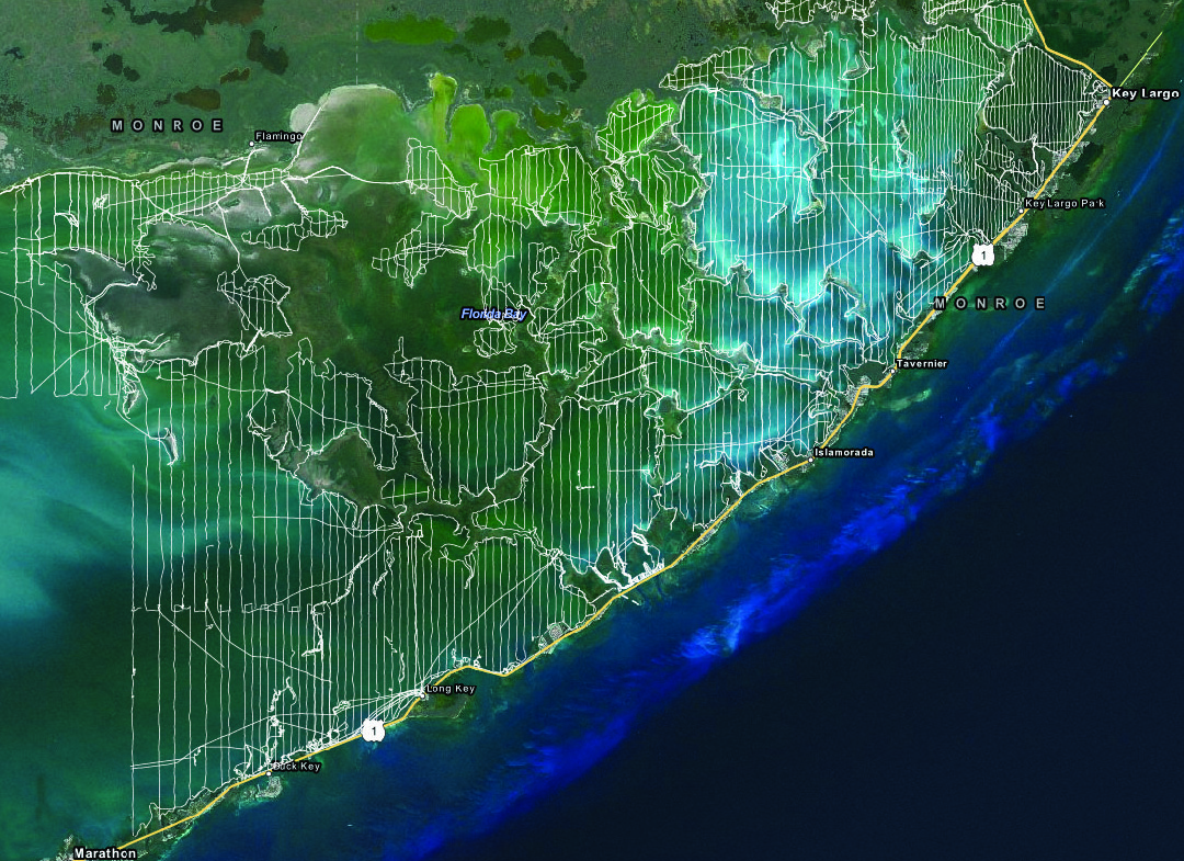
Figure 10. Survey tracklines where bathymetry were collected in Florida Bay. [Click to enlarge]
|
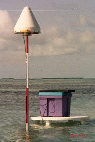
Figure 11. Survey DGPS reference station in a remote area of Florida Bay. [Click to enlarge]
|
|
SURVEY HIGHLIGHTS
- Area of Coverage Project extended south from the Florida Everglades to the Florida Keys and west from Key Largo to Marathon Key. Water depths ranged from 0.5 to 5.0 m.
- Survey Date Survey data were collected during multiple field efforts performed between 1995 and 1999.
- Data and Formats Single-beam bathymetric soundings, digital bathymetric contours, and bathymetric contour maps. Number of soundings: 2,138,572. Comma-delimited XYZ text,
ESRI point XYZ shapefile,
ESRI polyline shapefile, and
PDF formats.
- Survey Control All data were processed relative to the WGS84(G873) ellipsoid. In order to maintain the 15 km guideline, 16 new monuments were established throughout Florida Bay with each occupied for multiple long-duration (8 hours or greater) sessions. Coordinates of the control locations are listed here. The methodology for establishing new control is described in Establishing New Control using GIPSY, SCOUT and OPUS.
- Accuracy Precise differential Global Positioning System (DGPS) was used to determine horizontal and vertical positions (fig. 11). The estimated horizontal and vertical accuracy of the soundings is approximately 6 centimeters (cm) and 8 cm, respectively.
|


