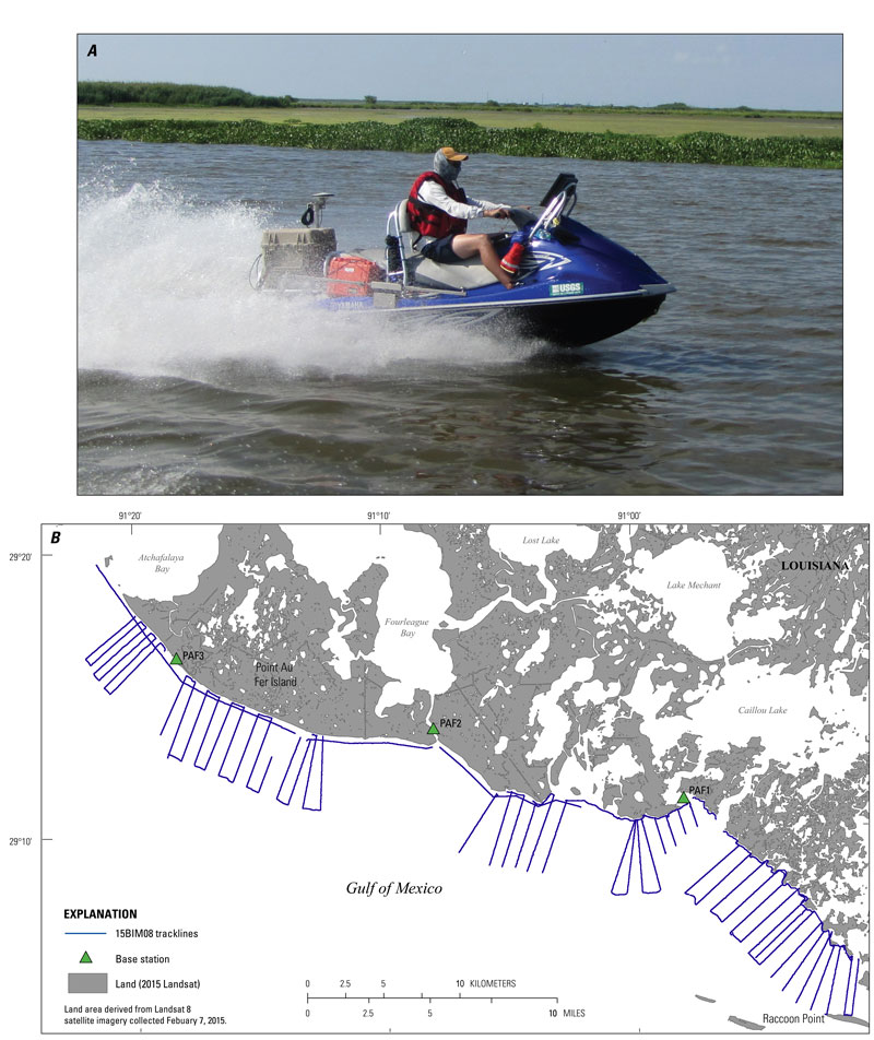
USGS - science for a changing world

Data Series 1041


Coastal Single-Beam Bathymetry Data Collected in 2015 from Raccoon Point to Point Au Fer Island, Louisiana

Skip Links

Citation Page
Abstract
Introduction
Survey Overview
Data Acquisition
Data Processing
Error Analysis
Survey Products
Data Downloads
Logs
Abbreviations
References Cited
 

Data Downloads

The bathymetry DEM is presented in GeoTiff format and can be opened directly in Esri ArcGIS 10.2 or higher. The map documents and shapefiles provided in this report were created in Esri ArcGIS 10.2.2 and can be found in the Geographic Information System (GIS) project folder. To open this folder in Esri ArcGIS, right-click and choose "Save As". The folder contains the .mxd file and all associated vector and raster data. The data layers provided may also be viewed using the free GIS viewer ArcGIS Explorer (http://www.esri.com/software/arcgis/explorer). Data files presented in this report are being resealed in both the native, WGS84 (ITRF00) ellipsoid height, as well as NAD83 (CORS 96), NAVD88 orthometric height, derived from the GEOID12A geoid model unless otherwise indicated. Note that these data should not be used for navigational purposes.

Preview File Description File Format Download File Metadata
thumbnail image of data Esri ArcGIS project Esri Files PAF_2015_GIS.zip
(398 MB)
Included with download
Bathymetry DEM
200-m cell size
GeoTIFF 32-bit floating point PAF_200m_DEM.zip
(64 KB)
Included with download
thumbnail image of data Single-beam soundings, R/V Sallenger ASCII 15BIM05_SBB_XYZ.zip
(20.5 MB)
Included with download
Single-beam tracklines, R/V Sallenger Esri shapefile 15BIM05_SBB_Tracklines.zip
(9.9 MB)
Included with download
thumbnail image of data Single-beam soundings, R/V Jabba Jaw ASCII 15BIM06_SBB_XYZ.zip
(12.5 MB)
Included with download
Single-beam tracklines, R/V Jabba Jaw Esri shapefile 15BIM06_SBB_Tracklines.zip
(6.3 MB)
Included with download
thumbnail image of data Single-beam soundings, R/V Shark ASCII 15BIM07_SBB_XYZ.zip
(19 MB)
Included with download
Single-beam tracklines, R/V Shark Esri shapefile 15BIM07_SBB_Tracklines.zip
(9.6 MB)
Included with download
thumbnail image of data Single-beam soundings, R/V Chum ASCII 15BIM08_SBB_XYZ.zip
(25.6 MB)
Included with download
Single-beam tracklines, R/V Chum Esri shapefile 15BIM08_SBB_Tracklines.zip
(12.7 MB)
Included with download

Accessibility FOIA Privacy Policies and Notices

Take Pride in America logo USA.gov logo U.S. Department of the Interior | U.S. Geological Survey
URL: http://pubsdata.usgs.gov/pubs/ds/1041/ds1041_data.html
Page Contact Information: GS Pubs Web Contact
Page Last Modified: Thursday, 09-Mar-2017 09:15:13 EST