Data Series 1041
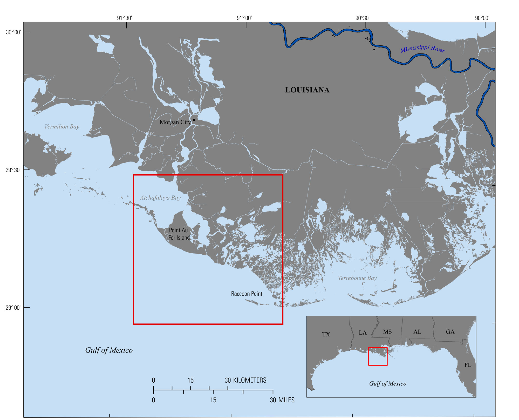
| IntroductionCoastal Louisiana encompasses a highly dynamic environment where high rates of deltaic sedimentation are offset by delta-plain subsidence, eustatic sea-level rise, storm impacts, barrier island erosion and segmentation, variable sediment supply, and human alteration. These factors collectively contribute to shoreline retreat and barrier-island and mainland land loss as shoreline sediments are eroded and coastal wetlands become inundated by marine waters (Kindinger and others, 2013). The associated effects are important because barrier islands protect natural ecosystems and human infrastructure by absorbing wave energy, thus mitigating the wave field in adjacent bays along fringing marshes and other coastal features. This survey, serves as part of the Barrier Island Comprehensive Monitoring Program (BICM), which was implemented under the Louisiana Coastal Area Science and Technology (LCA S&T) office as a component of the System Wide Assessment and Monitoring Program (SWAMP) originally developed by the State of Louisiana Coastal Protection Restoration Authority (CPRA, formerly Louisiana Department of Natural Resources [LDNR]) to complement other Louisiana coastal monitoring programs such as the Coastwide Reference Monitoring System-Wetlands (CRMS-Wetlands), and is an ongoing collaboration research effort by CPRA, the University of New Orleans, and the U.S. Geological Survey (USGS). The goal of BICM is to provide long-term data on Louisiana’s barrier islands, coastal features, and use this data to plan, design, evaluate, and maintain current and future barrier island restoration projects (Kindinger and others, 2013).The survey area extends 5 kilometers (km) offshore from Point Au Fer Island in the west to Raccoon Point in the east, encompassing the shallow water shelf of the Gulf of Mexico (fig. 1). The data described here will provide baseline bathymetric information for future research investigating island evolution, sediment transport, and recent and long term geomorphic change, and will support modeling of future changes in response to restoration and storm impacts. This data series report serves as an archive of processed single-beam bathymetry data collected in the nearshore of the southern coast of Louisiana from Raccoon Point to Point Au Fer Island. The data were collected from July 22–29, 2015, under USGS Field Activity Number (FAN) 2015-320-FA. Geographic information system data products include a 200-meter-cell-size interpolated bathymetry grid, trackline maps, and point data files. Additional files include error analysis maps, Field Activity Collection System (FACS) logs, and formal Federal Geographic Data Committee (FGDC) metadata.
|

![]() U.S. Department of the Interior |
U.S. Geological Survey
U.S. Department of the Interior |
U.S. Geological Survey
URL: http://pubsdata.usgs.gov/pubs/ds/1041/ds1041_intro.html
Page Contact Information: GS Pubs Web Contact
Page Last Modified: Thursday, 09-Mar-2017 09:16:54 EST