Data Series 1046
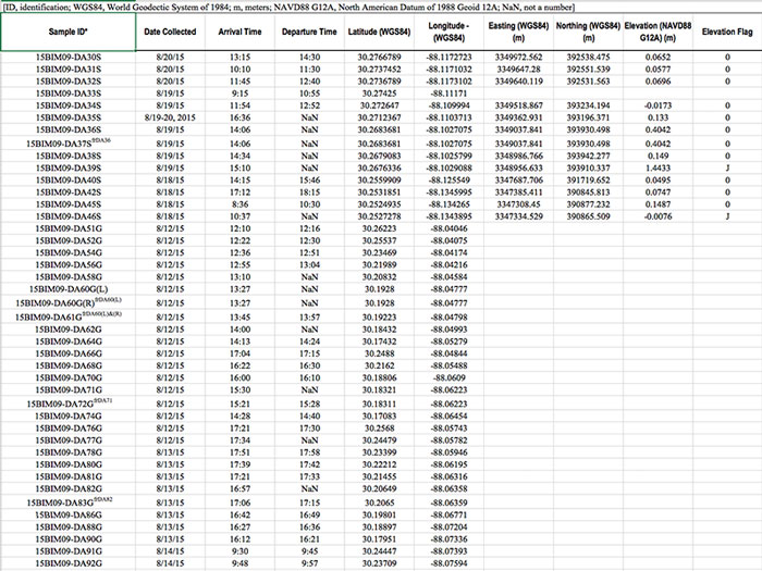
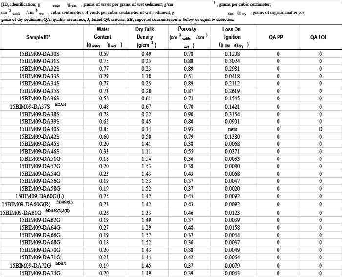
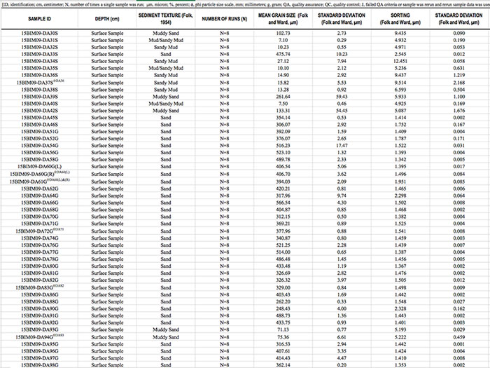
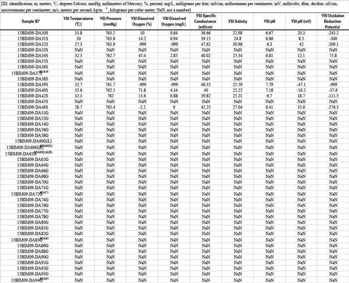
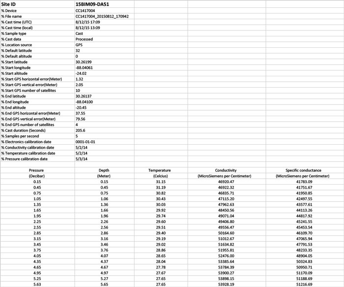
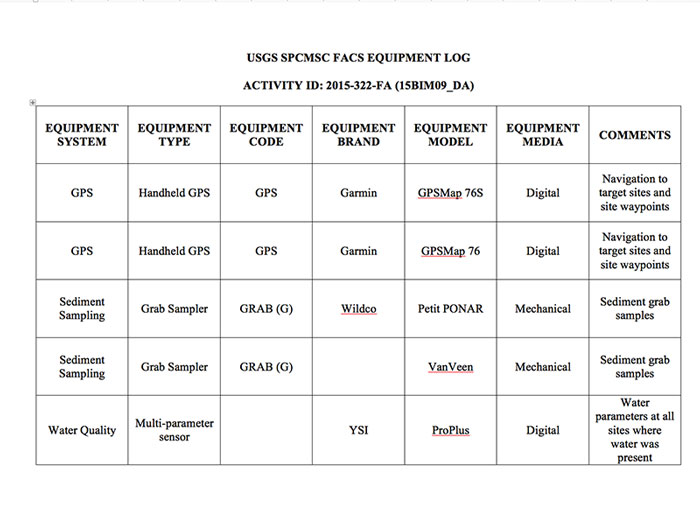
| Data Downloads Photograph of surface sample site DA201S on the southern side of Dauphin Island, Alabama. Photograph by Alisha Ellis. [Click to enlarge] All sample site location, water quality, physical sediment parameter, and grain-size data are available for download as a zipped Microsoft Excel (.xlsx) file or a Comma Separated Values (.csv) file from the Data Downloads table below. Spreadsheets and documents in this report were created in Microsoft Office 2016. Portable Document Format (PDF) files of field, crew, and equipment logs can be found in the Supplemental Data table and viewed using the free software Adobe Acrobat Reader (http://get.adobe.com/reader). All maps in this report were created in ESRI ArcGIS 10.0.2 and saved as Joint Photograph Expert Group (JPEG) files. Surficial Sediment Data
Supplemental Data
|

![]() U.S. Department of the Interior |
U.S. Geological Survey
U.S. Department of the Interior |
U.S. Geological Survey
URL: http://pubsdata.usgs.gov/pubs/ds/1046/ds1046_data.html
Page Contact Information: GS Pubs Web Contact
Page Last Modified: Wednesday, 07-Jun-2017 14:03:28 EDT