Data Series 1078
| Data AcquisitionNavigationPosition and elevation data for each GPR line were recorded at the time of collection using an Ashtech DGPS receiver and geodetic antenna. DGPS data were recorded concurrently throughout the survey using a similar instrument combination (Ashtech receiver and Thales choke ring antenna) at a base station set up on the National Park Service (NPS) benchmark at Robbins Rest (REST) (figs. 1 and 2). The rover unit was mounted above the GPR antenna (fig. 3) and was connected to the GPR’s digital control unit. Raw GPS positions were output to the GPR control unit as a National Marine Electronics Association (NMEA) GGA string at 1-second (s) intervals using coordinated universal time (UTC) stamps. 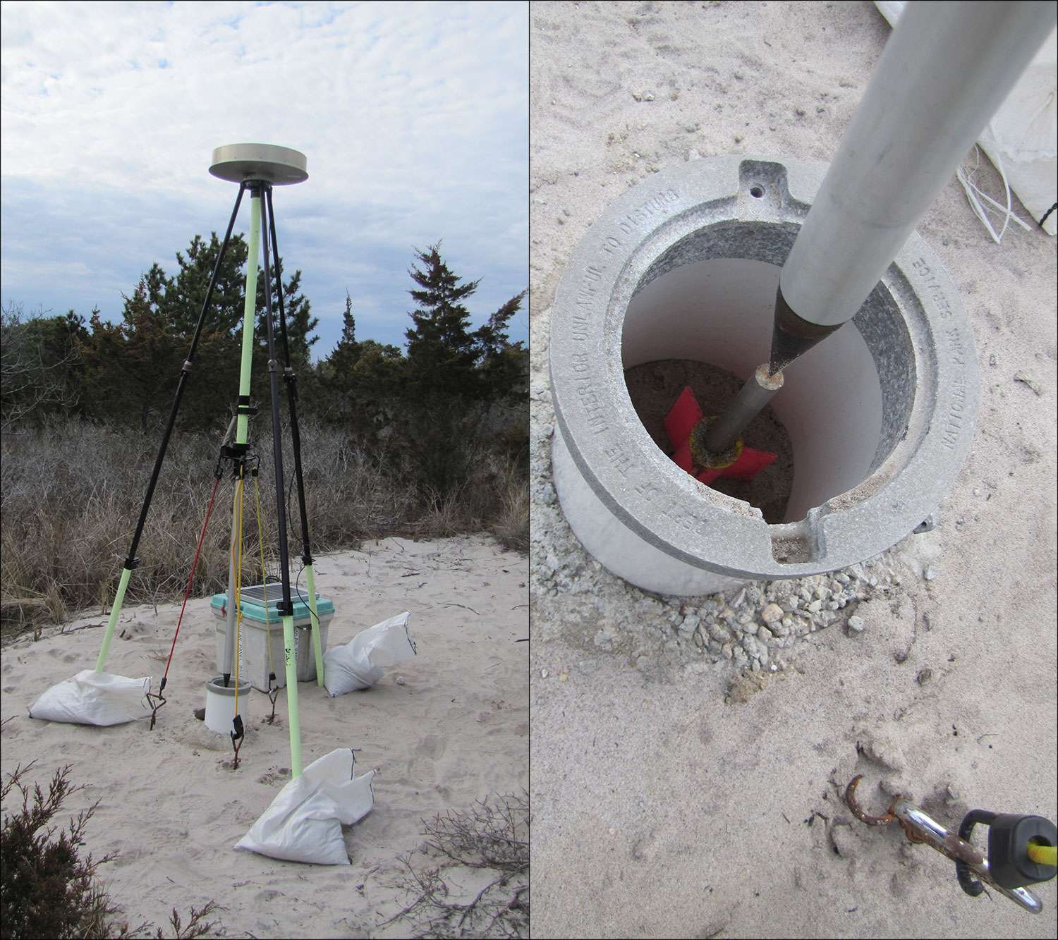 Figure 2. Photograph of differential global positioning system (DGPS) base station at Robbins Rest (REST), April 2016 (image on left). Image on the right shows the permanent survey marker housed within a polyvinyl chloride casing. Photograph by Kyle Kelso (USGS). [Click figure to enlarge] Ground Penetrating RadarA total of 90 GPR lines (fig. 3), representing a linear distance of approximately 21 km, were acquired during FAN 2016-322-FA from beach environments as well as developed and undeveloped back-barrier environments (figs. 3 and 4). Data were collected from three study sites (figs. 1, 5–8) that were considered representative of the western (site 1), central (site 2), and eastern (site 3) Fire Island geomorphic zones. At sites 1 and 2, back-barrier data were collected along beach access roads and established roads within and connecting local communities. At site 3, which is located entirely within the Otis G. Pike Wilderness Area, data were collected along washover fans and along hiking trails through back-barrier scrub/shrub vegetation. The GPR data were collected with a Geophysical Survey Systems, Inc. (GSSI) TerraSIRch SIR System-3000 (fig. 3), which acquires single-channel GPR data and includes a digital control unit (model DC-3000) and 200 megahertz (MHz) antenna. A 16-inch survey wheel (GSSI model 620) was attached to the back of the antenna and calibrated prior to surveying to ensure an accurate revolution-of-wheel-to-distance ratio. Distance mode was used to record the raw GPR data, and the raw GGA position string was recorded in real time via an Acumen SDR data logger. GPR traces were collected at a maximum rate of 64 scans per second with a vertical resolution of 1,024 samples per scan, and an infinite impulse response (IIR) filter was used (low pass = 600 MHz, high pass = 50 MHz) to increase the signal-to-noise ratio of the recorded GPR data. Data were acquired using RADAN 7 proprietary software in TerraSIRch mode and saved in Data Zero Time (DZT) format. Acquisition settings were adjusted when necessitated by changes to the subsurface geology or surrounding topography/surface conditions and were recorded in the Field Activity Collection System (FACS) logs available for download from Forde and others (2018). 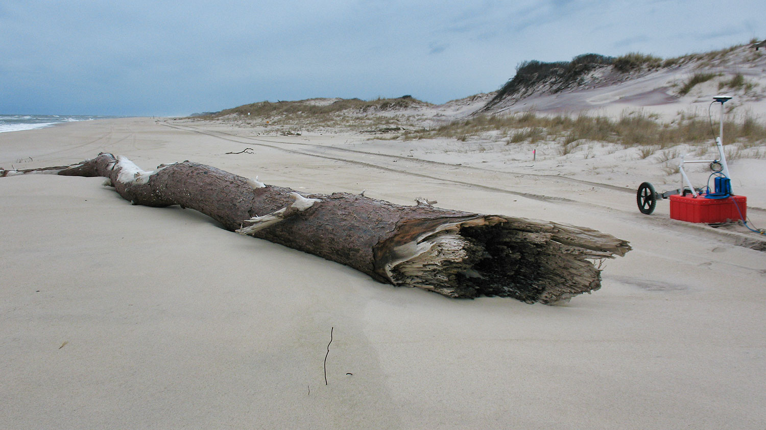 Figure 3. Photograph of ground penetrating radar acquisition of a shore-parallel line collected near the dune toe on a sandy beach environment. Photograph by Julie Bernier. [Click figure to enlarge] 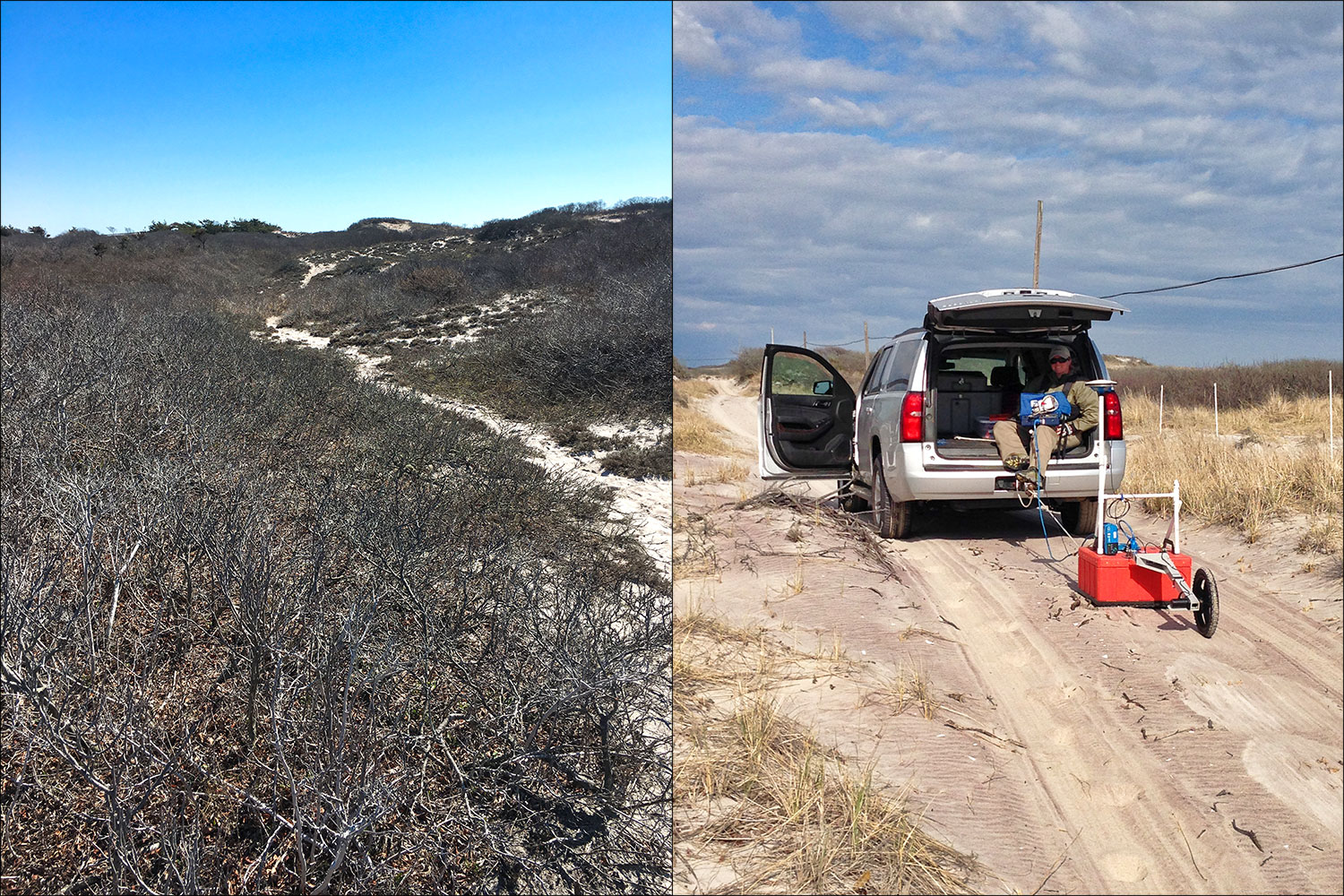 Figure 4. Photographs showing examples of shrub vegetation within wilderness area, left; and access road, right, typically encountered in back-barrier environments surveyed during the April 2016 Fire Island study. Photographs by Julie Bernier and Jennifer Miselis, respectively (USGS). [Click figure to enlarge] Note: To view PDF documents, the latest version of Adobe Reader or similar software is necessary. |

![]() U.S. Department of the Interior |
U.S. Geological Survey
U.S. Department of the Interior |
U.S. Geological Survey
URL: http://pubsdata.usgs.gov/pubs/ds/1078/ds1078_data-aquisition.html
Page Contact Information: GS Pubs Web Contact
Page Last Modified: Wednesday, 21-Feb-2018 09:51:39 EST
