Data Series 1078
| IntroductionFire Island is an approximately 50-kilometer (km) long barrier island with a northeast-southwest orientation that is separated from Long Island, New York, by Great South Bay. It is bounded by Fire Island Inlet to the west and Moriches Inlet to the east and was bisected by Hurricane Sandy in 2012 at Wilderness Breach (fig. 1). The island is centrally positioned within a larger barrier island system that spans the southern shore of Long Island. Fire Island is a wave-dominated, microtidal barrier island with a mean tidal range of 1.3 meters (m) (Lentz and Hapke, 2011) and includes developed (residential communities), moderately developed (county parks, state parks, and Fire Island National Seashore), and undeveloped (Otis G. Pike Wilderness Area) areas. Previous studies (for example, Lentz and Hapke, 2011; Hapke and others, 2016) divided Fire Island into three regions based on long-term shoreline-change and morphologic-response patterns: a net erosional eastern zone, a stable to slightly accretional central zone, and a mixed erosional and accretional western zone associated with westward barrier-island migration. West of Watch Hill, the inner continental shelf contains shoreface-attached sand ridges that overlie Pleistocene-age sediment, which is exposed in troughs between ridges (Schwab and others, 2000; Schwab and others, 2014). These sand ridges are composed of sand that is similar in texture, grain size, and composition to beach sand found on Fire Island, and the presence or absence of these sand ridges has been shown to affect sediment transport patterns and coastal erosion trends (Lentz and Hapke, 2011; Schwab and others, 2013; Warner and others, 2014; Hapke and others, 2016; Schwab and others, 2017). Locker and others (2017) mapped the distribution of nearshore sediments at Fire Island and showed that sediment thickness is greatest in the western region, providing further evidence of geologic controls on coastal sediment availability. This report, along with Forde and others (2018), serves as an archive of ground penetrating radar (GPR) and differential global positioning system (DGPS) data from profiles collected on Fire Island during a survey conducted in April 2016 (U.S. Geological Survey [USGS] Field Activity Number [FAN] 2016-322-FA). These data can be used to map shallow subsurface sediments such as erosional surfaces or washover deposits and can also be used to image deeper stratigraphic features that may aid in linking terrestrial morphology to nearshore and offshore geologic features. Beach profiles (Henderson and others, 2017) and sedimentologic (push- and vibracore) data were also collected during the same survey as part of ongoing research investigating post-Hurricane Sandy beach response and recovery. Data products, including raw GPR, processed DGPS data, elevation-corrected GPR profiles, and geographic information system (GIS) data files with accompanying formal Federal Geographic Data Committee (FGDC) metadata, can be downloaded from the Data Downloads page or the data release (Forde and others, 2018). 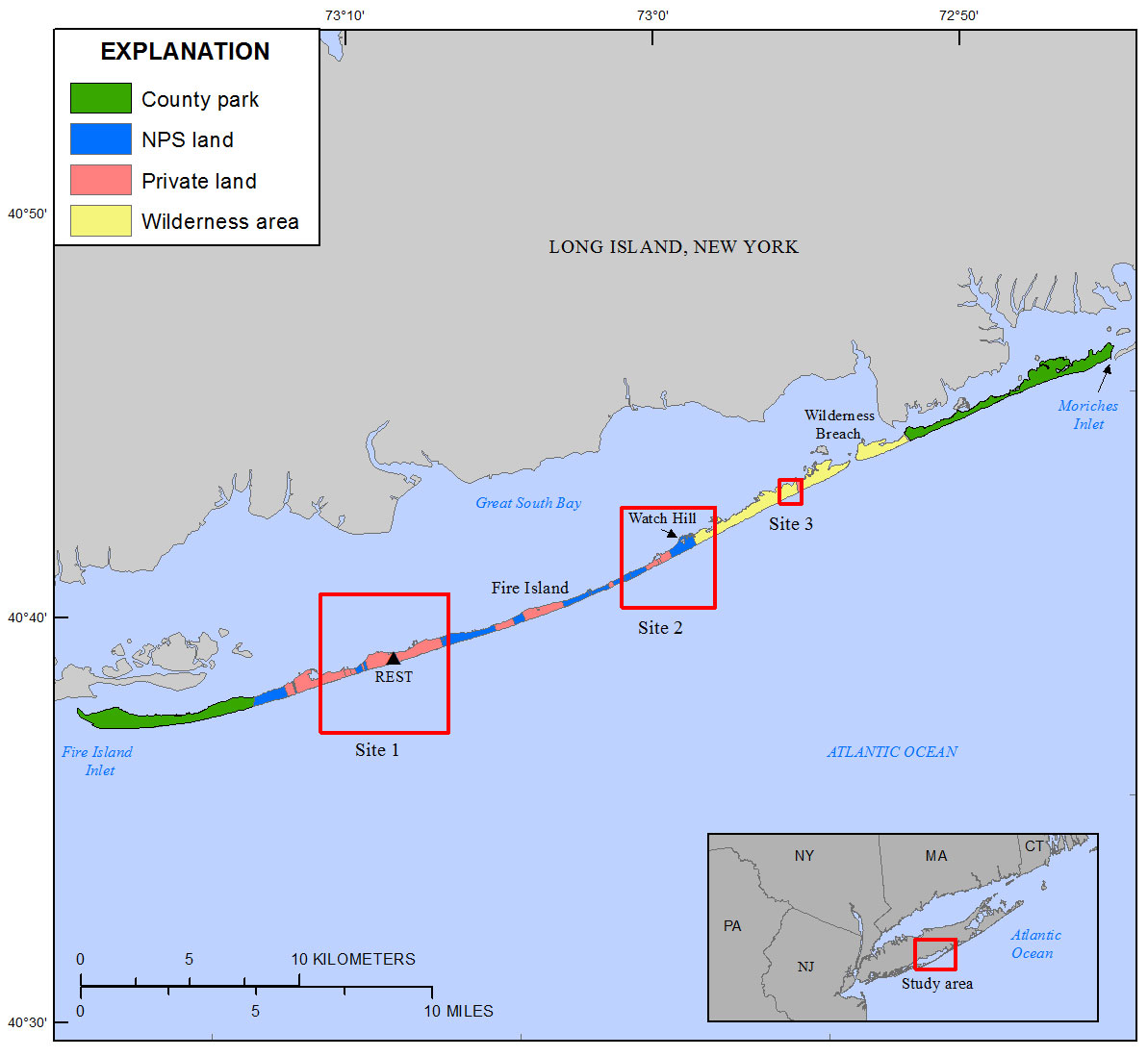 Figure 1. Location map showing the April 2016 study sites (indicated by red boxes) and differential global positioning system (DGPS) base station at Robbins Rest (REST) on Fire Island, New York. Base map modified from New York State Office of Information Technology Geographic Information System (GIS) Program Office, 1:24,000 scale. [NPS, National Park Service]. [Click figure to enlarge] |

![]() U.S. Department of the Interior |
U.S. Geological Survey
U.S. Department of the Interior |
U.S. Geological Survey
URL: http://pubsdata.usgs.gov/pubs/ds/1078/ds1078_intro.html
Page Contact Information: GS Pubs Web Contact
Page Last Modified: Wednesday, 21-Feb-2018 14:38:10 EST
