Data Series 1078
| Abstract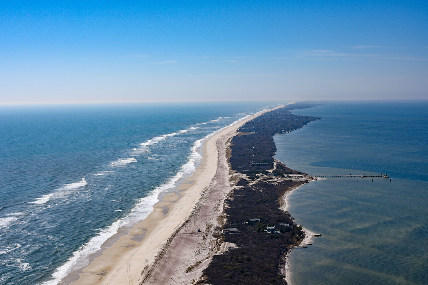 Coastal oblique aerial photograph looking southwest along Fire Island, New York, March 2016. Photograph courtesy of Karen Morgan (Morgan, 2017). [Click image to enlarge] Researchers from the U.S. Geological Survey (USGS) conducted a long-term coastal morphologic-change study at Fire Island, New York, prior to and after Hurricane Sandy impacted the area in October 2012. The Fire Island Coastal Change project objectives include understanding the morphologic evolution of the barrier island system on a variety of time scales (months to centuries) and resolving storm-related impacts, post-storm beach response, and recovery. In April 2016, scientists from the USGS St. Petersburg Coastal and Marine Science Center conducted geophysical and sediment sampling surveys on Fire Island to characterize and quantify spatial variability in the subaerial geology with the goal of subsequently integrating onshore geology with other surf zone and nearshore datasets. This report, along with the associated USGS data release, serves as an archive of ground penetrating radar (GPR) and post-processed differential global positioning system (DGPS) data collected from beach and back-barrier environments on Fire Island, April 6–13, 2016 (USGS Field Activity Number 2016-322-FA). Data products, including unprocessed GPR trace data, processed DGPS data, elevation-corrected subsurface profile images, geographic information system files, and accompanying Federal Geographic Data Committee metadata are available for download. AcknowledgmentsThis study was funded under the Disaster Relief Appropriations Act of 2013, using the U.S. Department of the Interior Hurricane Sandy supplemental funding. The authors thank Kyle Kelso and Owen Brenner (USGS) for their assistance with data collection. Logistical support for field work was provided by Michael Bilecki and Jordan Raphael at the Fire Island National Seashore. Betsy Boynton (Cherokee Nation Technologies) assisted with the report web design. The authors also thank Christopher G. Smith (USGS), Chelsea Stalk (Cherokee Nation Technologies), and Xan Fredericks (USGS) for conducting scientific, editorial, and metadata reviews that improved the content and presentation of this report. Information StatementAlthough these data have been processed successfully on a computer system at the USGS, no warranty expressed or implied is made regarding the display or utility of the data on any other system or for general or scientific purposes, nor shall the act of distribution constitute any such warranty. The USGS or the U.S. Government shall not be held liable for improper or incorrect use of the data described and (or) contained herein. Any use of trade, firm, or product names is for descriptive purposes only and does not imply endorsement by the U.S. Government. Suggested CitationForde, A.S., Bernier, J.C., and Miselis, J.L., 2018, Ground penetrating radar and differential global positioning system data collected in April 2016 from Fire Island, New York: U.S. Geological Survey Data Series 1078, https://doi.org/10.3133/ds1078. ContactArnell S. FordeU.S. Geological Survey St. Petersburg Coastal and Marine Science Center 600 4th Street South St. Petersburg, FL 33701 (727) 502-8000 aforde@usgs.gov |

![]() U.S. Department of the Interior |
U.S. Geological Survey
U.S. Department of the Interior |
U.S. Geological Survey
URL: http://pubsdata.usgs.gov/pubs/ds/1078/index.html
Page Contact Information: GS Pubs Web Contact
Page Last Modified: Wednesday, 21-Feb-2018 08:13:29 EST
