![]()
Prepared by the U.S. Geological Survey in
cooperation with the Kickapoo Tribe of Oklahoma Department of Environmental
Programs
A Compilation of Spatial Datasets and Surface-Water and Ground-Water
Data from the U.S. Geological Survey and other Federal and Oklahoma State
agencies for the Kickapoo Tribe of Oklahoma
By Shana L. Mashburn
Data Series-402
U.S. Department of the Interior
DIRK KEMPTHORNE, Secretary
U.S. Geological Survey
Mark D. Myers, Director
Any use of trade, product, or firm names is for descriptive purposes only and does not imply endorsement by the U.S. Government.
U.S. Department of the Interior
U.S. Geological Survey
U.S. Geological Survey
A Compilation of Spatial Datasets and Surface-Water and Ground-Water
Data from the U.S. Geological Survey and other Federal and Oklahoma State
agencies for the Kickapoo Tribe of Oklahoma
By Shana L. Mashburn
Abstract
This report contains spatial datasets
of natural and anthropogenic features and spatial datasets detailing
surface-water, ground-water, and other types of environmental information
collected in and surrounding Kickapoo Tribal Lands. Spatial datasets were
compiled from Federal and Oklahoma State agencies. Surface-water, ground-water,
and other types of environmental information of natural and anthropogenic
features were compiled from USGS National Water Information System database,
Oklahoma Department of Environmental Quality online Geographic Information
System data viewer, Oklahoma Water Resources Board online Water Information
Mapping System, and U.S. Environmental Protection Agency online Modernized
STORET database.
These spatial datasets were
compiled from many different sources with varying quality. Because of the
different sources, features common to multiple layers may not overlay exactly.
Users should check the metadata to determine proper use of these data. These
data were not checked for accuracy or completeness. Should a question of
accuracy or completeness arise, the user should contact the originator cited in
the metadata.
Introduction
A digital atlas containing
spatial datasets representing a compilation of natural, anthropogenic, and
environmental information in spatial format to the Kickapoo Tribe of Oklahoma
is needed for use in planning future detailed assessments of their water
resources. The U.S. Geological Survey, in cooperation with the Kickapoo Tribe
of Oklahoma prepared a digital atlas that includes 25 spatial datasets and 14
tabular files covering various parts of Canadian, Cleveland, Creek, Grady,
Hughes, Kingfisher, Lincoln, Logan, McClain, McIntosh, Muskogee, Okfuskee,
Oklahoma, Okmulgee, Payne, Pottawatomie, and Seminole counties.
This report describing a digital
atlas contains spatial datasets of natural and anthropogenic features and
spatial datasets detailing surface-water, ground-water, and other types of
environmental information collected within and surrounding Kickapoo Tribal
Lands (Figure 1). Natural and anthropogenic spatial datasets were compiled from
Federal and Oklahoma State agencies. Surface-water, ground-water, and other
types of environmental information were compiled from USGS National Water
Information System database, Oklahoma Department of Environmental Quality (ODEQ)
online Geographic Information System (GIS) data viewer, Oklahoma Water
Resources Board (OWRB) online Water Information Mapping System, and U.S. Environmental
Protection Agency (USEPA) online Modernized STORET (USEPA STOrage and
RETrieval) database.
This report contains
approximately 4.0 Gigabytes of data stored on one DVD (also known as a Digital
Video Disc or Digital Versatile Disc). These spatial datasets can be displayed
on personal computers with GIS software. Spatial data are provided in shapefile
format, imagery data are provided in raster format, and tabular data are
provided as dbase tables. Metadata, or documentation files, are provided as .xml
files within the datasets and also as .html files, which are hyperlinked from
Table 1.
Data Quality Statement
These spatial datasets were
compiled from many different sources with varying quality. Because of the
different sources, features common to multiple layers may not overlay exactly. Users
should check the metadata to determine proper use of these data. These data
were not checked for accuracy or completeness. Should a question of accuracy or
completeness arise, the user should contact the originator cited in the
metadata. There are some USGS trace element data collected prior to October
1992 that did not have quality-assurance samples to determine if contamination was or was
not introduced during the collection phase. Before using the trace element data
in this publication, users are encouraged to read USGS Office of Water Quality
Technical Memorandum 92.05 (http://water.usgs.gov/admin/memo/QW/qw92.05.html) to
determine the validity and usefulness of any trace element data collected
before October 1992.
The environmental data compiled for this publication include
time-series data that measure streamflow (discharge), reservoir and lake
levels, and surface-water quality in the basin. These data were collected by
automatic recorders and manual measurements. The USGS publishes daily
streamflow and peak-flow data for selected streams and rivers in Oklahoma in a
series of annual water-data reports (http://wdr.water.usgs.gov/wy2007/search.jsp).
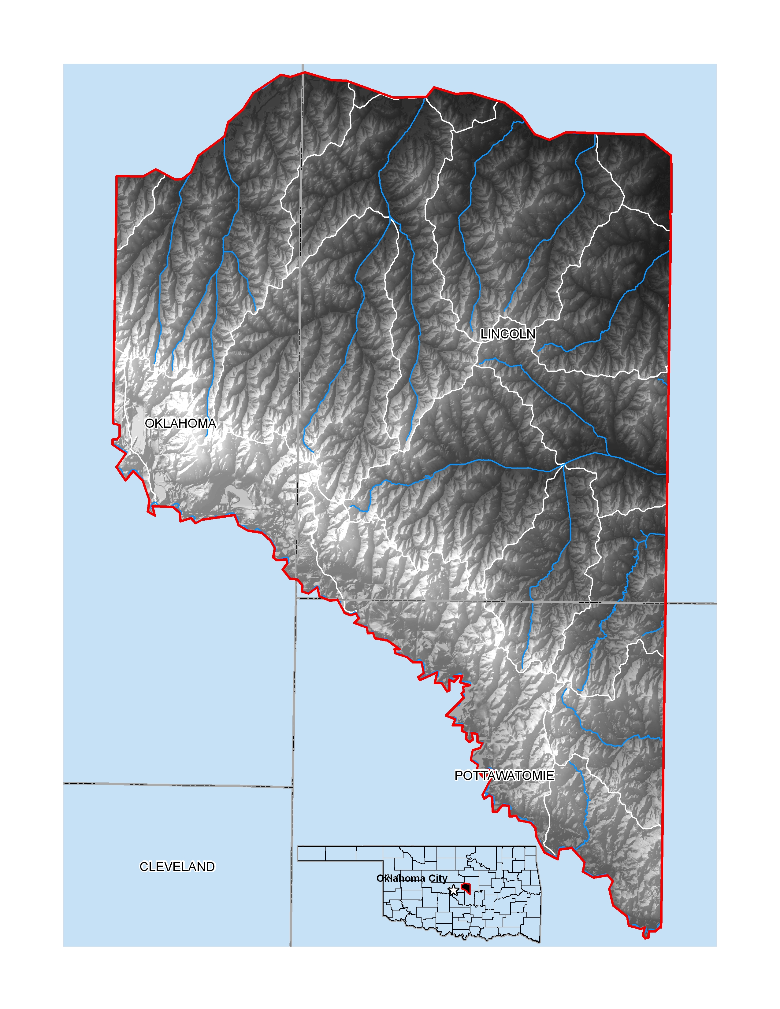
Figure 1. Kickapoo Tribal Lands (also known as the Oklahoma
Tribal Statistical Area for the Kickapoo Tribe of Oklahoma)
Data Organization
/anthropogenic_features/ -- contains
datasets for anthropogenic features
/natural_features/ -- contains datasets
for natural features
/OCC_data/ -- contains datasets
and tables for Oklahoma Conservation Commission data
/ODEQ_data/ -- contains datasets
and tables for Oklahoma Department of Environmental Quality data
/OWRB_data/ -- contains datasets
and tables for Oklahoma Water Resources Board data
/USGS_data/ -- contains datasets
and tables for United States Geological Survey data
Table 1. List of DVD directory, datasets for download (as zip files), file
types, and descriptions.
[DVD, Digital Video Disc; TIGER,
Topologically Integrated Geographic Encoding and Referencing system; MS,
Microsoft; DRG, Digital Raster Graphic; OCC, Oklahoma Conservation Commission;
ODEQ, Oklahoma Department of Environmental Quality; OWRB, Oklahoma Water
Resources Board; USGS, U.S. Geological Survey]
|
DVD Directory |
Dataset Title |
File Type |
Description |
Link to Metadata |
|
anthropogenic_features |
ds402_counties |
shapefile |
County
boundaries |
|
|
ds402_kickapooarea |
shapefile |
General
reference to the extent of the Kickapoo Tribal Lands or Tribal Statistical
Area for the Kickapoo Tribe of Oklahoma |
||
|
ds402_municipal_bounds |
shapefile |
Municipal
boundaries |
||
|
ds402_oilwells |
shapefile |
The
number of oilwells, type of production, and exploration maturity in
one-quarter mile cells |
||
|
ds402_roads |
shapefile |
Roads
from 2000 TIGER/Line files |
||
|
ds402_sections |
shapefile |
Township,
range, and section boundaries from the public land survey system |
||
|
|
ds402_aerials2003
|
raster |
Rasters
for year 2003 Digital Orthophoto Quarter Quadrangles |
|
|
Browse the contents of the natural_features directory |
ds402_aerials2006
|
raster |
Rasters
for year 2006 Digital Orthophoto Quarter Quadrangles |
|
|
ds402_DRGtopos
|
raster |
Raster
of topographic Digital Raster
Graphics |
||
|
ds402_elevation
|
raster |
Rasters
of National Elevation Dataset |
||
|
ds402_soils
|
shapefiles
and MS Access database |
Soils
spatial data and associated tabular data in Access database |
||
|
ds402_landuse
|
raster |
Land
use and land cover dataset |
||
|
ds402_ecoregions
|
shapefile |
Level
III and Level IV Ecoregions |
||
|
ds402_fed_species
|
shapefile |
County-level
species occurrence with U.S. Fish and Wildlife Service threatened and
endangered ranking |
||
|
ds402_geology
|
shapefile |
Surficial
geologic units |
||
|
ds402_hydrography
|
shapefile |
National
Hydrography Dataset of streams and reaches |
||
|
ds402_maj_aquifers
|
shapefile |
General
reference to the extent of major aquifer boundaries |
||
|
ds402_state_species
|
shapefile |
County-level
species occurrence with Oklahoma Department of Wildlife Conservation
threatened and endangered ranking |
||
|
ds402_wbdhuc12
|
shapefile |
Hydrologic
unit boundary dataset to the Subwatershed (12-digit) 6th level |
||
|
OCC_data |
ds402_OCCswsites |
shapefile |
Surface-water
sites sampled by the Oklahoma Conservation Commission |
|
|
ds402_OCCbiological |
table |
Biological
data for surface-water sites sampled by the Oklahoma Conservation Commission |
||
|
ds402_OCCswquality |
table |
Water-quality
data for surface-water sites sampled by the Oklahoma Conservation Commission |
||
|
|
ds402_ODEQswsites |
shapefile |
Surface-water
sites sampled by the Oklahoma Department of Environmental Quality |
|
|
ODEQ_data |
ds402_ODEQbiological |
table |
Biological
data for surface-water sites sampled by the Oklahoma Department of
Environmental Quality |
|
|
ds402_ODEQswquality |
table |
Water-quality
data for surface-water sites sampled by the Oklahoma Department of
Environmental Quality |
||
|
ds402_ODEQpdes |
shapefile |
Pollution
discharge elimination system discharger locations from Oklahoma Department of
Environmental Quality |
||
|
ds402_ODEQwellsites |
shapefile |
Wells
sampled by the Oklahoma Department of Environmental Quality |
||
|
ds402_ODEQwellwquality |
table |
Water-quality
data for wells sampled by the Oklahoma Department of Environmental Quality |
||
|
OWRB_data |
ds402_OWRBswsites |
shapefile |
Surface-water
sites monitored by the Oklahoma Water Resources Board |
|
|
ds402_OWRBswquality |
table |
Water-quality
data for surface-water sites monitored by the Oklahoma Water Resources Board |
||
|
ds402_OWRBwells |
shapefile |
Reported
well locations from the Oklahoma Water Resources Board |
||
|
USGS_data |
ds402_USGSswsites |
shapefile |
Surface-water
sites sampled by the U.S. Geological Survey |
|
|
ds402_USGSswsiteinfo |
table |
Site
information for U.S. Geological Survey surface-water sites |
||
|
ds402_USGSswmeasuredsf |
table |
Streamflow
measurements for U.S. Geological Survey surface-water sites |
||
|
ds402_USGSswdailysf |
table |
Daily
streamflow for U.S. Geological Survey surface-water sites |
||
|
ds402_USGSswpeaksf |
table |
Peak
streamflow for U.S. Geological Survey surface-water sites |
||
|
ds402_USGSswquality |
table |
Water-quality
data for U.S. Geological Survey surface-water sites |
||
|
ds402_USGSgwsites |
shapefile |
Ground-water
sites sampled by the U.S. Geological Survey |
||
|
ds402_USGSgwsiteinfo |
table |
Site
information for U.S. Geological Survey ground-water sites |
||
|
ds402_USGSgwlevels |
table |
Water
levels for U.S. Geological Survey ground-water sites |
||
|
ds402_USGSgwquality |
table |
Water-quality
data for U.S. Geological Survey ground-water sites |
||
|
|
|
|
|
|
Geometric Registration
The Albers Equal-Area Conic map
projection (Snyder, 1987) is used as the base projection for most spatial datasets
included in this report, except for ds402_aerials2003, ds402_aerials2006, and ds402_DRGtopos,
which are in Universal Transverse Mercator Zone 14 projection; and ds402_soils and
ds402_elevation, which are in Geographic Coordinate System North American Datum
of 1983. The Albers Equal-Area Conic projection is used frequently for
spatial-map datasets in the conterminous United States because of the minimal
distortion between two standard parallels that provides equal-area
characteristics. This projection slightly distorts shapes and distances (scale)
to maintain equal-area properties. Scale is true along the standard parallels
(29.5 and 45.5 degrees North), which are to the north and south of Oklahoma.
Scale distortion in Oklahoma reaches a maximum of slightly less than 1 percent
at the northern border of the State (Snyder, 1987).
Selected References
Federal Geographic Data
Committee, 1998, Content standard for digital geospatial metadata (revised June
1998): FGDC-STD-001-1998, Washington, D.C., 78 p.
Snyder, J.P., 1987, Map
projections—A working manual: U.S. Geological Survey Professional Paper
1395, #383 p.
