
INTRODUCTION
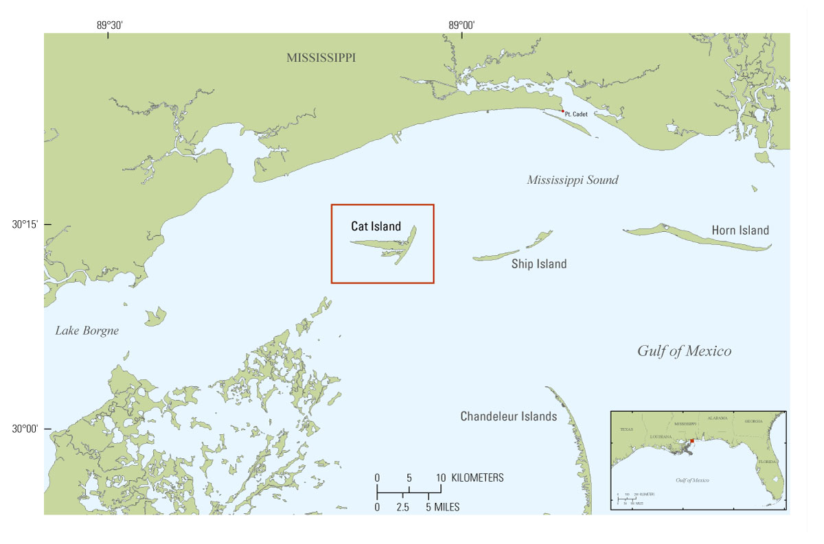
Figure 2. Study area and location map of Cat Island, Mississippi. [Click to enlarge.]
The Mississippi-Alabama barrier islands are part of a dynamic coastal environment with changing coastlines and increased land loss over time (Morton and others, 2004; Morton, 2008, Buster and Morton, 2011). While Cat Island is considered the most “stable” of all the islands and is not migrating or losing land in the same ways or at the rates of the other islands, the size and morphology of the island have changed over the last ~150 years (Morton, 2007) (fig. 2). In order to understand these changes in the context of the evolution of the northern Gulf of Mexico coastal system, it is important to link the sub-aerial morphology to the morphology and sedimentology surrounding the island. Sediment located in the littoral zone is transported by longshore currents, waves, and storms, shaping both the sub-aerial and sub-aqueous environments of barrier islands. Mapping the bathymetry and surficial sediment distribution contributes essential information on island platform morphology, nearshore processes, and coastal evolution. In addition, these data can be combined with subsurface geological information (Forde and others, 2012) to provide a three-dimensional analysis of the geology surrounding the island.
The bathymetric and side-scan sonar products presented in this report provide information about the seafloor geology and morphology around Cat Island, Miss. The geophysical data were collected during two cruises as part of the Barrier Island Monitoring (BIM) project (USGS Field Activity Numbers 10BIM04 and 10BIM05) covering an area of ~100 square kilometers (km2) with 487 line-kilometers (km) of interferometric swath bathymetry and acoustic backscatter data, and 274 line-km of single-beam bathymetry data. Processed data, map, and imagery products are downloadable in a geographic information system (GIS) format located in data downloads.
This report includes the bathymetric and side-scan sonar data collected in 2010 to study the geomorphic and geologic evolution of Cat Island, Miss. The seismic-reflection data for the same cruise are reported by Forde and others (2012) and the terrestrial and marine vibracore and sediment analysis for Cat Island are yet to be published. Other U.S. Geological Survey geophysical publications relevant to this study area include: Morton and Rogers (2009); Smith and others (2009); DeWitt and others (2010; 2011a, b, c, d); Flocks and others (2011); Forde and others (2011a, b, c, d); Pendleton and others (2011); Pfeiffer and others (2011); and Twichell and others (2011).
