
ABSTRACT
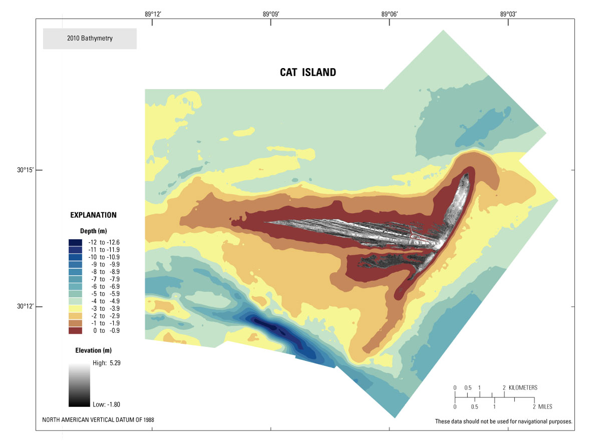
Figure 1. A 50-meter grid of 2010 bathymetry surrounding Cat Island, Mississippi, with 2007 lidar topography (lidar modified from Smith and others, 2009). [Click to enlarge.] Abbreviation: m, meter.
Scientists from the U.S. Geological Survey (USGS), St. Petersburg Coastal and Marine Science Center (SPCMSC), in collaboration with the U.S. Army Corps of Engineers (USACE), conducted geophysical and sedimentological surveys around Cat Island, the westernmost island in the Mississippi-Alabama barrier island chain (fig. 1). The objectives of the study were to understand the geologic evolution of Cat Island relative to other barrier islands in the northern Gulf of Mexico and to identify relationships between the geologic history, present day morphology, and sediment distribution.
This report contains data from the bathymetry and side-scan sonar portion of the study collected during two geophysical cruises. Interferometric swath bathymetry and side-scan sonar data were collected aboard the RV G.K. Gilbert September 7-15, 2010. Single-beam bathymetry was collected in shallow water around the island (< 2 meter (m)) from the RV Streeterville from September 28 to October 2, 2010, to cover the data gap between the landward limit of the previous cruise and the shoreline.
This report serves as an archive of processed interferometric swath and single-beam bathymetry and side scan sonar data. GIS data products include a 50-m cell size interpolated gridded bathymetry surface, trackline maps, and an acoustic side-scan sonar image. Additional files include error analysis maps, Field Activity Collection System (FACS) logs, and formal Federal Geographic Data Committee (FDGC) metadata.
Do not use these data for navigational purposes.
Information Statement
This DVD publication was prepared by an agency of the United States Government. Although these data have been processed successfully on a computer system at the U.S. Geological Survey, no warranty expressed or implied is made regarding the display or utility of the data on any other system, or for general or scientific purposes, nor shall the act of distribution imply any such warranty. The U.S. Geological Survey shall not be held liable for improper or incorrect use of the data described and (or) contained herein. Reference herein to any specific commercial product, process, or service by trade name, trademark, manufacturer, or otherwise does not constitute or imply its endorsement, recommendation, or favoring by the United States Government or any agency thereof.
Suggested Citation
Buster, N.A., Pfeiffer, W.R, Miselis, J.L, Kindinger, J.L., Wiese, D.S., and Reynolds, B.J., 2012, Bathymetry and acoustic backscatter data collected in 2010 from Cat Island, Mississippi: U.S. Geological Survey Data Series 739, 1 DVD, available at https://pubs.usgs.gov/ds/739/.
Contact
Noreen A. Buster
Geologist
U.S. Geological Survey
St. Petersburg Coastal and Marine Science Center
600 4th Street South
St. Petersburg, FL 33701
(727) 803-8747 x3114
nbuster@usgs.gov
