
SURVEY OVERVIEW
The first Cat Island geophysical cruise by the U.S. Geological Survey (10BIM04) occurred during September 7-15, 2010, aboard the 50-foot (ft) RV G.K. Gilbert (fig. 3). A total of 487 line-km of data were collected utilizing an integrated suite of geophysical instruments capable of mapping the geologic environment around the island in three dimensions. An interferometer provided swath bathymetry (for example, water depth or submerged elevation). A side-scan sonar system provided information about seafloor reflectivity, but in a wider swath than the interferometer. Finally, a high-resolution chirp subbottom profiler imaged the shallow subbottom (Forde and others, 2012). Survey tracklines (76 lines) were shore parallel for swath bathymetry with spacing of approximately 300 m (fig. 4). During the second cruise (September 28 through October 2, 2010) (10BIM05) aboard the 22-ft RV Streeterville (fig. 5), 274 line-km of single-beam bathymetry data were collected. Tracklines (106 lines) were primarily perpendicular to shore with spacing of approximately 500 m (fig. 6). Total survey area was ~100 km2 with 22 percent swath coverage of the seafloor (side-scan sonar swath width was almost double that of the interferometric swath width). Elevation ranges for bathymetry are -0.49 to -12.85 m North American Vertical Datum 1988 (NAVD88).
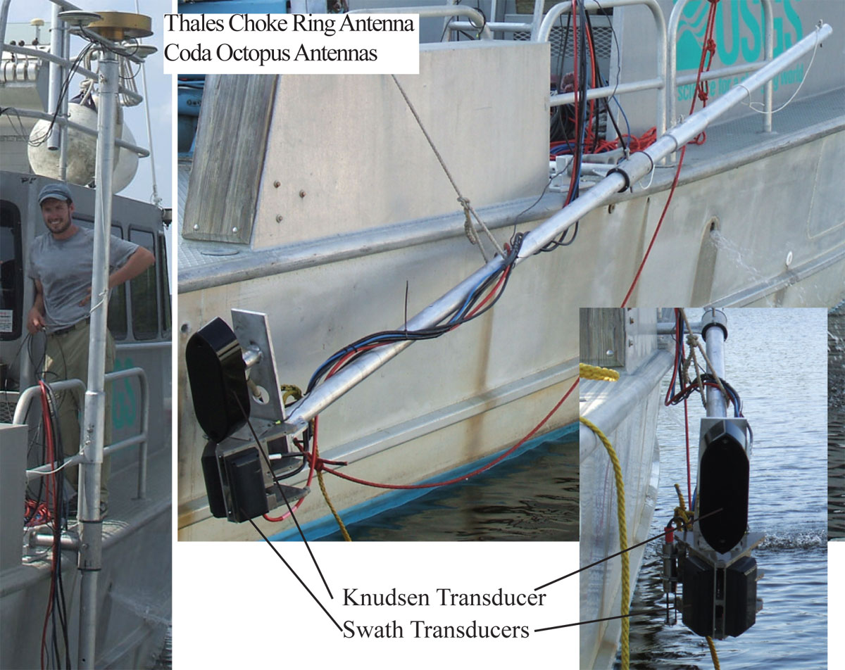
Figure 3. The RV G.K. Gilbert mobilized with navigation and interferometric swath bathymetry equipment. |
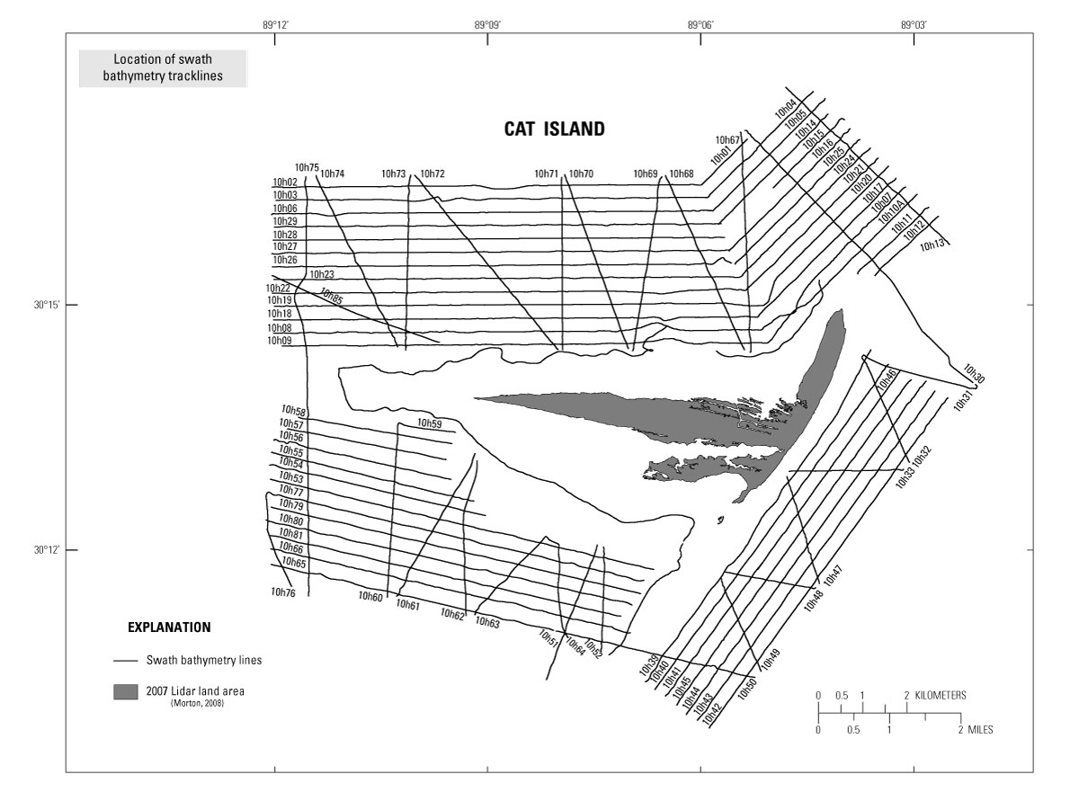
Figure 4. Swath bathymetry tracklines for Cat Island survey in 2010. |
|
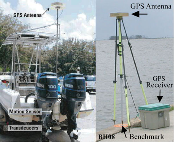
Figure 5. The RV Streeterville, mobilized with single-beam bathymetry equipment and navigation base station at Point Cadet, Mississippi. |
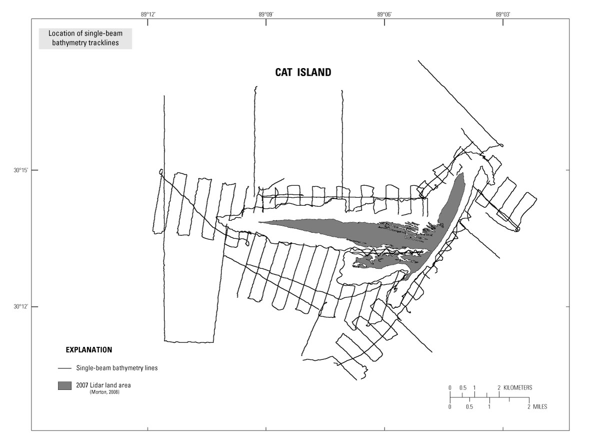
Figure 6. Single-beam bathymetry tracklines for Cat Island survey in 2010. |
