U.S. Geological Survey Data Series 761
Click on a segment name to view the contact sheet.
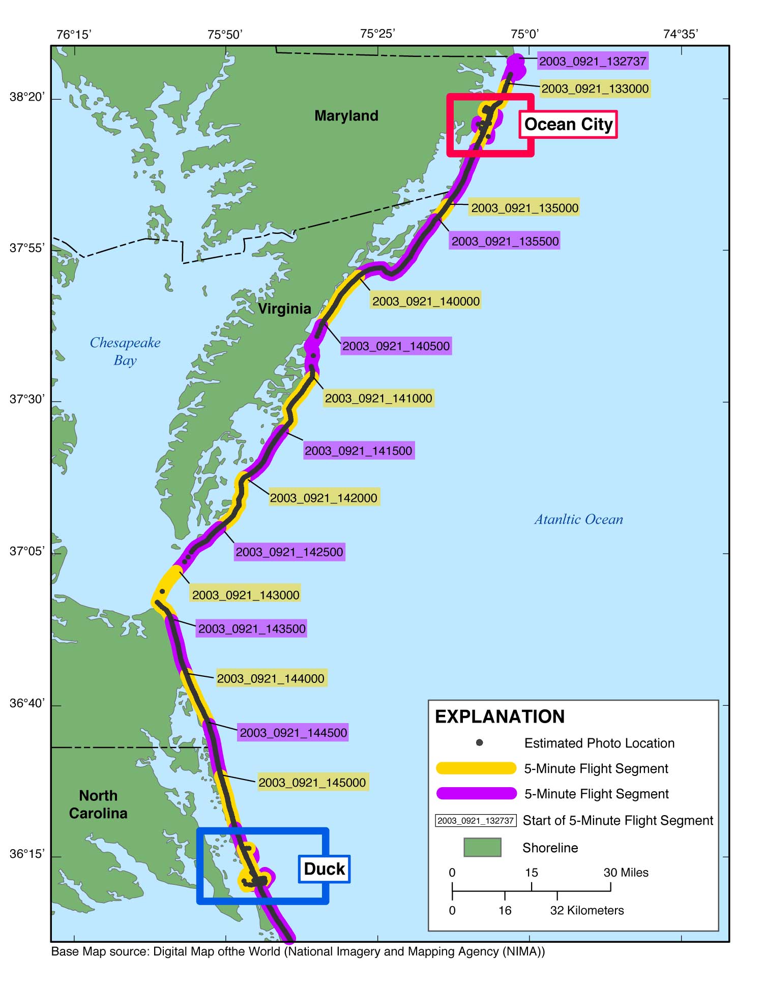
| Figure 3. Map showing the post-Hurricane Isabel flightpath for the USGS field activity 03CCH01 (Area 1) from Ocean City, Maryland, to Duck, North Carolina. The flightpath is represented by the alternating purple and yellow line and the photographs by the gray dots along the flightpath. The region boxes link to more detailed maps of the area. The full-size photos are divided by region onto this report's three DVDs. NOTE: Links to the contact sheets are available on all three discs, but links to full-size photos will work only if viewing from Disc 1. (Internet version contains all photographs.) |

![]() U.S. Department of the Interior |
U.S. Geological Survey
U.S. Department of the Interior |
U.S. Geological Survey
URL: http://pubsdata.usgs.gov/pubs/ds/761/pubs761/html/03cch01_1.html
Page Contact Information: GS Pubs Web Contact
Page Last Modified: Monday, 28-Nov-2016 19:11:22 EST
