U.S. Geological Survey Data Series 761
Click on a segment name to view the contact sheet.

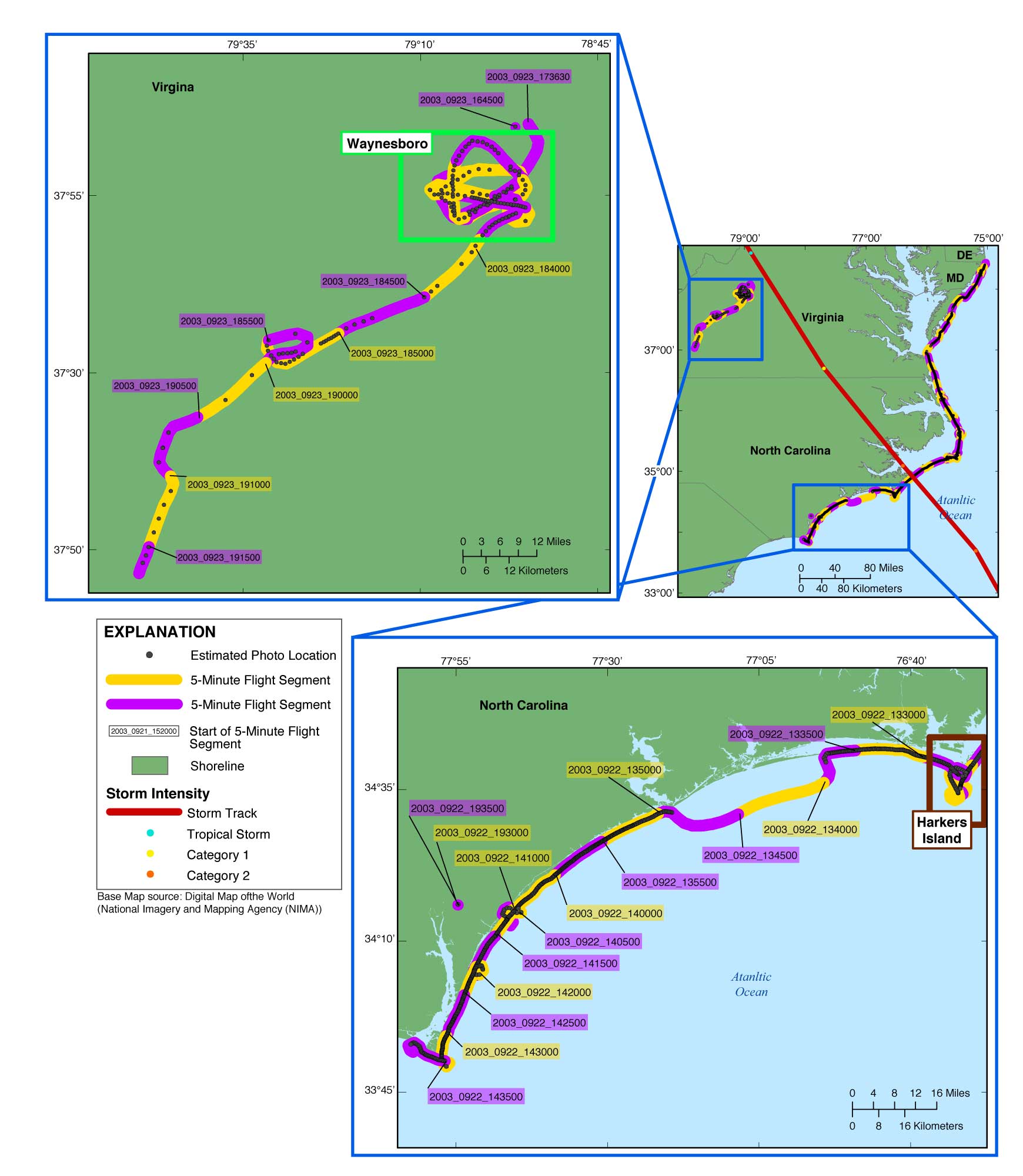
| Figure 5. Map showing the post-Hurricane Isabel flightpath for the USGS field activity 03CCH01 (Area 3, southern and inland segments) from Davis Island to Fort Caswell, North Carolina, and the inland from Waynesboro to Redwood, Virginia. The flightpath is represented by the alternating purple and yellow line, the photographs by the gray dots along the flightpath, the storm track is a red line (provided by NOAA), and the storm strength is indicated by orange, yellow, and blue dots, based on the Saffir-Simpson Hurricane Wind Scale (Saffir, 1973; Simpson, 1974). The region boxes link to more detailed maps of the area. The full-size photos are divided by region onto this reports three DVDs. NOTE: There are no slides, and therefore will be no contact sheets, corresponding to segments beginning at 2003_0922_131919, 2003_0922_134000, 2003_0923_173630, 2003_0923_174000, and 2003_0923_174500. NOTE: Links to the contact sheets are available on all three discs, but links to full-size photos will work only if viewing from Disc 3. (Internet version contains all photographs.) |