U.S. Geological Survey Data Series 761
Click on a segment name to view the contact sheet.
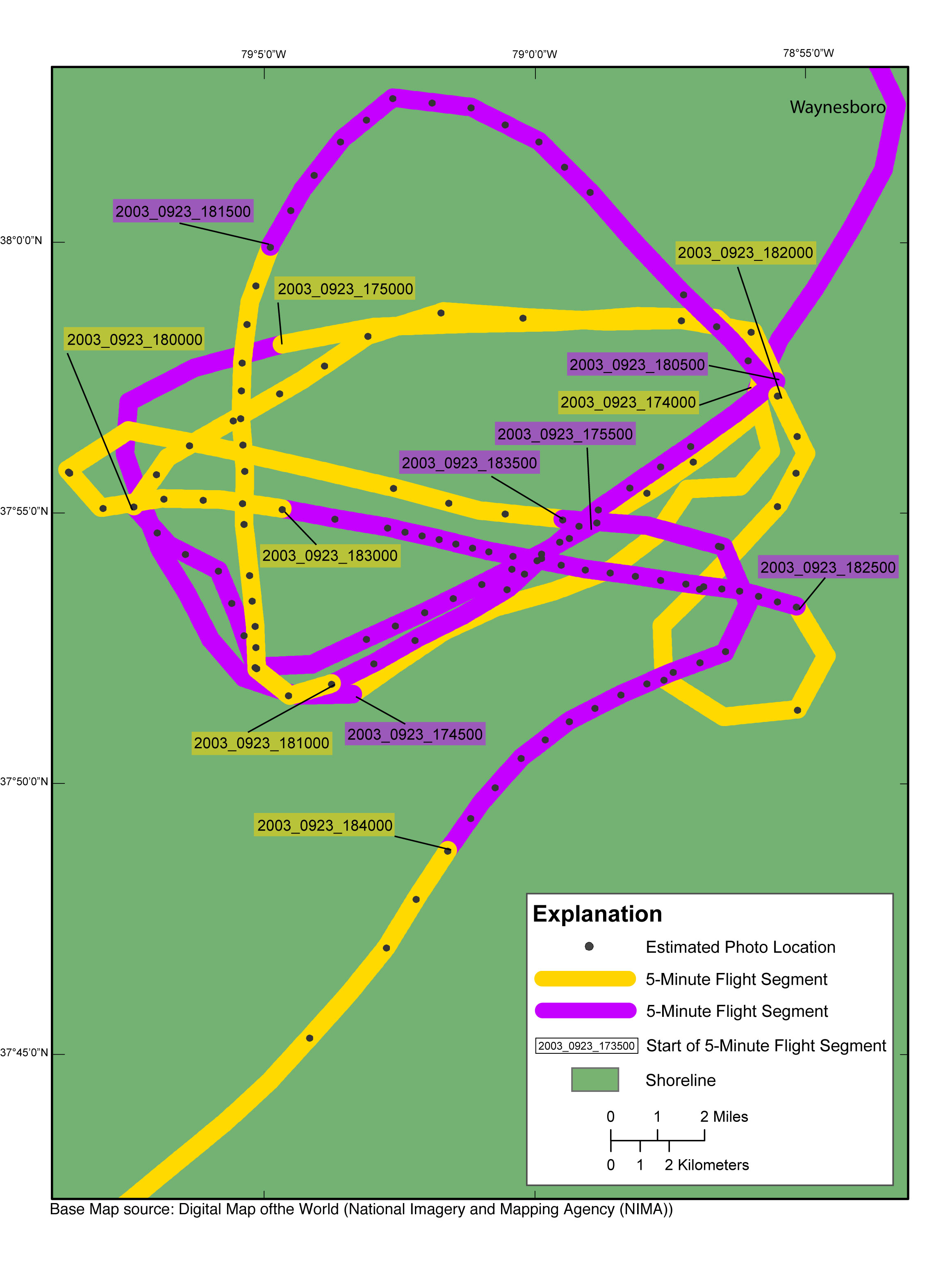
| Figure 12.Map showing the post-Hurricane Isabel flightpath in the Waynesboro, Virginia, region of the study area. The flightpath is represented by the alternating purple and yellow line and photographs by the gray dots along the flightpath. The flightpaths link to contact sheets of associated photo thumbnails. NOTE: There are no slides, and therefore will be no contact sheet, corresponding to segment beginning at 2003_0923_173630, 2003_0923_174000, and 2003_0923_174500. NOTE: Links to the contact sheets are available on all three discs, but links to full-size photos will work only if viewing from Disc 3. Internet version contains all photographs. |

![]() U.S. Department of the Interior |
U.S. Geological Survey
U.S. Department of the Interior |
U.S. Geological Survey
URL: http://pubsdata.usgs.gov/pubs/ds/761/pubs761/html/waynesboro.html
Page Contact Information: GS Pubs Web Contact
Page Last Modified: Monday, 28-Nov-2016 19:11:31 EST
