National Assessment of Coastal Vulnerability to Sea-Level Rise: Preliminary Results for the U.S. Atlantic Coast:
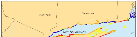
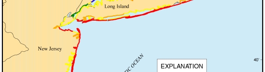
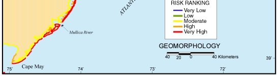
Figure 5. Map of the geomorphology variable for the New York to New Jersey region. The open-ocean shoreline is composed primarily of high-risk sandy barrier island, while risk due to geomorphology is lower for lagoons and along the bluffs of northern Long Island.
 |
 |
 |
| Contents | Back to Top | Title Page |
| Introduction | Risk Variables |
Data Ranking |
CVI | Results | Discussion | Summary | References |
|
Web Page by
Donna Newman [an error occurred while processing this directive] |