Open–File Report 2000–0347
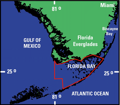
This Open File Report contains bathymetric data collected in Florida Bay by the US Geological Survey, South Florida Place-Based Studies Program using SANDS (System for Accurate Nearshore Depth Surveying). SANDS is a USGS developed, high precision bathymetric system which integrates depth soundings, boat motion, and GPS positioning needed for nearshore bathymetric mapping. Data acquisition occurred between 1995 and 1999 on a 22' shallow draft boat. Processed data points are in X, Y, Z format and relative to the North American Datum of 1983 (GRS80/NAD83) and the North American Vertical Datum of 1988 (NAVD88). Vertical control was derived from GPS data processed with Jet Propulsion Laboratory GIPSY software. Horizontal and vertical accuracies are within +/- 4 centimeters and +/- 8 centimeters, respectively.

![]() U.S. Department of the Interior |
U.S. Geological Survey
U.S. Department of the Interior |
U.S. Geological Survey
URL: http://pubsdata.usgs.gov/pubs/of/2000/0347/intro.html
Page Contact Information: GS Pubs Web Contact
Page Last Modified: Wednesday, 01-Jun-2022 10:19:42 EDT
