
|
|
publications > open file report > historical aerial photography for the greater everglades of south florida: the 1940, 1:40,000 photoset > flight lines
Open-File Report 02-327 - Historical Aerial Photography for the Greater Everglades of South Florida: The 1940, 1:40,000 Photoset
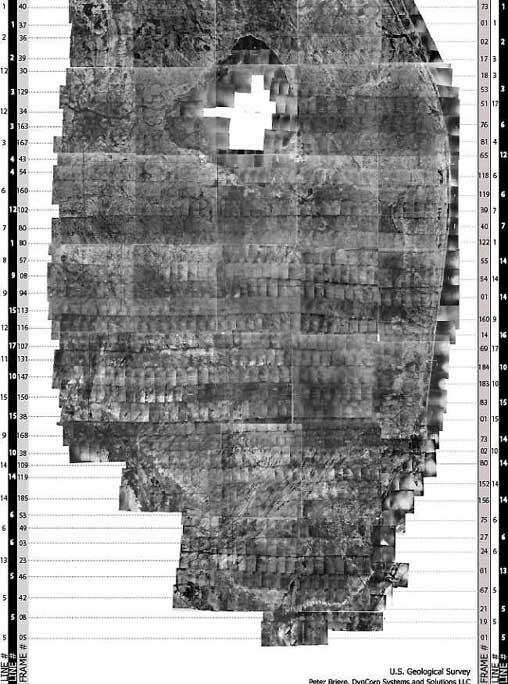
1940 Flight Lines Directory:A larger version (11" x 17") of the flight lines image is downloadable in *PDF format. The image contains flight line and frame number references. To download the latest version of Acrobat Reader, visit the Adobe website: Flight line shapefiles for Collier county and the 1940 mosaic are located in the following zip files: 40collflightl.zip and 40mosflightl.zip. XY coordinates are provided in detail by viewing the sn01_1940xy.shp file located (after unzipping) the sn01_1940xy.zip.
Home | Introduction | Location | GIS Files | Image Directory | Flight Lines | Metadata | Notes |
| Disclaimer | Privacy Statement | Accessibility |
U.S. Department of the Interior, U.S. Geological Survey
This page is: http://sofia.usgs.gov/publications/ofr/02-327/htm/fltlines.htm
Comments and suggestions? Contact: Heather Henkel - Webmaster
Last updated: 06 May, 2014 @ 01:14 PM(HSH)