|
|
publications > open file report > historical aerial photography for the greater everglades of south florida: the 1940, 1:40,000 photoset > image directory
Open-File Report 02-327 - Historical Aerial Photography for the Greater Everglades of South Florida: The 1940, 1:40,000 Photoset
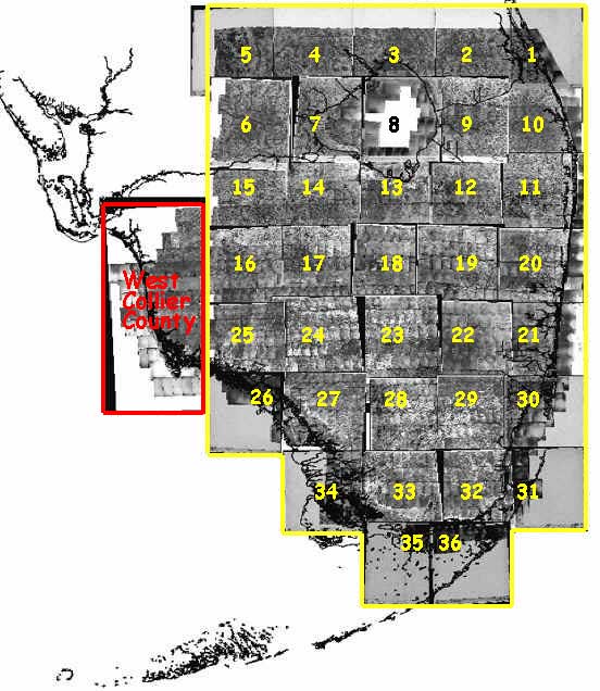
Image Directory:Areas 1-7 and 10 contain mosaic sheet images only, no individual over-flight images are available for viewing. Each over-flight image contained in a mosaic sheet has a pair of numbers vertically aligned in the upper-left corner of the image. These number pairs refer to the flight line and the frame number (i.e., 06 123, 14 108). To locate the 300 dpi versions of the individual mosaic images, please contact Tom Smith (hhenkel@usgs.gov) for a copy of the DVD. (Update: A DVD of the images is no longer available, as these images can be downloaded directly online. Please visit 1940 Greater Everglades and South Florida Aerial Photoset.) Click on a number below to open the mosaic of that area.
Home | Introduction | Location| GIS Files | Image Directory | Flight Lines | Metadata | Notes |
| Disclaimer | Privacy Statement | Accessibility |
U.S. Department of the Interior, U.S. Geological Survey
This page is: http://sofia.usgs.gov/publications/ofr/02-327/htm/imagedir.htm
Comments and suggestions? Contact: Heather Henkel - Webmaster
Last updated: 29 February, 2016 @ 11:00 AM(HSH)

