
|
|
publications > open file report > historical aerial photography for the greater everglades of south florida: the 1940, 1:40,000 photoset > location
Open-File Report 02-327 - Historical Aerial Photography for the Greater Everglades of South Florida: The 1940, 1:40,000 Photoset
Location Map and Mosaics: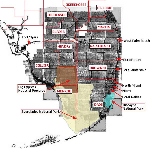 Uppercase text in boxes are county names: (Dade, Monroe, Broward, Collier, Palm Beach, Hendry, Martin, Glades, Highlands, St. Lucie and Okeechobee) Text inside boxes are Federal Lands: (Biscayne National Park, Everglades National Park and Big Cypress National Preserve) Text not contained in a box are city names: (Coral Gables, Miami, North Miami, Fort Lauderdale, Boca Raton, West Palm Beach and Fort Myers)
in the greater Everglades and south Florida. Home | Introduction | Location | GIS Files | Image Directory | Flight Lines | Metadata | Notes
|
| Disclaimer | Privacy Statement | Accessibility |
U.S. Department of the Interior, U.S. Geological Survey
This page is: http://sofia.usgs.gov/publications/ofr/02-327/htm/location.htm
Comments and suggestions? Contact: Heather Henkel - Webmaster
Last updated: 06 May, 2014 @ 01:14 PM(HSH)