High-Resolution Quaternary Seismic Stratigraphy, New York Bight Continental Shelf,
OFR
02-152
OF
02-152 Home
DVD-ROM
Contents
Geologic
Discussion
Introduction
Background
Mapping Results
Discussion
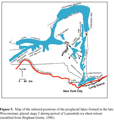
Conclusions
Acknowledgements
References
Figure Captions
GIS
Data
Contacts
Title Page
/
Contents
/
Discussion
/
GIS
Data
/
Contacts
[an error occurred while processing this directive]