| |  |  | | Lake Pontchartrain Atlas: | | | | | | | | | | | | | | | | | | | | | | Physical Environments |  | | | | | | | | | | | | | | | | | | | | | | |  | | | | | | | | | | |  | Physical Environments - Circulation Contributors: Haralampides, McCorquodale Three-dimensional circulation modeling shows that the wind blowing over the surface of the lakes forces a two-gyre circulation pattern within the Lake. The pattern results in relatively strong downwind currents near the shorelines and return flow against the wind in the middle of the Lake. 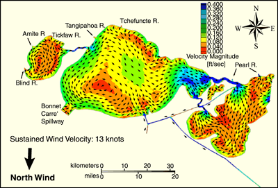 | | Figure 41: Velocity magnitudes and induced lake circulation patterns resulting from sustained winds from the North. | 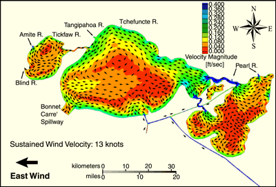 | | Figure 42: Velocity magnitudes and induced lake circulation patterns resulting from sustained winds from the East. | 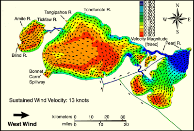 | | Figure 43: Velocity magnitudes and induced lake circulation patterns resulting from sustained winds from the West. | 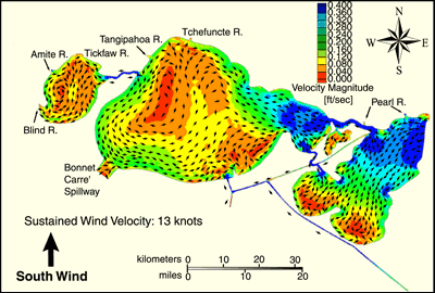 | | Figure 44: Velocity magnitudes and induced lake circulation patterns resulting from sustained winds from the South. | « Previous | Next » |
