
WATER-LEVEL ALTITUDES 2002 AND WATER-LEVEL
CHANGES IN THE CHICOT, EVANGELINE, AND JASPER AQUIFERS AND COMPACTION
1973– 2001 IN THE CHICOT AND EVANGELINE AQUIFERS, HOUSTON-GALVESTON REGION, TEXAS
By L.S. Coplin and Jennifer Lanning-Rush
Open-File Report 02–134
You will need Acrobat Reader to read the PDF version of this report. If you
do not have Acrobat Reader, you may download it here:
http://www.adobe.com/products/acrobat/readstep2.html
CONTENTS
Introduction
Geohydrology
Water-Level Measurements
Measured Compaction
References
Plates
zipped 17" X 22" pdf files
(17.4 MB), page-size pdf files
(16.9 MB), or jpeg
files (3.7 MB)
- Map
showing approximate water-level altitudes in the Chicot aquifer,
Houston-Galveston region,
Texas,
January–February
2002
plate
1 pdf (17" X 22" 1,280 KB), 8
1/2" X 11" pdf (1,252 KB), or plate 1 jpeg
(379 KB)
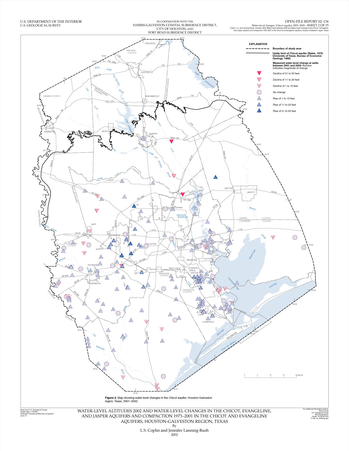
- Map
showing water-level changes in the Chicot aquifer, Houston-Galveston region,
Texas, 2001–2002
plate 2 pdf (17" X 22" 1,131 KB), 8
1/2" X 11" pdf (1,090 KB), or plate
2 jpeg (272 KB)
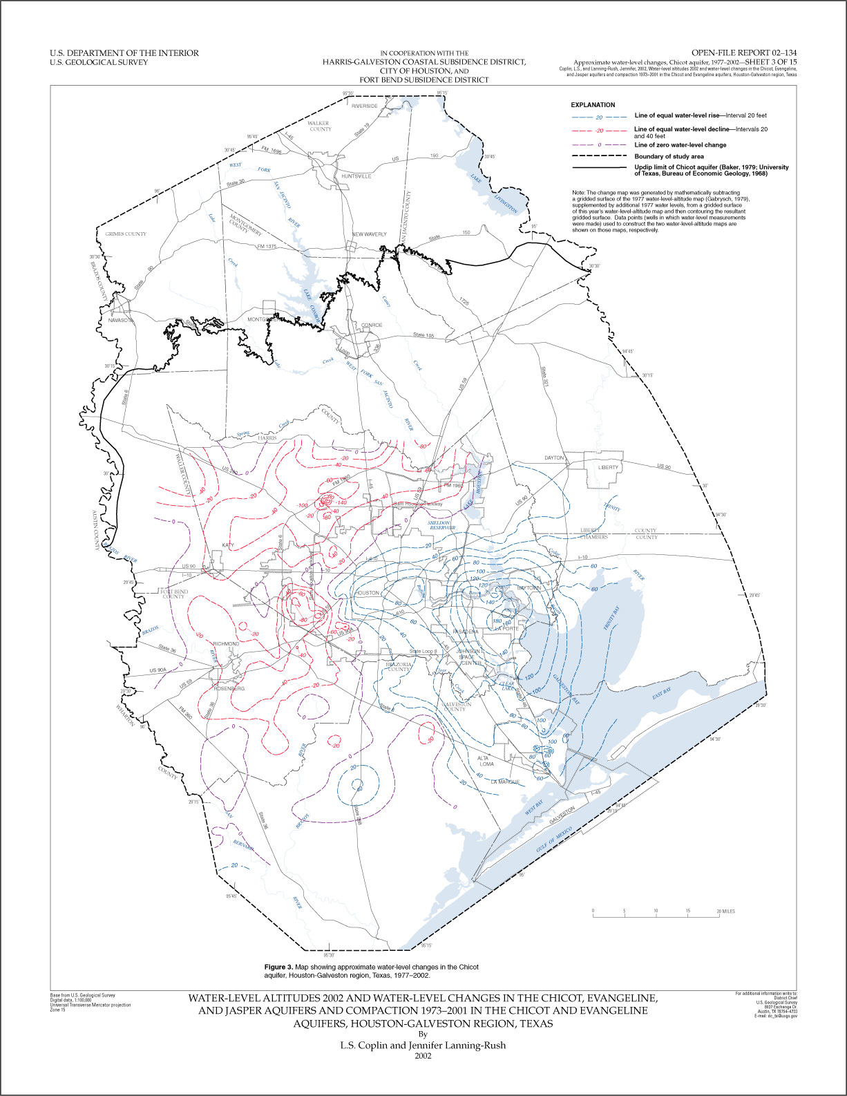
- Map
showing approximate water-level changes in the Chicot aquifer, Houston-Galveston
region, Texas, 1977–2002
plate 3 pdf (17" X 22" 1,713 KB), 8
1/2" X 11" pdf (1,666 KB), or plate
3 jpeg (324 KB)
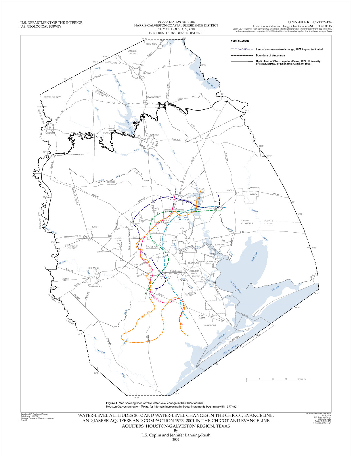
- Map showing lines of
zero water-level change in the Chicot aquifer, Houston-Galveston region,
Texas, for intervals increasing in 5-year increments beginning with 1977–82
plate
4 pdf (17" X 22" 1,147 KB), 8
1/2" X 11" pdf (1,120 KB), or plate 4 jpeg
(264 KB)
- Map showing approximate
water-level changes in the Chicot aquifer, Fort Bend County and adjacent areas,
Texas, 1990–2002
plate
5 pdf (17" X 22" 1,466 KB), 8
1/2" X 11" pdf (1,437 KB), or plate 5 jpeg
(289 KB)
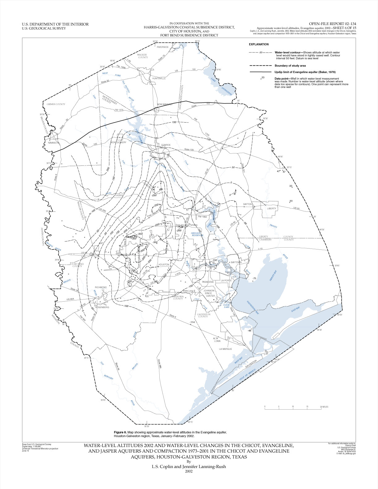
- Map showing approximate
water-level altitudes in the Evangeline aquifer, Houston-Galveston region, Texas,
January–February 2002
plate
6 pdf (17" X 22" 1,239 KB), 8
1/2" X 11" pdf (1,205 KB), or plate 6 jpeg
(282 KB)
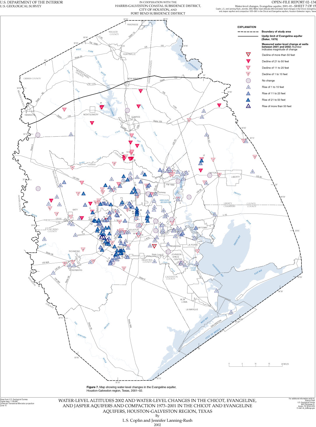
- Map showing water-level
changes in the Evangeline aquifer, Houston-Galveston region, Texas,
2001;
plate
7 pdf (17" X 22" 1,080 KB), 8
1/2" X 11" pdf (1,057 KB), or plate 7 jpeg
(267 KB)
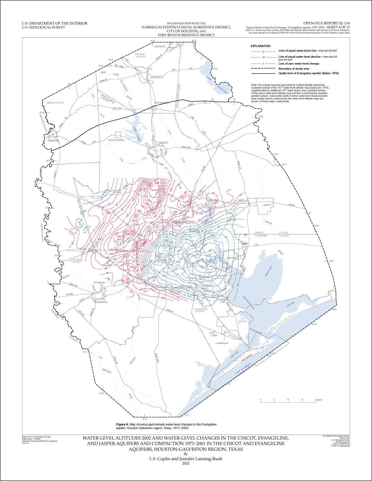
- Map showing approximate
water-level changes in the Evangeline aquifer, Houston-Galveston region Texas, 1977–2002
plate
8 pdf (17" X 22" 2,105 KB), 8
1/2" X 11" pdf (2,075 KB), or plate 8 jpeg
(328 KB)
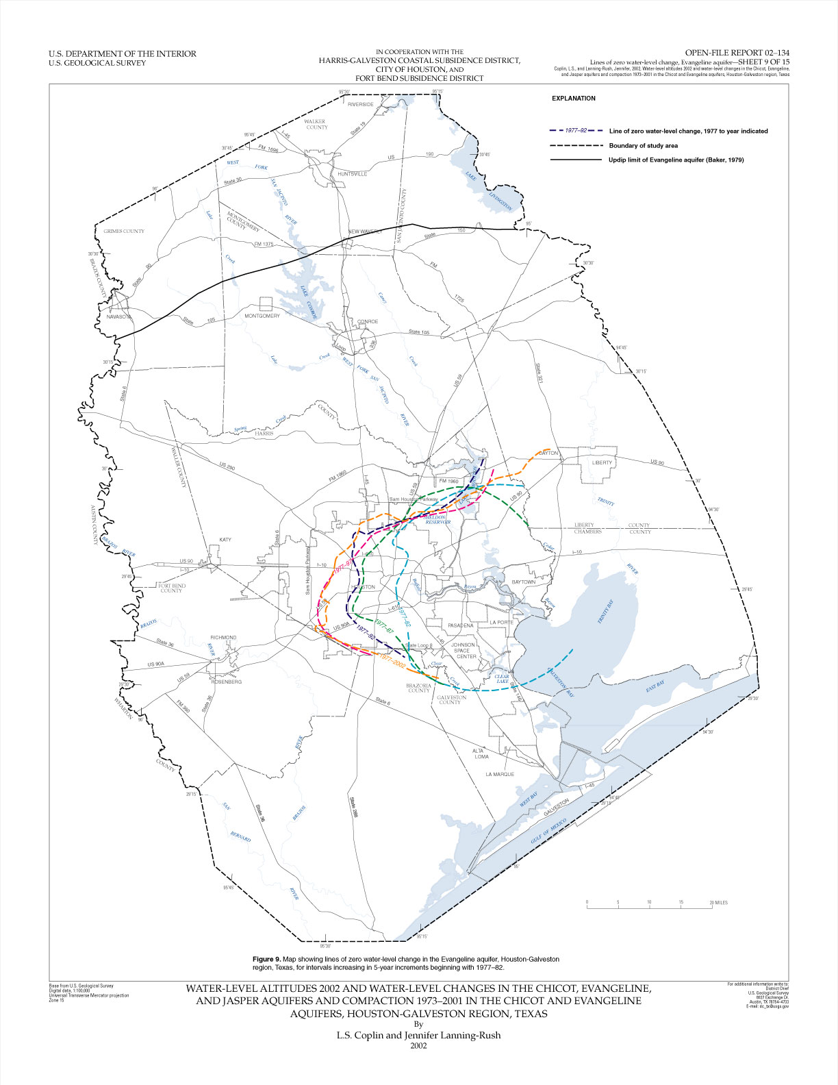
- Map showing lines of zero
water-level change in the Evangeline aquifer, Houston-Galveston region, Texas,
for intervals increasing in 5-year increments beginning with 1977–82
plate
9 pdf (17" X 22" 1,073 KB), 8
1/2" X 11" pdf (1,044 KB), or plate 9 jpeg
(252 KB)
- Map showing approximate water-level
changes in the Evangeline aquifer, Fort Bend County and
adjacent areas, Texas, 1990–2002
plate
10 pdf (17" X 22" 1,300 KB), 8
1/2" X 11" pdf (1,264 KB), or plate 10 jpeg
(272 KB)
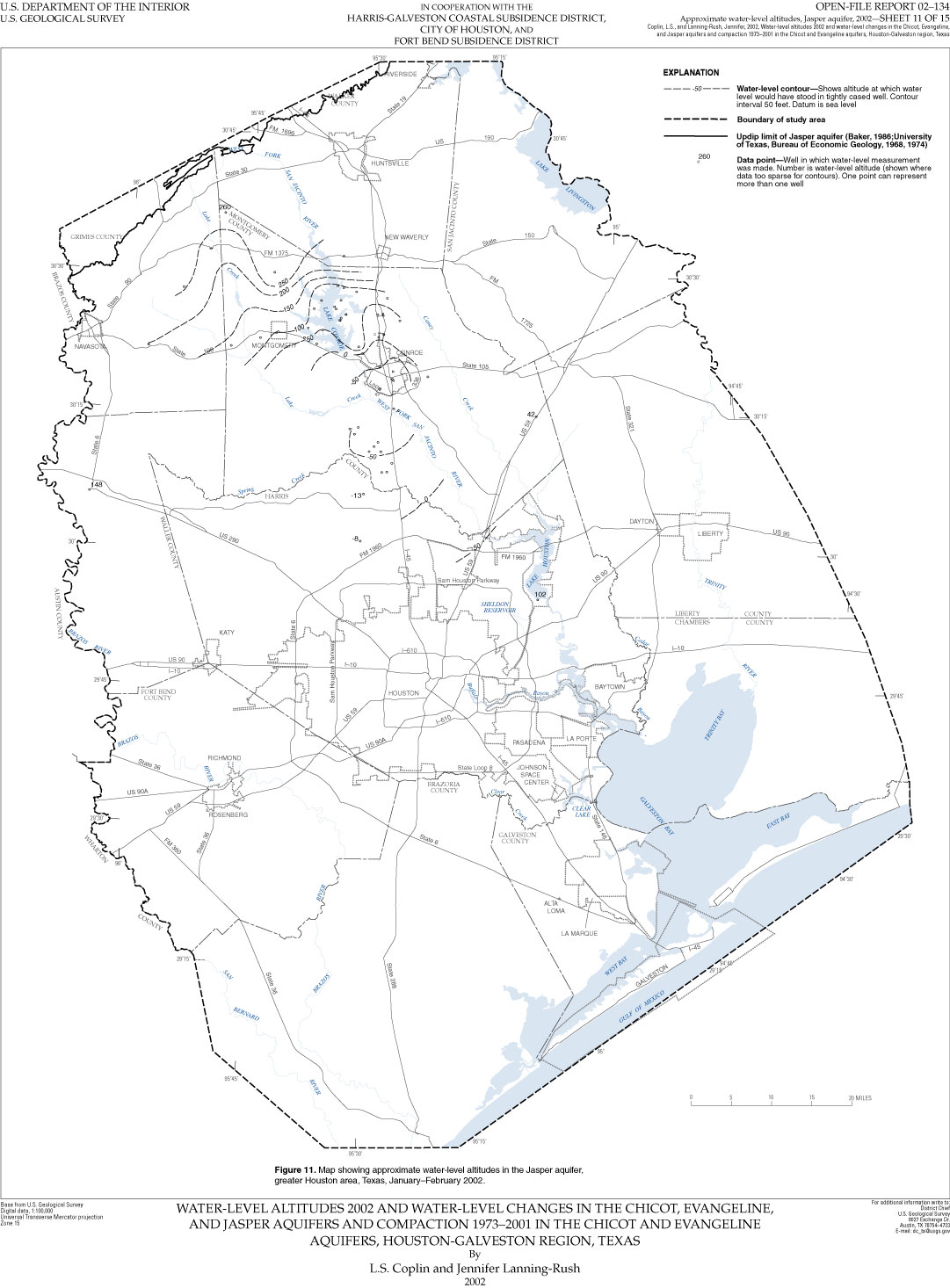
- Map showing approximate water-level
altitudes in the Jasper aquifer, greater Houston area, Texas,January–February
2002
plate
11 pdf (17" X 22" 1,113 KB), 8
1/2" X 11" pdf (1,079 KB), or plate 11 jpeg
(240 KB)
-
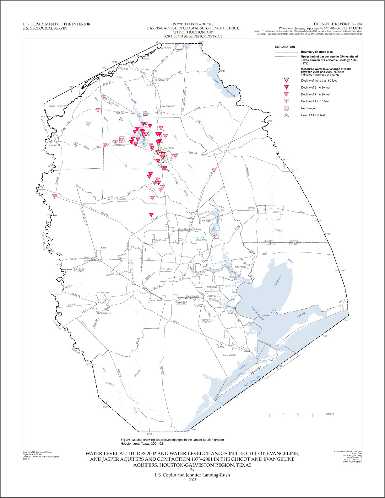
Map showing water-level changes in
the Jasper aquifer, greater Houston area, Texas, 2001–02
plate
12 pdf (17" X 22" 1,077 KB), 8
1/2" X 11" pdf (1,033 KB), or plate 12 jpeg
(249 KB)
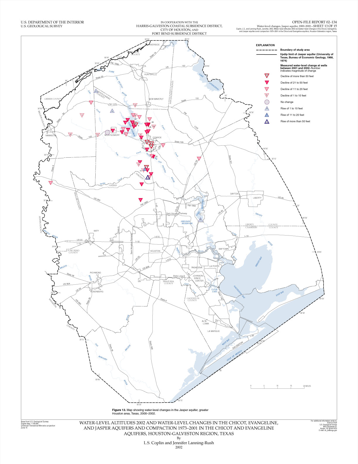
- Map showing water-level changes in
the Jasper aquifer, greater Houston area, Texas, 2000–2002
plate
13 pdf (17" X 22" 1,078 KB), 8
1/2" X 11" pdf (1,033 KB), or plate 13 jpeg
(253 KB)
- Map showing location of extensometer
sites, Houston-Galveston region, Texas
plate
14 pdf (17" X 22" 1,054 KB), 8
1/2" X 11" pdf (1,014 KB), or plate 14 jpeg
(229 KB)
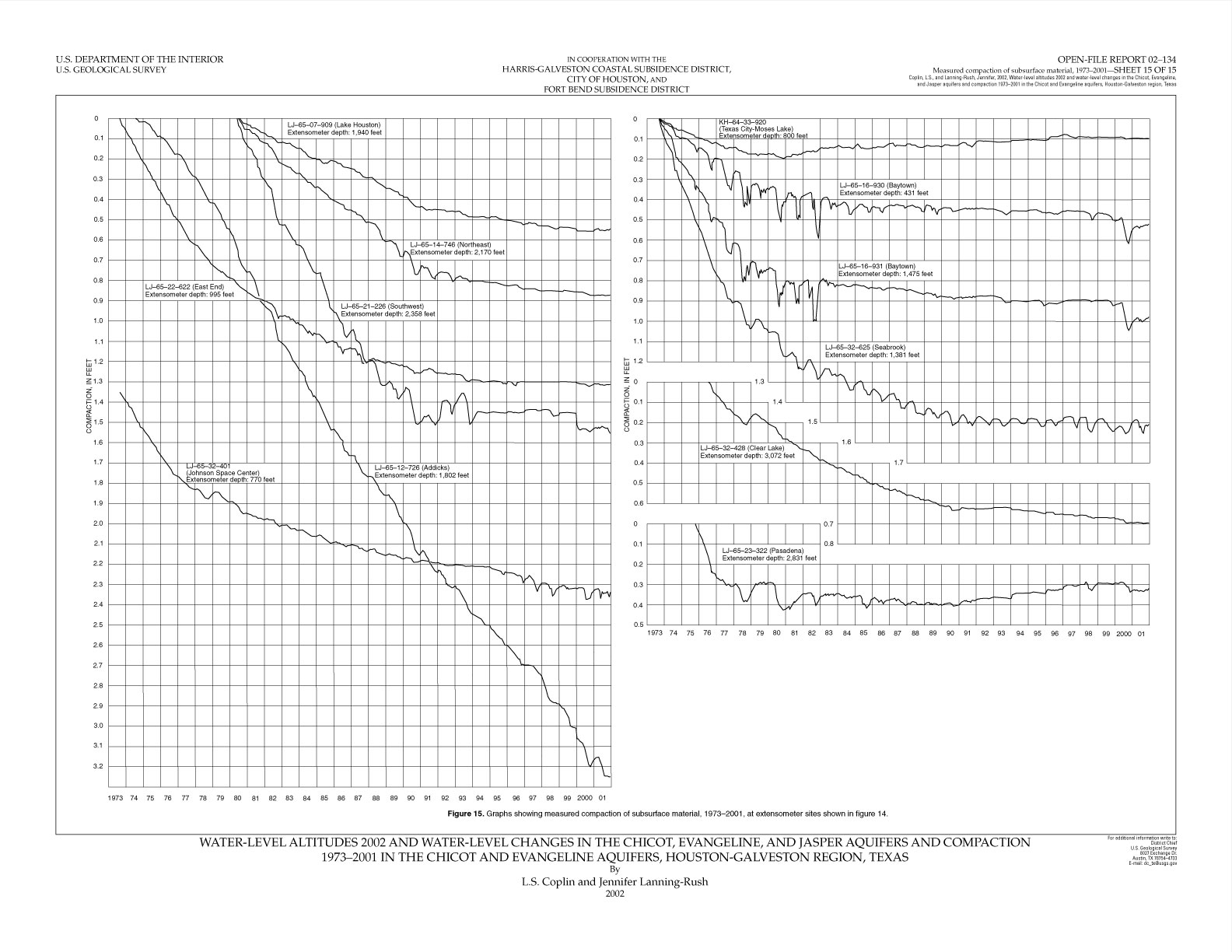
- Graphs showing measured compaction
of subsurface material, 1973– 2001, at extensometer sites; shown
in figure 14
plate
15 pdf (22" X 17" 168 KB), 11"
X 8 1/2" pdf (164 KB), or plate 15 jpeg
(270 KB)
