Texture, Carbonate Content, and Preliminary Maps of Surficial Sediments, Flower Garden Banks Area, Northwest Gulf of Mexico Outer Shelf, USGS Open-File Report 03-002
Home / Contents / Introduction / Setting / Methods / Previous Work / Discussion / Conclusions / Acknowledgments / References
Appendices: I. Field Report / II. Sediment Analysis / III. Table / Graphic / IV. Figures / V. Fig. Summary / VI. GIS/Metadata
GIS Data & Metadata
This Open-File Report contains ready-to-use GIS data that was prepared using ESRI's ArcView, ArcGIS and ArcInfo. Data pertaining to this report can be view directly off this CD-ROM by opening the ArcView project "FGB_OFR.apr" located in the directory "Data." (note: If you do not have ArcView, you will need the FREE GIS browser ArcExplorer which may be downloaded from ESRI at www.esri.com). Otherwise, the individual datasets are available for download, to be used with you own GIS mapping software.
| ArcView Project: | |
| Project Info and Instructions | |
| Download GIS Data & Metadata: | |
| Flower Garden Bank Regional Data | |
| East Flower Garden Bank Data | |
| West Flower Garden Bank Data | |
ArcView Project:
Project Info and Instructions
The directory "Data" of this CD-ROM contains an ArcView project file called FGB_OFR.apr which was created on a Windows2000 system using ArcView 3.2a. When using the CD, either double-click on the filename to launch ArcView, or open ArcView and load the project (see README for software requirements). The project file has been modified to reflect relative pathnames to files, so it should work from the CD-ROM drive, regardless of the assigned drive letter. However, this project files contains grids and requires the user have the Spatial Analyst extension to open the project. For those users who have ArcView, but not Spatial Analyst, open the ArcView project file in the data directory of the CD-ROM entitled FGB_nosa.apr. This ArcView project does not contain any of the gridded surfaces. Those grids can be loaded as images, but because the grids are floating point grids the default colormap loaded is grayscale which does not reveal many of the details of the surfaces.
![]() Hotlinks:
These ArcView projects contain hotlinks which, when run off the CD-ROM,
will link sediment sample locations to a pop-up photo of the sediment grab sample.
These hotlinks will work in both the Spatial Analyst and Non-Spatial Analyst
versions of the project but will only work when running the project off the
CD-ROM. Hotlinking is activated by making the sediment point shapefile the active
theme, selecting the hotlink button (left) from the view toolbar and clicking
on a sample in view "2. Bottom Sample Locations & Photos."
Hotlinks:
These ArcView projects contain hotlinks which, when run off the CD-ROM,
will link sediment sample locations to a pop-up photo of the sediment grab sample.
These hotlinks will work in both the Spatial Analyst and Non-Spatial Analyst
versions of the project but will only work when running the project off the
CD-ROM. Hotlinking is activated by making the sediment point shapefile the active
theme, selecting the hotlink button (left) from the view toolbar and clicking
on a sample in view "2. Bottom Sample Locations & Photos."
For the hotlinks to work with these ArcView projects, the user must supply information regarding the data location. When the ArcView project is first opened, a window will prompt the user to enter the location ArcView project file (the root directory, i.e. "d:/data/"). If the file is read from the CD-ROM, then the drive letter of the CD-ROM is what needs to be filled in. If the whole contents of the CD-ROM are copied to the hard disk, then this directory information needs to be entered at the prompt. This procedure only works of the directory structure of the CD-ROM is kept in tact when moved to the hard disk.
Download GIS Data:
The tables below represent the GIS data available for download pertaining to USGS Open-File Report 03-002. The first column contains a description of the dataset as well as a link to the metadata file and a browse graphic of the data. The second column contains a .zip file for each data file. To use these data with your own GIS mapping software you will need to unzip each of these files to a local data directory using an unzipping program such as WinZip (a trial version can be downloaded from WinZip at http://www.winzip.com/download.htm). Once unzipped, shapefiles should be ready to use with ESRI GIS mapping programs. Note that grids from this Open-File Report are made available here as zipped ascii files and must be unzipped and then converted to grids using ArcToolbox, ArcInfo, ArcView or other GIS software. ArcGIS layer (.lyr) files are included within most of the zipped data files (.zip). Because layer files simply link a legend to a data source, you may need to update the links ("set data source") within the layer file and set it to where you have placed the data on your own system. In addition, the zipped data files ferltxtr.shp, caco3.shp, ef_interp.shp and wf_interp.shp also include ArcView legend files (.avl) which were created using ArcView 3.2a.
|
Flower
Garden Data
|
ESRI Shapefile
|
|
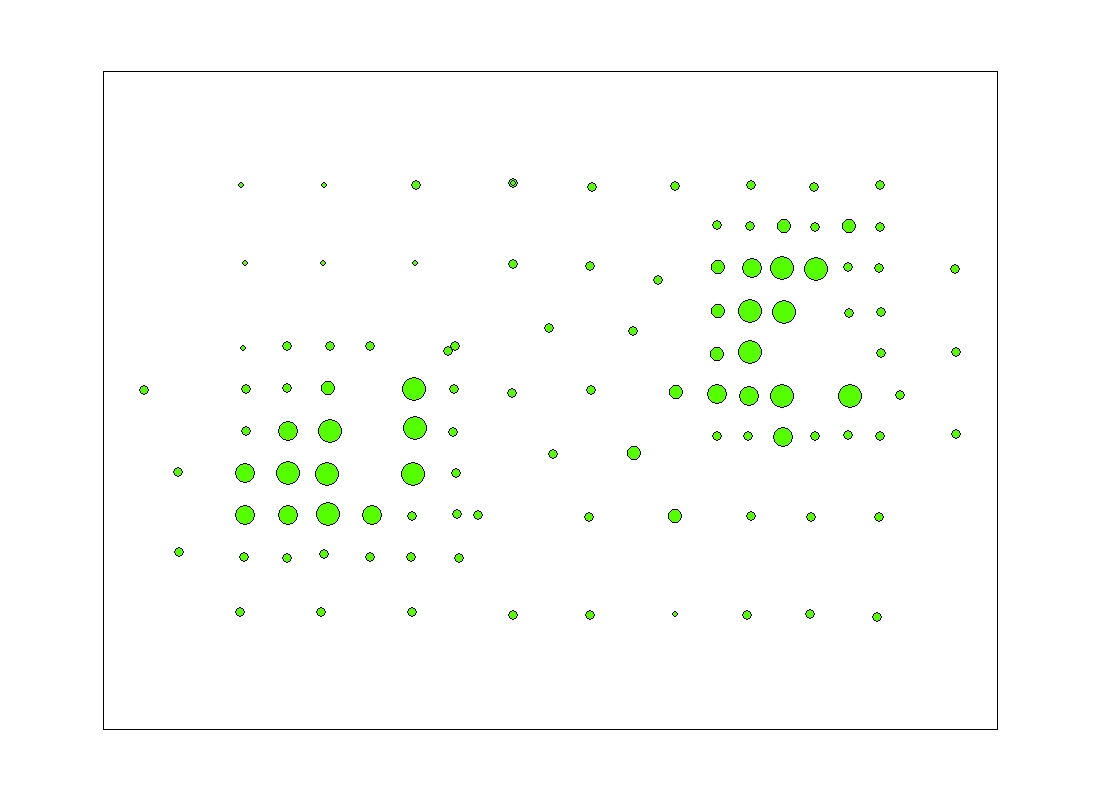
caco3 - Sediment analysis of % CaCO3 for the bottom samples. (Point Shapefile) Directory: data/fgb_gis |
caco3.zip |
|
ferltxtr - Sediment analysis of % Gravel, Sand, Silt and Clay for the bottom samples. (Point Shapefile) Directory: data/fgb_gis |
ferltxtr.zip
(~25 KB) |
|
10mci - 10 meter bathymetric contours from the Multibeam Bathymetry in the East and West Flower Garden regions. (Polyline Shapefile) Directory: data/fgb_gis |
10mCI.zip
(~7.5 MB) |
|
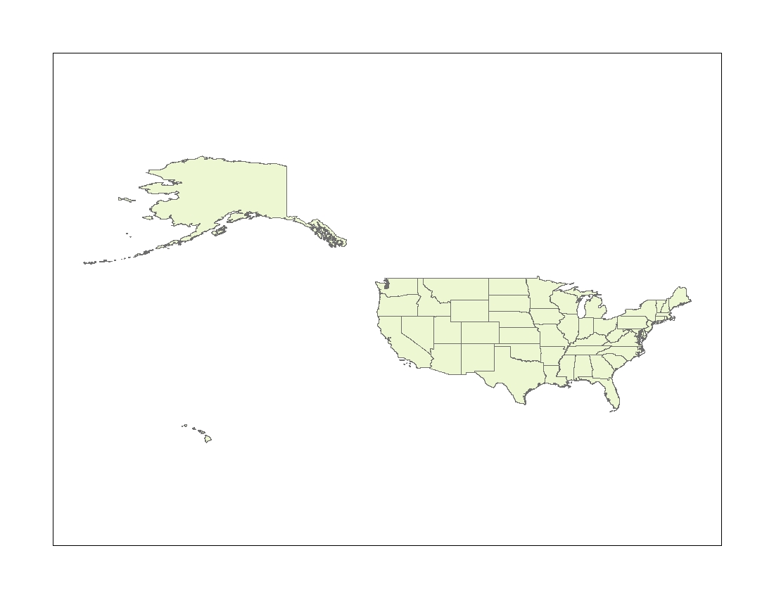
dtl_st - ESRI dataset of the U.S. States (from ESRIDATA2002 cd3). (Polygon Shapefile) Directory: data/fgb_gis |
dtl_st.zip
(~12.6 MB) |
|
stetbank - Boundary of the Stetson Bank portion of the Flower Garden Banks National Marine Sanctuary. (Polygon Shapefile) Directory: data/fgb_gis |
stetbank.zip
(~5 KB) |
|
East
Flower Garden Data
|
ESRI Shapefile
|
|
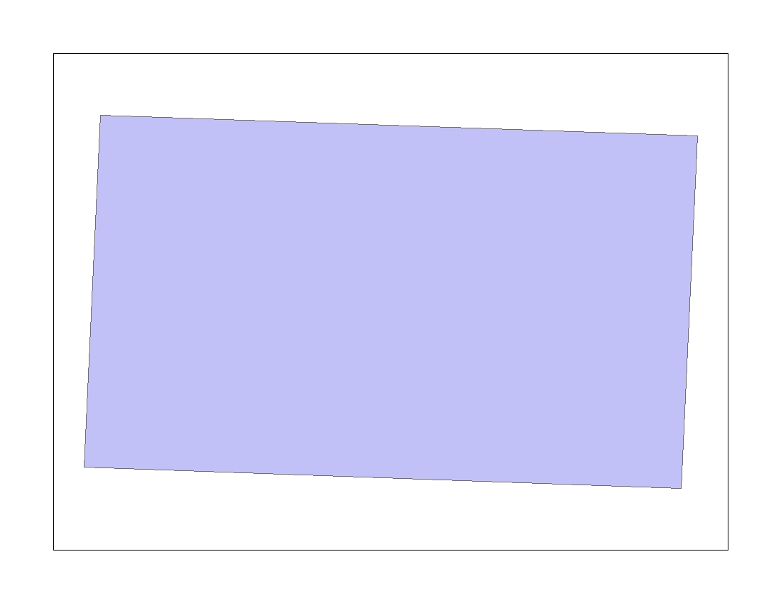
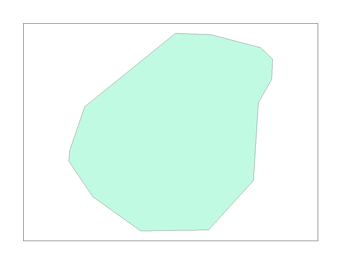
eastflower - Boundary of the East Flower Garden Bank portion of the Flower Garden Banks National Marine Sanctuary. (Polygon Shapefile) Directory: data/fgb_gis |
eastflower.zip
(~5 KB) |
|
ef_bathy - Multibeam bathymetry grid (5m resolution) of the East Flower Garden Bank portion of the Flower Garden Banks NMS. (Raster Grid) Directory: data/fgb_gis |
ef_bathy.zip
(~14.5 MB) |
|
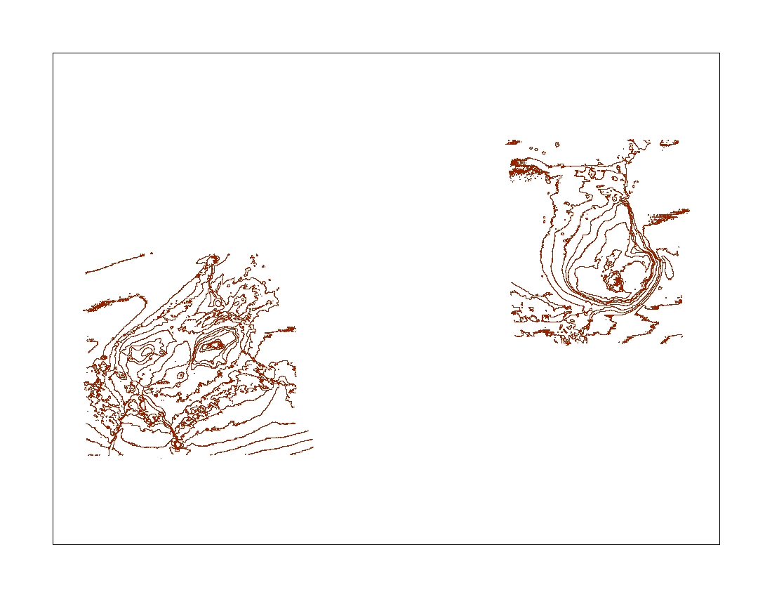
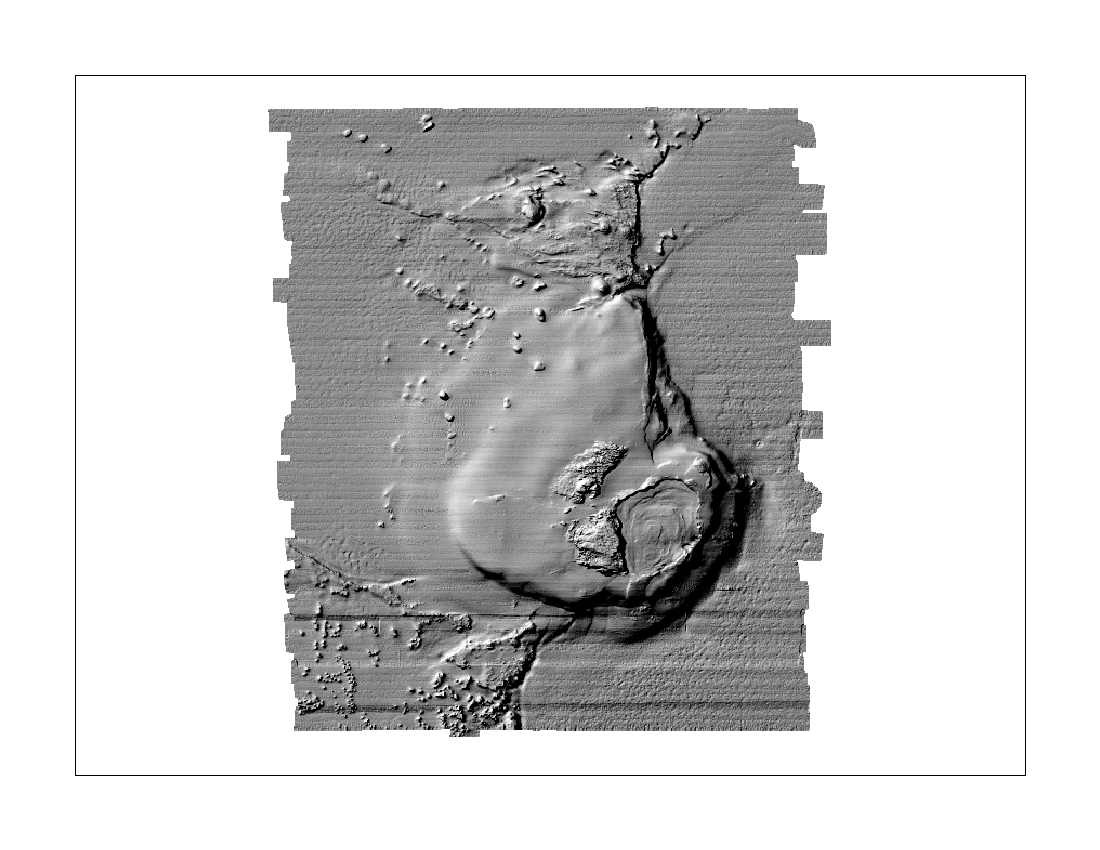
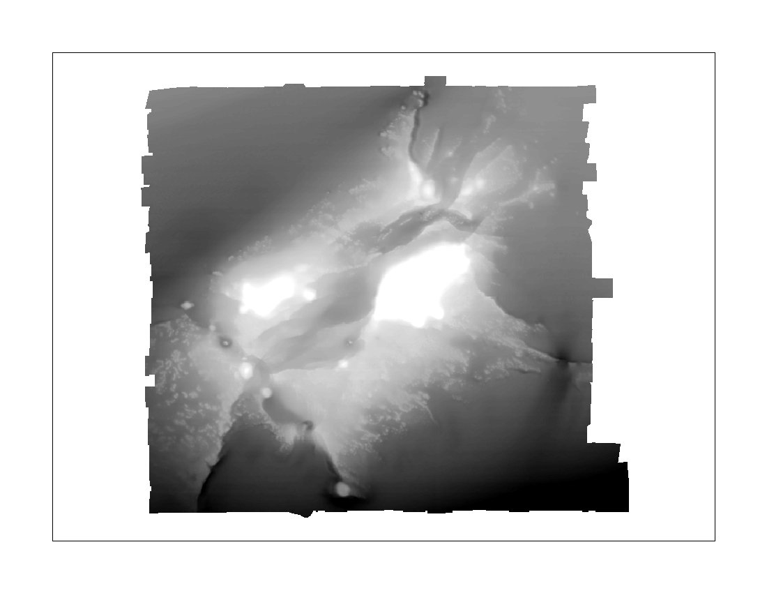
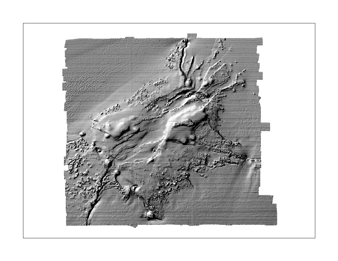
ef_hlshd - Shaded relief grid created from the 5m multibeam bathymetry of the East Flower Garden Bank portion of the Flower Garden Banks NMS. (Raster Grid) Directory: data/fgb_gis |
ef_hlshd.zip
(~4.5 MB) |
|
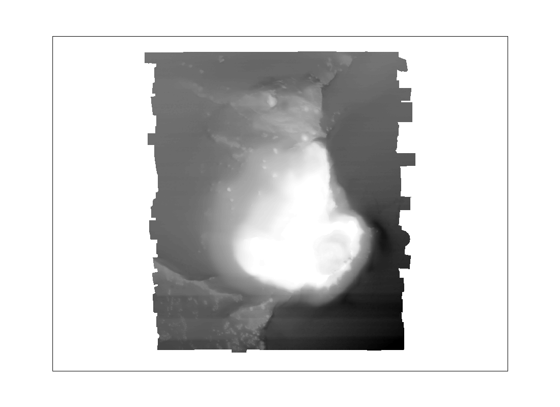
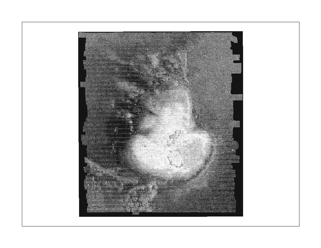
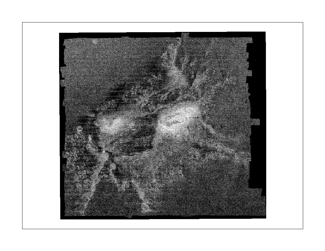
ef_back4 - Multibeam backscatter (5m resolution) of the East Flower Garden Bank portion of the Flower Garden Banks NMS. (TIFF image) Directory: data/fgb_gis |
ef_back4.zip
(~3 MB) |
|
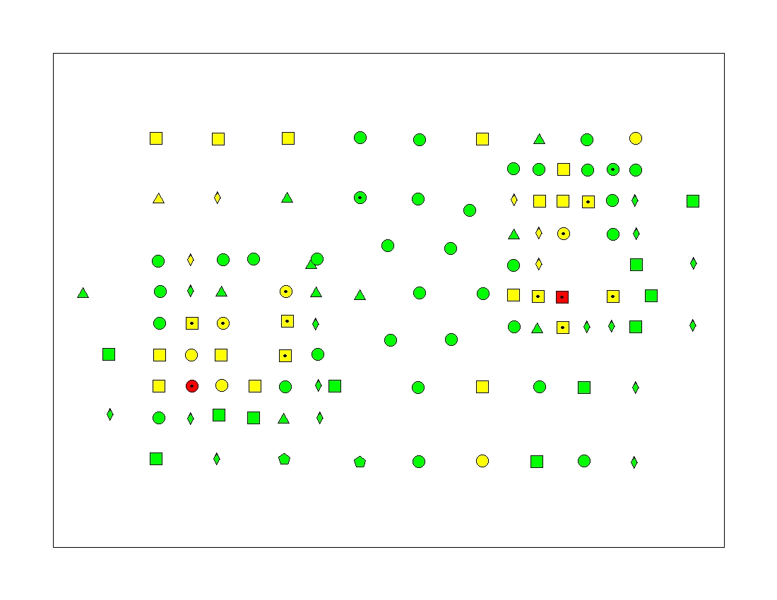
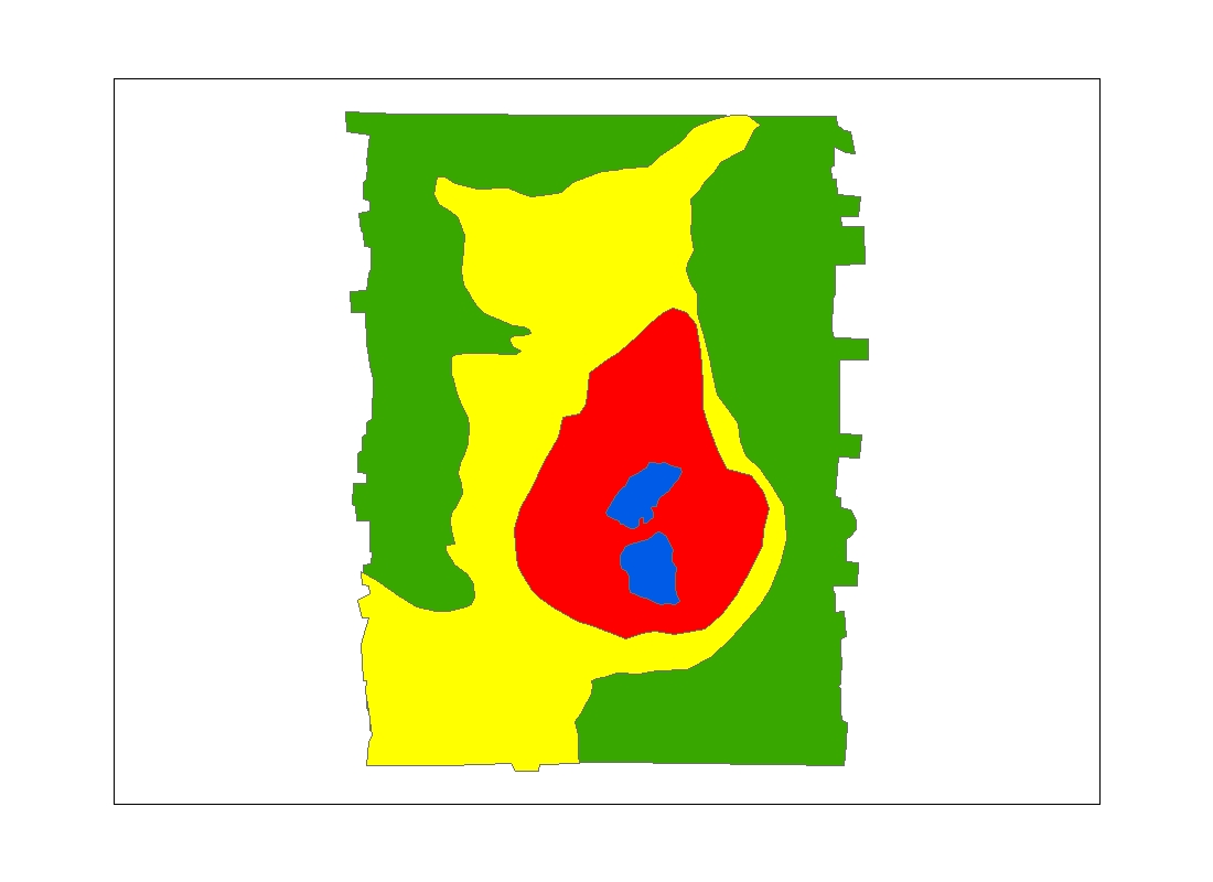
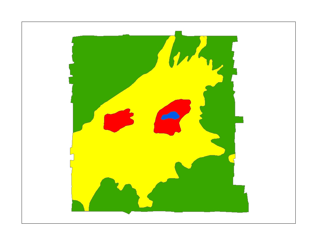
ef_interp - Sea-floor bottom type interpretation of the East Flower Garden Bank portion of the Flower Garden Banks NMS based on sediment samples and the multibeam backscatter and bathymetry. (Polygon Shapefile) Directory: data/fgb_gis |
ef_interp.zip
(~10 KB) |
|
West
Flower Garden Data
|
ESRI Shapefile
|
|
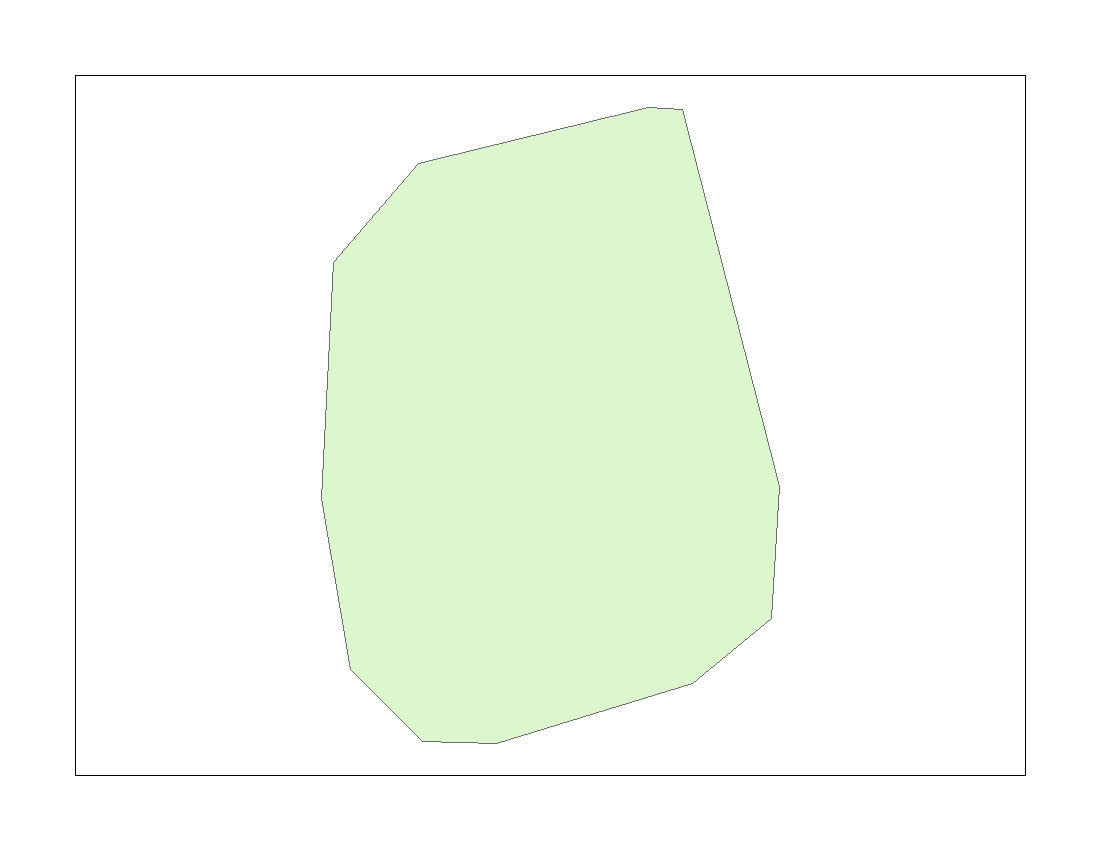
westflower - Boundary of the West Flower Garden Bank portion of the Flower Garden Banks National Marine Sanctuary. (Polygon Shapefile) Directory: data/fgb_gis |
westflower.zip
(~5 KB) |
|
wf_bathy - Multibeam bathymetry grid (5m resolution) of the West Flower Garden Bank portion of the Flower Garden Banks NMS. (Raster Grid) Directory: data/fgb_gis |
wf_bathy.zip
(~18 MB) |
|
wf_hlshd - Shaded relief grid created from the 5m multibeam bathymetry of the West Flower Garden Bank portion of the Flower Garden Banks NMS. (Raster Grid) Directory: data/fgb_gis |
wf_hlshd.zip
(~5.5 MB) |
|
wf_back3 - Multibeam backscatter (5m resolution) of the West Flower Garden Bank portion of the Flower Garden Banks NMS. (TIFF image) Directory: data/fgb_gis |
wf_back3.zip
(~4 MB) |
|
wf_interp - Sea-floor bottom type interpretation of the West Flower Garden Bank portion of the Flower Garden Banks NMS based on sediment samples and the multibeam backscatter and bathymetry. (Polygon Shapefile) Directory: data/fgb_gis |
wf_interp.zip
(~10 KB) |

Home / Contents / Introduction / Setting / Methods / Previous Work / Discussion / Conclusions / Acknowledgments / References
Appendices: I. Field Report / II. Sediment Analysis / III. Table / Graphic / IV. Figures / V. Fig. Summary / VI. GIS/Metadata
[an error occurred while processing this directive]