Texture, Carbonate Content, and Preliminary Maps of Surficial Sediments, Flower Garden Banks Area, Northwest Gulf of Mexico Outer Shelf, USGS Open-File Report 03-002
Home / Contents / Introduction / Setting / Methods / Previous Work / Discussion / Conclusions / Acknowledgments / References
Appendices: I. Field Report / II. Sediment Analysis / III. Table / Graphic / IV. Figures / V. Fig. Summary / VI. GIS/Metadata
POST CRUISE INFORMATION FOR FIELD ACTIVITY NUMBER: 01052
| Objectives: | Sediment sampling of the Sanctuary and nearby areas for habitat mapping | ||||||||||
|---|---|---|---|---|---|---|---|---|---|---|---|
| Type of Activity: | |||||||||||
| Center Principal and
Affiliate Principal (if any): |
K. Scanlon Doug Weaver, USGS/BRD, Gainesville, FL | ||||||||||
| Start and End Dates: | May 27, 2001 to June 2, 2001 | ||||||||||
| Start and End Ports: | from Galveston, TX to Galveston, TX | ||||||||||
| Area of Operations: | Flower Gardens, NW Gulf of Mexico | ||||||||||
| Bounding Coordinates | |||||||||||
| North: | 28.0300 | ||||||||||
| South: | 27.7500 | ||||||||||
| West: | -93.9400 | ||||||||||
| East: | -93.5000 | ||||||||||
| Scientific Equipment: | van Veen grab sampler digital camera (Scanlon s) none | ||||||||||
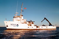
 FERREL (http://www.moc.noaa.gov/fe/) |
| ||||||||||
| Scientific
Party (USGS): |
Jill Rozycki (geologist) - sampling Dave Walsh (tech) - sampling | ||||||||||
| Scientific
Party (affiliate): |
Doug Weaver, USGS/BRD and University of Florida, Gainseville, FL - biological sampling and UW video James Piper, Texas A&M Applied Research Laboratories - UW video Roger Banks, Texas A&M Applied Research Laboratories - UW video Kevin Buch, NOAA Sanctuary program - | ||||||||||
| Navigation techniques used: | NOBELTEC Visual Suite | ||||||||||
| Cruise Funding Source: | NOAA Sanctuary Program / Flower Gardens Bank NMS | ||||||||||
| Project Title: | Flower Gardens Habitat Mapping | ||||||||||
| Contract: | |||||||||||
| Remarks: | Number of samples reported include only benthic grab samples, additional UW video and biological samples not reported here. |
Results
| Summary of Results: | |
|---|---|
| Information to be derived: | |
| Days at Sea: | 7 |
| Continuous Data (in Km): | N/A |
| Number of Stations Occupied: | 109 |
| Number of Submersible Dives: | N/A |
| Station Description: | http://quashnet.er.usgs.gov/data/2001/01052/ |
| Seismic Line Descriptions: | http://quashnet.er.usgs.gov/data/2001/01052/ |
| Track Plot: | http://quashnet.er.usgs.gov/data/2001/01052/ |
| Related Web Site: | OFR 03-002 (http://pubs.usgs.gov/of/2003/of03-002/)- Texture, Carbonate Content, and Preliminary Maps of Surficial Sediments of the Flower Garden Banks Area, Northwestern Gulf of Mexico Outer Shelf. |
Report Date: 13:12 7/26/2001
Submitted by: J. Rozycki
Updated on: 16:10 1/22/2003
Updated by: S. Ackerman

Home / Contents / Introduction / Setting / Methods / Previous Work / Discussion / Conclusions / Acknowledgments / References
Appendices: I. Field Report / II. Sediment Analysis / III. Table / Graphic / IV. Figures / V. Fig. Summary / VI. GIS/Metadata
[an error occurred while processing this directive]