The Gulf of the Farallones: Sidescan-Sonar Imagery,
USGS
Open-File Report 2004-1082
Home Page
Mosaic &
Explanation
Introduction
Methods
Discussion
Acknowledgments
Figure Captions
References
GIS
Data
Contacts
About this Disk
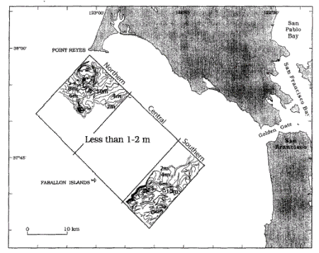
Figure 6.
Isopach map of sediment thickness contoured at 2
m
intervals created by
Chin and others (1997)
.
Back Sidescan-Sonar Data
Home Page
/
Mosaic & Explanation
/
GIS
Data
/
Contacts
/
About this Disk
[an error occurred while processing this directive]