
Open-File Report 2005-1293
Title Page / Table of Contents / List of Figures / Introduction / Maps / Data Collection/Processing / Interpretation / Acknowledgments / Appendix 1 / Appendix 2 / Appendix 3 / Appendix 4
 |
 |
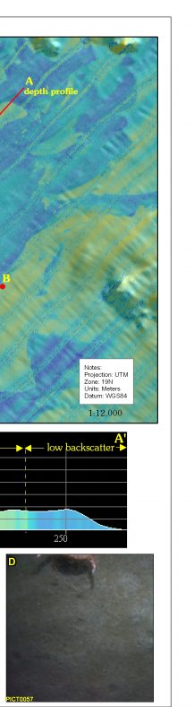 |
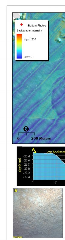
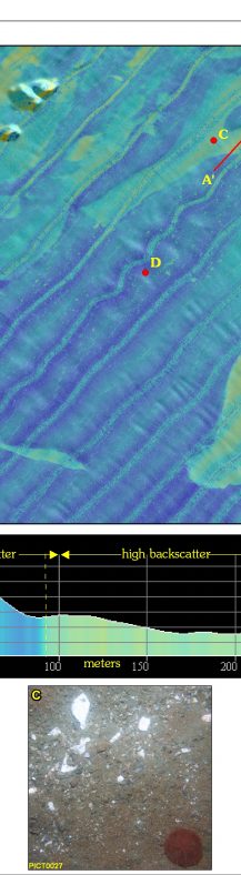
Figure 4.8. Map of seafloor topography colored by backscatter intensity in the northeastern part of the study area. Depth and backscatter data in this map were collected simultaneously by the pole-mounted interferometric sonar, ensuring precise navigation. The depth profile (A - A') crosses a sorted bedform in the upper part of the map; color coding on the profile shows high backscatter material on the floor of a shallow depression. Parallel stripes that trend SW-NE are artefacts of data collection. Bottom photographs B-D are indicated by red circles on map. Map scale is 1:10,000. See figure 3.3 for location. | ||


![]() U.S. Department of the Interior |
U.S. Geological Survey
U.S. Department of the Interior |
U.S. Geological Survey
URL: http://pubsdata.usgs.gov/pubs/of/2005/1293/html/imagepages/fig4_8.html
Page Contact Information: GS Pubs Web Contact
Page Last Modified: Friday, 03-May-2024 15:44:17 EDT

