Skip past header information
USGS - science for a changing world
CZM logo with link to CZM home page

U.S. Geological Survey Open-File Report 2007-1373

High-Resolution Geologic Mapping of the Inner Continental Shelf: Cape Ann to Salisbury Beach, Massachusetts


Skip past contents informationTitle Page / Table of Contents / List of Figures / Introduction / Maps / Data Collection/Processing / Interpretation / Summary / Acknowledgments / References Cited / Appendix 1 / Appendix 2 / Appendix 3 / Appendix 4 / Appendix 5
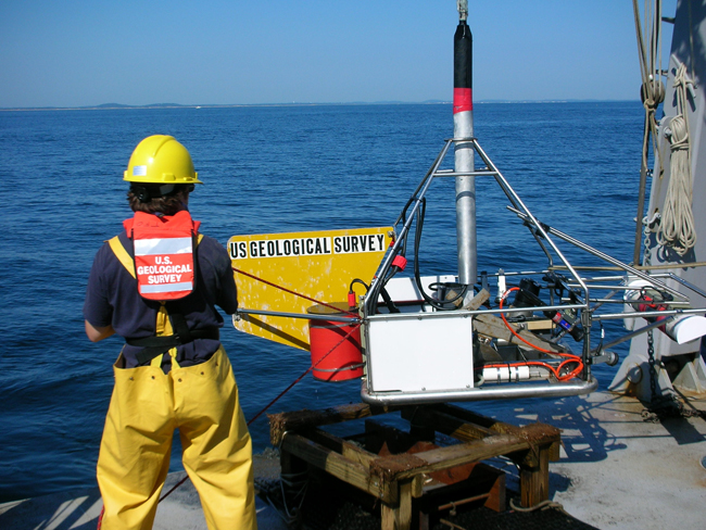

Figure 3.8. Photograph of the SEABed Observation and Sampling System (SEABOSS) on the deck of the RV Connecticut. Photographic data and sediment samples collected by the system were used to validate geophysical data and characterize seafloor environments.


Figure 3.8.  Photograph of the SEABed Observation and Sampling System (SEABOSS) on the deck of the RV Connecticut.  Photographic data and sediment samples collected by the system were used to validate geophysical data and characterize seafloor environments.

Download the full size JPG image (2.3 MB)

Skip USGS links group

Accessibility FOIA Privacy Policies and Notices

Take Pride in America logo USAGov logo U.S. Department of the Interior | U.S. Geological Survey
End of USGS links group