U.S. Geological Survey Open-File Report 2007-1373
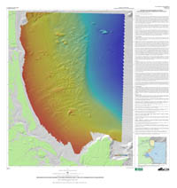
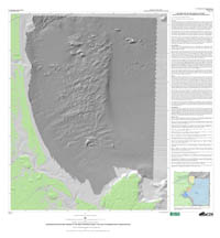
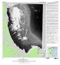
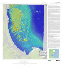
High-Resolution Geologic Mapping of the Inner Continental Shelf: Cape Ann to Salisbury Beach, Massachusetts

|
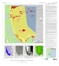
Five map sheets have been compiled showing the seafloor offshore of Massachusetts from Cape Ann to Salisbury Beach. The text on each map sheet introduces the map, briefly describes the data and methods, and summarizes key features. Section 3 (Data Collection and Processing) and Section 4 (Geologic Interpretation) provide more detailed information than presented on the map sheets. Links to the maps at full scale, the map text, and a page-size map are provided on the USGS website: http://woodshole.er.usgs.gov/project-pages/coastal_mass/
|

![]() U.S. Department of the Interior |
U.S. Geological Survey
U.S. Department of the Interior |
U.S. Geological Survey
URL: https://pubsdata.usgs.gov/pubs/of/2007/1373/html/maps.html
Page Contact Information: Contact USGS
Page Last Modified: Wednesday, 07-Dec-2016 21:00:28 EST