U.S. Geological Survey Open-File Report 2009-1042
National Assessment of Historical Shoreline Change: A Pilot Study of Historical Coastal Bluff Retreat in the Great Lakes, Erie, Pennsylvania
Return to: Abstract » Introduction » Prior Assessments » Geology, Physiography, and Recession » Methodology » Bluff-Retreat Rates » Conclusion » Acknowledgments » References Cited |
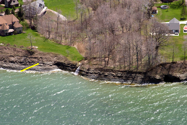
Figure 6. Oblique aerial photograph of bluffs in Harborcreek Township, Pa. (see fig. 3 for location). The base of the bluff in this location is exposed Devonian sandstone and shale, which is overlain by unconsolidated glacial deposits (contact indicated by yellow line). Bluff recession rates tend to be lower where the basal exposures are bedrock. Photograph from Pennsylvania Coastal Resource Management Program. |
 |

![]() U.S. Department of the Interior |
U.S. Geological Survey
U.S. Department of the Interior |
U.S. Geological Survey
[an error occurred while processing this directive]
URL: https://pubsdata.usgs.gov
Page Contact Information: Contact USGS
Page Last Modified: Wednesday, 07-Dec-2016 21:51:31 EST
