U.S. Geological Survey Open-File Report 2009-1042
National Assessment of Historical Shoreline Change: A Pilot Study of Historical Coastal Bluff Retreat in the Great Lakes, Erie, Pennsylvania
Return to: Abstract » Introduction » Prior Assessments » Geology, Physiography, and Recession » Methodology » Bluff-Retreat Rates » Conclusion » Acknowledgments » References Cited |
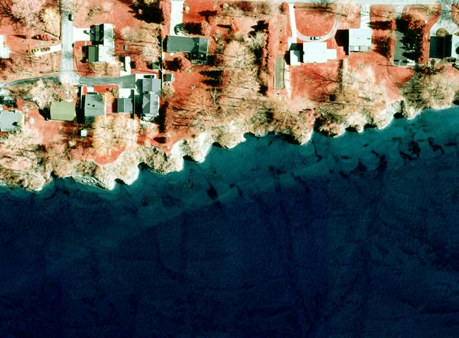
Figure 8. Aerial photograph showing headland-cove morphology formed in portions of the Lake Erie, Pa., bluffs in areas where jointed bedrock makes up the bluff face. The morphology can also be seen in the submerged portion of the bluff, where the jointing in the bedrock is also visible. Photograph from Pennsylvania Coastal Resource Management Program. |
 |

![]() U.S. Department of the Interior |
U.S. Geological Survey
U.S. Department of the Interior |
U.S. Geological Survey
[an error occurred while processing this directive]
URL: https://pubsdata.usgs.gov
Page Contact Information: Contact USGS
Page Last Modified: Wednesday, 07-Dec-2016 21:51:32 EST
