U.S. Geological Survey Open-File Report 2009-1042
National Assessment of Historical Shoreline Change: A Pilot Study of Historical Coastal Bluff Retreat in the Great Lakes, Erie, Pennsylvania
Return to: Abstract » Introduction » Prior Assessments » Geology, Physiography, and Recession » Methodology » Bluff-Retreat Rates » Conclusion » Acknowledgments » References Cited |
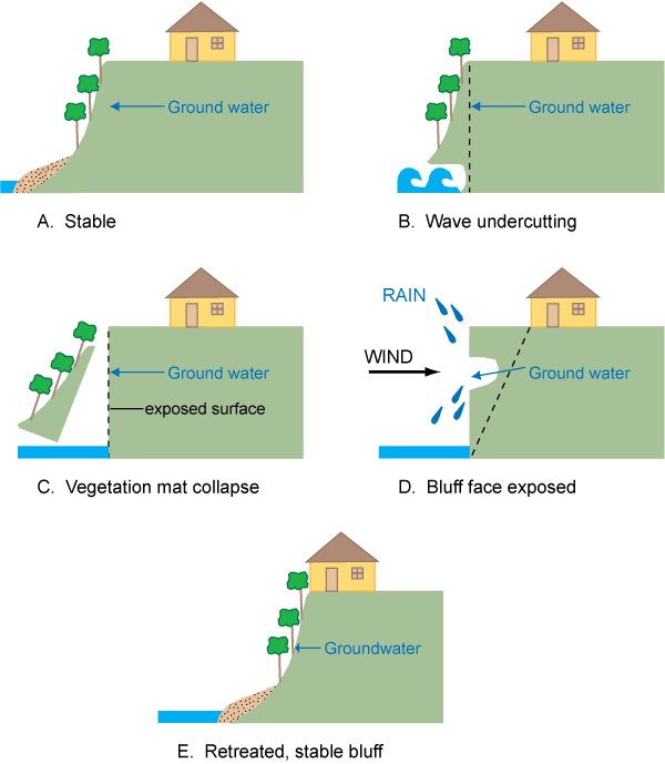
Figure 9. Schematic diagrams showing stages of bluff retreat unique to the Lake Erie, Pa., bluffs. (A) Bluff is in a stable condition; steep slopes are fully vegetated and vegetation is nourished by ample ground-water flows; residential structure is a safe distance from the bluff crest. (B) Wave contact at the base of the bluff undercuts the bluff face and creates instability for the now-unattached vegetation mat higher on the bluff face. (C) The bluff face, stripped of a protective vegetative mat, is increasingly susceptible to further erosion. (D) The unprotected and over-steepened bluff face is susceptible to the erosion processes of wind, rain, and ground-water flow. (E) The bluff slope retreats to an angle of repose, vegetation returns, and the bluff face is stabilized. However, bluff recession now has encroached close to the residential structure. |
 |