U.S. Geological Survey Open-File Report 2009-1137
Quaternary Geologic Framework of the St. Clair River between Michigan and Ontario, Canada
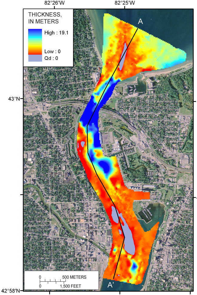
Figure 16. Thickness of Quaternary undifferentiated glaciofluvial, glaciolacustrine, fluvial, and lacustrine deposits (Qu) in the northernmost St. Clair River area. Qu is absent where Quaternary glacial drift (Qd) is exposed at the surface (purple area). The black line shows the location of the geologic section A-A’ (fig. 12). Grid-cell size is 20 m x 20 m. (2005 orthophoto base from Michigan State University, Remote Sensing & GIS Research and Outreach Services, USDA-FSA Aerial Photography Field Office.) |
 |

![]() U.S. Department of the Interior |
U.S. Geological Survey
U.S. Department of the Interior |
U.S. Geological Survey
URL: https://pubsdata.usgs.gov/pubs/of/2009/1137/html/figure16.html
Page Contact Information: Contact USGS
Page Last Modified: Wednesday, 07-Dec-2016 21:58:20 EST
