U.S. Geological Survey Open-File Report 2009-1137
Quaternary Geologic Framework of the St. Clair River between Michigan and Ontario, Canada
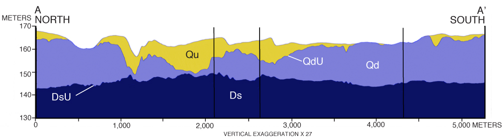
Figure 12. Geologic section A-A’ showing the major seismic stratigraphic units and unconformities in the northernmost St. Clair River area. Vertical scale is elevation in meters IGLD 1895. Vertical black lines show bends in the section. (See table 1 for explanation of stratigraphic units and unconformities; see fig. 10 for cross section location.) Click on figure for larger image. |
 |

![]() U.S. Department of the Interior |
U.S. Geological Survey
U.S. Department of the Interior |
U.S. Geological Survey
URL: https://pubsdata.usgs.gov/pubs/of/2009/1137/html/figure12.html
Page Contact Information: Contact USGS
Page Last Modified: Wednesday, 07-Dec-2016 21:58:17 EST
