U.S. Geological Survey Open-File Report 2009-1137
Quaternary Geologic Framework of the St. Clair River between Michigan and Ontario, Canada
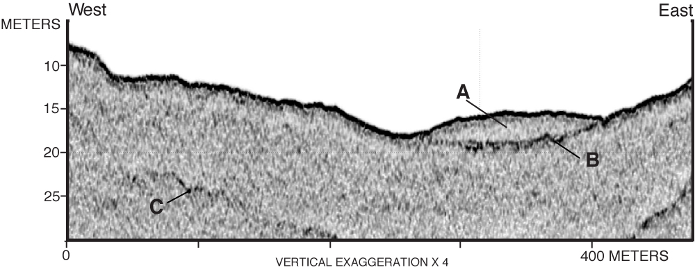
Figure 29. Chirp profile at Port Lambton, Ontario (see fig. 28 for location): A, lens of sediment deposited in the channel thalweg; B, buried fluvial channel surface; C, first multiple reflection of riverbed. Vertical scale is depth in meters (zero depth is 175.2 m IGLD 1985 based on water level, at the time of data acquisition, at the Canadian Hydrographic Service gage at Port Lambton), using a sound velocity of 1,450 m/s in water and 1,650 m/s in sediment. Click on figure for larger image. |
 |

![]() U.S. Department of the Interior |
U.S. Geological Survey
U.S. Department of the Interior |
U.S. Geological Survey
URL: https://pubsdata.usgs.gov/pubs/of/2009/1137/html/figure29.html
Page Contact Information: Contact USGS
Page Last Modified: Wednesday, 07-Dec-2016 21:58:27 EST
