U.S. Geological Survey Open-File Report 2010–1007
Sea-Floor Geology and Character Offshore of Rocky Point, New York
 |
||
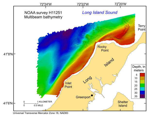
Figure 15. Digital terrain model of the sea floor produced from the multibeam bathymetry collected during National Oceanic and Atmospheric Administration survey H11251 and gridded to 2 m. Image is sun-illuminated from the north and vertically exaggerated 5X. Warmer colors are shallower areas; cooler colors are deeper areas. See key for depth ranges. Click here for a larger version of image. | ||

![]() U.S. Department of the Interior |
U.S. Geological Survey
U.S. Department of the Interior |
U.S. Geological Survey
URL: https://pubsdata.usgs.gov/pubs/of/2010/1007/html/fig15.html
Page Contact Information: Contact USGS
Page Last Modified: Wednesday, 07-Dec-2016 22:38:08 EST


