U.S. Geological Survey Open-File Report 2010–1007
Sea-Floor Geology and Character Offshore of Rocky Point, New York
 |
||
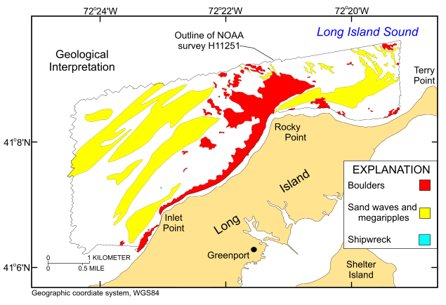
Figure 19. Interpretation of the digital terrain model and sidescan-sonar mosaic from National Oceanic and Atmospheric Administration survey H11251 off Rocky Point, New York. Areas characterized by boulders, large bedforms, and a shipwreck are shown. White areas within the study area are primarily nondescript reworked Holocene sediment. | ||

![]() U.S. Department of the Interior |
U.S. Geological Survey
U.S. Department of the Interior |
U.S. Geological Survey
URL: https://pubsdata.usgs.gov/pubs/of/2010/1007/html/fig19.html
Page Contact Information: Contact USGS
Page Last Modified: Wednesday, 07-Dec-2016 22:38:10 EST


